Near the End of the Big Climb
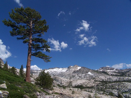
This was the first hike that I did with my friend Erik, and very nearly the last. I had been making hikes rated as difficulty level 3 out of 5 in California Hiking, and those were all rated as moderate in Tahoe Sierra. This hike was also rated as moderate, and was a bit shorter than others I had done recently. It wasn't until after the hike that I read the description in California Hiking, which rated it as difficulty level 4 and said, "One memorable .5 mile stretch goes straight uphill and will cause you to question your sanity." It was a bit much for Erik at the time, although he'd probably find it easier today.
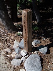
The destination at the end of Tyler Lake Trail is . . . Gertrude Lake. Tyler Lake is not far off, but you have to find it going cross country. There is also a small spur trail to William Tyler's grave. He was a rancher who died in a blizzard in the 1920s. We did not make either of these side trips, but I hope to this year.
We began at the western end of Wrights Lake taking the Rockbound Pass Trail. Up until the junction with Tyler Lake Trail, we were only faced with gentle ups and downs. We passed by Beauty Lake, which is popular with swimmers.
Beauty Lake
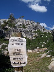
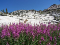
When we headed off on Tyler Lake Trail from the junction, we quickly hit the border of Desolation Wilderness (permit required). From that point, the climbing begins.
Junction
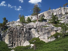
Start of the Climb
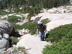
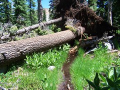
I well recall the section the authors of California Hiking were referring to. I was surprised by it, but had a lot of fun climbing that slope. Once we reached the top, we went through a forest that was still swampy in many areas from the recent snow melts. Occasionally we had to rock hop to avoid getting our feet wet. I was impressed with a fallen tree that had a large boulder clutched in its roots.

There were a couple of points that I had a hard time following the trail. Luckily, Erik is much better at that than me. He was always able to spot an obvious section of trail in the distance, or a cairn.
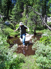
Close to the lake we had to climb again, and our way was made more difficult by all of the runoff. We picked our way across the rocks however we could just to keep moving without getting soaked.
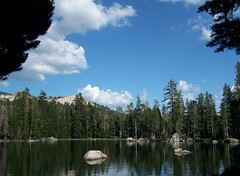
Finally, we arrived at the lake. A convenient granite shelf slopes down to the waters' edge, and provided a great spot to hang out and eat lunch. There was snow in some shady areas, but it was a perfect day.
After eating we explored around the lake's edge. There was a use trail that headed off from the lake that I decided to follow to see if there was anything interesting. I stopped to use my tripod to try and get a long exposure of a little creeklet, and was startled when Erik came up behind me, thinking he was back at the lake.

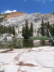
Gertrude Lake
Then it was time to return. Erik had done well up to this point, but eventually the trail caught up with him. On the easiest portion of the hike, the last 2.3 miles on Rockbound Pass Trail, he was dragging because his legs were so worn out.
We agreed later that he would join me on some easier hikes, and I would take the harder ones alone. But it was only a couple of weeks later that we ended up doing a more difficult hike when we got a long ways off trail, and I've taken him on some much longer hikes that are rated as more difficult since then.
Update:
I just repeated the Tyler Lake Trail, with a couple of changes. By starting at the Twin Lakes Trailhead, I was able to shave .5 miles off the distance to Gertrude Lake each way, and go consistently up at the beginning, rather than up and down. And I went ahead and traveled cross country to Tyler Lake this time.
Last year, when we had unusually high snow levels, there was a lot of runoff. This year we had unusually low snow levels and the trail was dry. This made it easier to follow--I believe a few times Erik and I had trouble following the trail last year it was because parts of it had turned into creeklets.
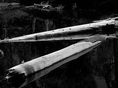
Logs in a Pond
I lost the trail in the granite near Gertrude Lake, but followed some cairns. Soon I saw Gertrude Lake below to the north, and realized the cairns must be leading me to Tyler Lake. I continued on until there was a cliff with lots of bushes below. I went up to the cliff towards the east where I could get there without going through the bushes, then headed along the cliff to west to where there was a spot easy enough to climb up. Then I just began heading southeast where it was easiest to climb.
After a while I checked my map and compass and decided I had been going too much to the east, so I turned directly south. I only climbed a little ways before I saw Tyler Lake slightly below me to the west. I quickly hiked down to the eastern shore of the lake, to a nice granite slab that ran into the lake.
I had expected to be alone on a Tuesday at a lake without an official trail to it, but there were three other people there. I had lunch and took a brief swim, then dried out on the granite in the sun.
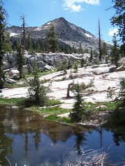
Tyler Lake
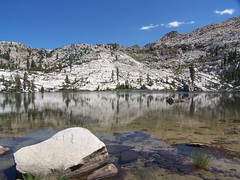
Above Tyler Lake
After drying off and circling part of the lake to take pictures, I headed back down to Gertrude Lake. It was quite a bit different from the year before, with the water level much lower and more weeds and mud about. Not nearly as pleasant.
After returning to the car and getting back to US 50, I took a detour on the way home to visit the institution known as Poor Red's in El Dorado. Hopefully I'll get a report on that place written up soon.
Hike Summary
Date: 22 July 2006 & 31 July 2007
Trailheads: Rockbound Pass & Twin Lakes
Approximate distances: 8.4 & 8.0 miles
1 comment:
Which picture shows the difficult half mile?
Post a Comment