Some of my photos are now for sale at ImageKind.

Nature Index
(My hiking and camping adventures in Northern California.)

Culture Index
(NorCal cities, highways, restaurants, museums, architecture, historic attractions, vintage neon signs, roadside attractions, etc.)

Thursday, August 30, 2007

El Dorado National Forest: Carson Pass to Emigrant Lake

20070830 Grass-of-Parnassus
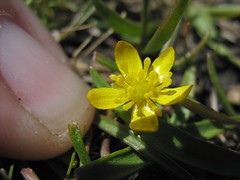
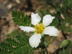
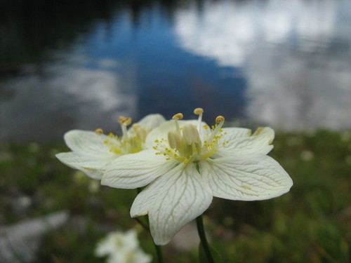
Grass-of-Parnassus Next to Emigrant Lake

My friend Erik and I decided to squeeze in one more hike before the crowds hit the trails for Labor Day Weekend. I gave Erik a choice of an easy hike to Emigrant Lake from Caples Lake, or a more difficult hike from Carson Pass to Fourth of July Lake via Round Top Lake. In finding information to answer his questions about the hikes, I read about an alternative: Carson Pass to Round Top Lake, and then off trail to Emigrant Lake. I suggested to Erik that we try that, writing "Why bother to drive all that way and not have a little fun?" He agreed.

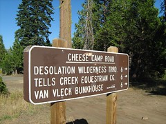
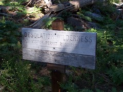
Carson Pass is the high point on CA 88 when it passes through the Sierra Nevada, south of Lake Tahoe, and east of Sacramento. It is named after Kit Carson, who led John Fremont through the area, and performed the great feat of carving his name on a tree. A bronze replica of the carving stands at the edge of the parking lot for the trailhead, and indicates that the original is preserved at Sutter's Fort in Sacramento. The trailhead here has an information center, where permits for camping my be purchased. This is where the Pacific Crest Trail crosses CA 80, with another trailhead just west on the other side of the road heading north on the PCT. At both trailheads, parking is $3.

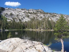
This trail quickly passes three mountain lakes, without much climbing, and we weren't slowed down by heat either, as it was a cool day with lots of interesting cloud cover. We quickly climbed a broad, winding path up to an unmarked junction. I glanced over and saw a lake to my left, which had to be Frog Lake, so we headed over. This late in a dry year, the lake had shrunk considerably from its usual perimeter, leaving that unappealing bathtub ring look. But there were nice granite boulders along the south shore of the lake, and a backdrop to the north of a volcanic ridge in the distance forming the northern wall of the valley.
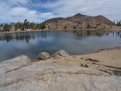
20070830 Frog Lake
Frog Lake

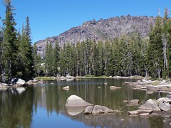
Back on the trail, we soon encountered a signed junction, left to continue on the Pacific Crest Trail 22 miles to Ebbetts Pass, or right one mile to beautiful Winnemucca Lake, which was our direction. The gradual climb here was through a mostly treeless area covered with small shrubs, with distant views on the right (northern) side of the trail, and the looming hulk of dark, rounded, and barren Elephant's Back to the left. The hike to Winnemucca Lake from Woods Lake is also short and easy, and so the area is heavily used. In my brief hiking career, this would be my fourth visit to Winnemucca Lake. There weren't many people on the trail on a cool and cloudy Thursday before Labor Day Weekend, but there was plenty of evidence of the popularity of these trails, particularly in the "Stay on Trail" signs and the posts near Winnemucca Lake indicating an area that was off limits for plant rehabilitation.

Loving the clouds, Erik was stopping to take pictures while I walked ahead. I came up above Winnemucca Lake to the northeast of it, and left the official trail to follow a use trail above the eastern edge of the lake to get some shots with the best lighting, and with one of the granite islands in the southeast corner in the shot. By the time I got over there, I saw Erik had arrived at the lake and called out to him, so he wouldn't think I had continued on past Winnemucca Lake.

I walked back and we headed down along the northern shore of Winnemucca Lake as soon as we were past the restricted area. The sky above the mountain that rises directly from the lake's edge to the south was dramatic, but without direct sunshine on the lakes and rocks, I wasn't getting the sharp colors and contrasts I enjoy.
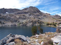
20070830 Winnemucca Lake
Winnemucca Lake

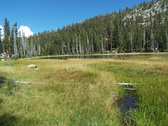
From the junction with the trail from Woods Lake at the northwest corner of the lake, we headed towards Round Top Lake, first crossing the outlet creek from Winnemucca Lake on a log. As we started up on the other side of the log, I started noticing more wildflowers. It was not the rich profusion you will find in July on the trail from Woods Lake to Winnemuca Lake, but any and all wildflowers are a welcome sight this late in the year.

As we climbed up with Round Top looming above us to the left and distant views of the valley to our right, we crossed a small stream flowing down from pockets of snow still clinging to Round Top's north face. Near this source of water the wildflowers were more abundant.

We climbed to a ridge, then started the gentle descent to Round Top Lake. I waited on a granite rock for Erik there, behind taking pictures again, and showed him the contour map while reading the directions from my book on how to get over to Emigrant Lake. I wanted us both to have an idea of where we were going.

From Round Top Lake, we followed the official trail, which goes on to Fourth of July Lake, south past posts marking where designated campsites were, and started descending gradually, with dramatic views of Caples Lake in the distance to the right, and directly below a view of lovely meadows, some of which I believe we explored when we got lost last year going to Emigrant Lake (I later made the hike to the lake from Caples Lake alone). A junction with a path that veered off to the right to the saddle between Two Sisters and Fourth of July Peak was clear, although unsigned. We took that, and passed where a sign of some substance once stood. On top of rocks, there were metal bars sticking out of a rock and mortar base, but no sign was attached to the metal bars. We descended to the saddle, then started up Fourth of July Peak slightly. We reached a fork in the trail, the more heavily used path heading right up towards the peak, while the more lightly used trail headed west, staying at the same elevation.

From the description I had read, I had the impression that our 1-mile jaunt west would be at about the same elevation most of the way, following the contours of the land, before making a short but steep descent to Emigrant Lake. The trail headed up seemed to me to have the top of this peak as its destination, whereas the other trail was following the sort of path I was expecting to find. I thought we should take the one that stayed at the same level, which ended up being my third worst decision of the day.

The path was clear at first, but as we hit talus, the trail disappeared. I just crossed as best I could, with Erik following, trying to avoid going up or down, except when necessary. Erik noticed there was a ledge up above, and thought the trail might be there, but I wasn't too concerned about the lack of a trail, since my book had described this as "cross country."

When we got to the other side of this talus, we climbed up to a saddle where there was clear trail, coming down from up above. We followed this some ways, and then it disappeared. I didn't stop to search for it, again, because I thought we were going off trail, and we just had to head west and stay at about the same elevation.

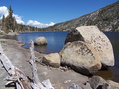
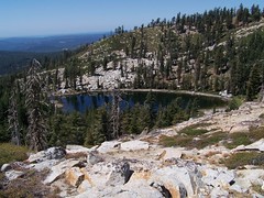
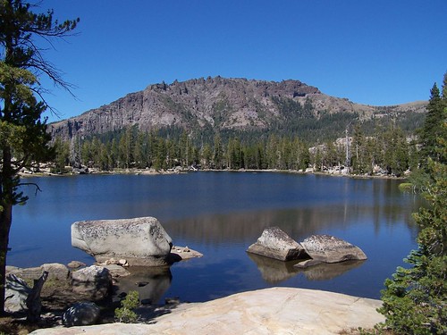
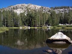
We continued on, just taking the route that looked best initially, and then we arrived at the top of the cirque around Emigrant Lake. I had told Erik that if he chose to take the easy trail from Caples Lake to Emigrant Lake, I would want to try to climb the rim above it for more interesting views. That is where we found ourselves, and it was dramatic. The mountain rises about 500 feet above Emigrant Lake with the exception of a small section to the north where the trail from Caples Lake arrives. Just to the east of that, and to the north of where we were, the rise of the mountain is not so shear as it is where we were, looking nearly directly down on a mixture of emerald and blue water, with Larger Caples Lake visible in the distance to the northwest.
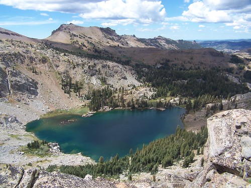
20070830 500 Feet Above Emigrant Lake
Above Emigrant Lake

The easiest way down appeared to be the more gradual course to the north, and I had climbed up part of that from the shore on my previous visit to Emigrant Lake. But it also appeared that we could get down more quickly following some slanting paths from where we were, directly east of the lake. So I made my second-worse decision of the day, and started down.
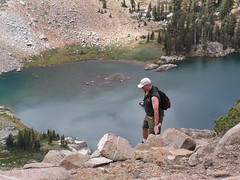
20070830 Me Starting a Tricky Descent
Me Starting Down

We both chose our own ways down, according to what looked best to us. My way was steep and required careful footing, and I had to walk through prickly bushes and hold on to tree branches. It took far longer than I expected. I kept looking down and then looking back up, and was always surprised that I still had so far to go, having put in so much work to descend already. But Erik was even higher up, and sometimes I couldn't see him. I would call out because I was worried. I thought he might choose to stay up top, rather than go down, which meant I would have to climb back up the same way, and I had decided I wanted to take the more gradual route up.

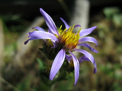
I made it down to the lake's edge and started to eat, but had little appetite. After taking some wildflower photos, I thought about the return route. It looked difficult to get around via the east shore to the area where I wanted to start up again, because the mountain rose up directly from the lake's edge. On the west shore a talus pile looked like a problem, so I started over to scout it out before Erik made it down.

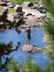
The talus ended up being no problem, but there was a huge granite arm of the mountain sticking out before it that was trouble. I started climbing it to get over. By this time, Erik had made it down to the lake's edge. As I was trying to decide whether to proceed, we called out to each other. At first I suggested Erik come my way, but looking at how difficult it was, I suggest he go the other way, if he could find a reasonable route. I thought about heading back the same way, but then made my worst decision of the day. I chose to slide down a slope I knew I would not be able to return on, and then drop down to the edge of that talus.

But the drop down was much more than I was expecting, about 9 feet directly below me, with little for grips along the edge to allow me to lower myself down. I tried to go back up, but couldn't make it. I thought about just dropping down that distance, but decided it was unnecessarily risky. Instead I called out to Erik and told him, "I'm in trouble, and I need help. I can't get down and I can't go back up."

So Erik crawled to my rescue. Not only did he have to pick his way back from the way he was coming, but then he had to climb up above me to cross over this outcropping and get down safely to the other side. I'm not sure how he made it, as looking at it later, the whole thing seemed impassable. He didn't make it easily, and had to stop to rest above me before continuing down.

I dropped down my backpack, which had to fall a short ways before Erik caught it. We talked about our approach and studied the situation. I had Erik set up his camera on a rock pointed in my direction to record a video of the event. It's not like I was going to die, or even break a leg, but if I ended up with a sprained ankle, $100 from America's Funniest Home Videos would help ease the pain.

It looked to Erik like I could climb back up, but I had already tried that. The slope was too steep, and the crevices just didn't let me get a finger hold, but I tried again to show him I couldn't do it. It was less of a drop to my left and Erik's right (where you'll see him setting up in the video, making the drop look shorter than it was) and Erik suggested I try and get over there, and I did try, but it just wasn't possible. But soon I was fully committed committed to coming down. I was sliding down slowly, but inevitably, with no way to stop myself and get back up. It was slow and controlled because Erik supported some of my weight by holding up one foot, and I was holding the ledge as best I could as I slid down. We were both most worried about me being twisted to the side and not landing on my feet, but Erik backed off at the perfect moment, and I landed with little trouble, much to my surprise. It was more of a challenge than it looks like in the video.


Untitled from Elund and Vimeo.

My legs were shaky for several minutes after that, but not from any exertion--I had mostly been resting comfortably, saving my strength. It was just from adrenaline. But I wanted to start across that talus immediately, as now my only thought was of getting home. On the other side of the talus, it was easy to pick up a use trail that took us through bushes and the sometimes swampy land around Emigrant Lake (not that day). We made one stop because Erik's boot had separated at the sole. I taped it up with medical tape, which is no match for duct tape, and we continued on.

We started up the use trail I had followed up the rim of the cirque on the northeast side of the lake the year before, and soon I realized it was more than a use trail. Not only was there the occasional cairn, there were orange paint marks on rocks leading the way, each one a line with a dot above it, like a small "i," the same mark used in blazes on trees. This simple fact changed my approach dramatically: no longer did I think I was going cross country, as best I saw fit, but instead I was following a diaphanous trail, and needed to carefully search for signs of it. Erik, being totally spent and not having the time to rest that I did, was moving slowly, so I took advantage of that time. Rather than plowing ahead as usual, I took the time to stop and study the area, and look for any sort of indicator of trail.

This worked pretty well. I would lose the trail at points, and just start up what seemed the most reasonable route, and then I would see another trail indicator. This meticulous approach really paid off at one point when I didn't see any trail indicators ahead, and would have just continued the direction I was going, but after long study, I saw one of the orange paint marks above. The trail jogs sharply up and to the right at this point, whereas it had been fairly linear. I had gotten a little too far ahead of Erik at this point, however, and he jogged down here, only to see me up above.

Shortly afterwards I lost the trail completely, but a route to the saddle we had crossed before was easy and obvious, and as I got close to it, I saw the trail we had followed briefly on the way out a couple of yards above us. When I lost that trail on the way out, I should have been looking all around for cairns and orange paint marks, and maybe I would have spotted one below the trail that would have saved us a lot of effort, although it also would have deprived us of a great view.

Back at the saddle and the trail, this time we headed up over the trail we had seen and joined from below on the way out. Again, it was not easy to follow. This is talus, "A scree slope, consisting of material which has fallen from the face of the cliff above" (SOED). With the heavy snows, run off, and freezing and thawing, there's a lot of erosion and rock slides each year on talus, and a well-laid cairn is likely to be knocked away. But we did as best we could. I'm pretty comfortable with crossing talus with trail or without, so when I seemed to lose the trail, I would head up or down and try and find it. If I succeeded, I would let Erik know where to go.

Once we got across that field, we were back on a well-defined, and nicely switchbacked trail, the one that I had thought on the way out climbed to the peak of Fourth of July. When we got back to the junction where I had erred before, I pointed out the mistake to Erik.

Everything was clear from then on out. Both Erik and I had run out of water long before and were looking forward to getting back to the car, but it would take awhile. Near the end of the return, we saw a backpacking couple just heading out with their two dogs, a small white one, and a large black one. The large dog had only three legs, but he was hopping forward on the trail with great enthusiasm. That dog looked as though he felt the same way I did in planning this trip, "Why bother to drive all that way and not have a little fun?" It was nice to pick up some of that vibe again as the hike ended.


Hike Summary

Date: 30 August 2007
Trailhead: Carson Pass
Approximate distance: 10 miles

Wednesday, August 29, 2007

Lake Tahoe Basin: Meeks Bay to Stony Ridge Lake

20070828 Crag Lake
Crag Lake

Meeks Bay is along the west edge of Lake Tahoe, somewhere close enough to the middle north/south that I wasn't sure whether it would be faster to reach it from Sacramento via I-80, heading down from Truckee, or from US 50, heading north from South Lake Tahoe. For the record, Google Maps said I-80.

I took US 50, but with a plan. Before I have gone on these blitzkrieg hikes: drive up there as quickly as possible, get a long hike in without dawdling too much, and drive home the same evening. This time I wanted to dawdle. So I took a more leisurely drive up, stopping to photograph sites on US 50 that have become such familiar mileage marks to me. And I explored South Lake Tahoe, then went to the Taylor Creek Visitor Center and followed the short trails there, which lead back to other turnoffs, Tallac Historic Site & Valhalla.

For the evening, I got a campsite (#153) at Sugar Pine Point State Park for $25. There's a campground directly across the highway from the Meeks Bay Trailhead, but it was just off the road, separated by a chainlink fence. I'm not sure that is the Meeks Bay Campground, though, as when I was leaving the area I saw the sign for it that seemed to lead to protected area below the road.

I set up my new REI tent with no problem, but this was my first night in a sleeping bag on the ground in 18 years. To be fair, I had slept on a kitchen floor of a tiny San Francisco apartment in August of 1998 when all of the inn keepers turned me away (where can you find a good stable these days?), and that was more uncomfortable. But I didn't have chronic back trouble then.

Despite having bought a pad to go under my sleeping bag, and laying the tent on soft dirt with pine needles that gave no resistance to the stakes I anchored it with, I had a hard time sleeping with the discomfort. That could have been a good thing--there was a total eclipse of a full moon that night. But I was under the mistaken impression it was the next night. I'll catch that one next lifetime.

I was just anxious for 6 a.m., when quiet hours ended, to come. It started to get light sometime after 5, and just about 6 some birds began cawing loudly, as though they knew it was now permissible. I jumped right up and set about getting ready, brushing my teeth, eating, packing things up, etc. Then I was off to the trailhead.

Surprisingly, with all that and the preparation for the hike, it took me until 7:35 to head out. It was cold, but I quickly warmed myself up with a brisk pace, and took off my jacket after 15 minutes (I was already wearing shorts). The trail starts as a sandy, unpaved road just off of CA 89, next to private property, with plenty of signs to indicate that. There isn't room for a lot of cars. It seems like it should be a popular hike, with all the lakes you can access, but then it took me a long time to get around to hiking it.

I passed one person headed the other way early on this road, and that was the only person I saw until I started back to the car. The path continues southwest with minimal elevation change until reaching a junction sign marked for the Tahoe-Yosemite Trail. The road continues off a short distance to the left to the former site of Camp Wasiu, according to Tahoe Sierra, while the trail begins to climb to the right.

After a good climb, the trail leveled off and there was a meadow off to my left, filled with dead trees in the western half of it. The meadow near Shadow Lake that I saw later on was much like this, making me wish I knew more about the processes going on in these mountains.

After this the trail followed along Meeks Creek, although it was often not visible, and crossed over the Desolation Wilderness boundary, gradually curving farther towards due south. After crossing a large bridge over Meeks Creek, which could have been walked straight through or stepped over this late in a dry year, the trail began climbing again. At one point it veered to the east away from the creek and then looped back west to it, all so the hiker can make a more gradual ascent that the water's rapid descent.

As is often the case, when I approached the closest point on the trail to the creek, that meant I was just about to hit the lake from which the creek was flowing. I hit a junction sign, marked for General Creek and Phipps Pass (my direction) at Lake Genevieve. It surprised me to see the lake this soon, only 1 hour and 50 minutes into the hike. My map indicated that I had traveled 5.5 miles, which would mean I went much faster than I usually climb in the mountains. But I have two books here at home that say it was a shorter distance, 4.7 miles according to one, 4.6 miles according to the other.

Lake Genevieve was a delight, with a mountain ridge behind it, and a peak farther back. This would be the common backdrop for the first three lakes. The lake itself was a bit grassy and muddy for my tastes, without large sections of granite along the shoreline, or islands of granite.

I continued on the trail down the eastern shore of the lake and past it, only to once again be surprised with how rapidly I reached a lake. It was less than 10 minutes from when I started off from Lake Genevieve until I hit Crag Lake. Crag Lake is about the same width east to west as Lake Genevieve, but more than twice the length of it north to south. It's a bit closer to that dramatic backdrop, and thus prettier. Also helping is the granite western shore of the lake, which rises too steeply for exploration of that side.

I stopped atop a rock at the north end of the lake right next to its small dam and outlet creek to take the photograph placed at the start of this blog entry. Then I wandered down the eastern shore, looking for access points, but trees and bushes came right up to the lake. About half way down there was a rise of granite boulders, and from here it was possible to see the lake well, but farther along it was trees and bushes kissing the lake's edge, leaving no good area to hang out and swim from.

Passing on, I expected to quickly come upon a junction with a short spur to Hidden Lake. I began climbing and had to rock hop the creek that I was following from lake to lake. It was a minor crossing, but it was nice to see some water flow. I kept climbing, much longer than I expected.

Finally, I saw an unmarked junction. There were rocks laid across the path to the obvious trail to the right, and a cairn over on the trail on the left, indicating don't go right, go left. But I could see Hidden Lake below me at the end of that spur to the right, so I took it.

It's too steep for a good trail, and with lots of loose dirt and small rocks. It would be very easy to slip here, and I don't think the forest service wants people going this way. Midway down, the trail split, with an easier grade to the north end of the lake and a more difficult one to the south end. I went down to the north end.

I don't believe this is the trail on the map, as that heads directly south to the north end of the lake from a junction to the north. This trail headed from a junction directly east of the lake. The contour map also showed less than 20 feet of elevation change on the spur, whereas this was about a 100-foot drop. But I didn't see any other junction or spur trail, even looking again when I came back that way.

20070828 Hidden Lake
Hidden Lake

Hidden Lake is smaller than the other two, and that peak rises directly above it, so close that it is difficult to take it in. It had a nice little granite rock island. After wandering the use trail along its eastern shore, I made the steep climb back up to the main trail and continued my journey.

Soon I was next to the creek with a large depression to the east, and I expected to see Shadow Lake as I came over a ridge. But instead I saw a large meadow, once again with dead trees at one end. Looking back, there was a small lake off the northern end of the meadow, with reeds growing in it. Shadow Lake will not be a lake much longer, as the meadow will eventually win out, only to be supplanted later by forest, if I remember my 8th grade earth science course correctly. As I was passing and photographing each of these lakes I was sizing each of them up for swimming potential, and Shadow Lake had the least potential.

20070828 Shadow Lake
Shadow Lake

From here, only my final destination for the hike waited ahead of me, Stony Ridge Lake. I made it to the lake with plenty of time left in the day, and had a decision to make. Should I press on to Rubicon Lake? I thought (not knowing of the map's inaccurate marking of distance) that I had traveled a little over 7 miles. It looked like Rubicon Lake would add at least 1.5 miles, making for a round-trip hike of over 17 miles, plus a lot of additional climbing, as the map showed switchbacks up a steep slope to the lake. (Looking now at the mileage from another source, it would have been about a 16.2-mile hike, which is about what I wanted to do that day.)

I decided to stick with my original plan, and hang out at Stony Ridge Lake, waiting for the sun to shift in the sky. Like Shadow Lake, Stony Ridge Lake lies to the east of the trail, making it a better subject to photograph in the afternoon, whereas the first three lakes all were off to the west of the trail.

But I did choose to hike up the length of the lake to its south end, which is smidgeon under 1/2 mile of hiking. I'm glad I did, because near the south end was the spot I had been looking for, smooth granite shelves sloping gently down into the water, the ideal place to hang out next to the water and to lie on while drying out after a swim. I ate a sandwich, and then, not having seen anyone, decided to go skinny dipping.

20070828 Stony Ridge Lake
My Hang-Out

Stony Ridge Lake is easily the largest of the 5 lakes I visited that day, and it looked deep. The stony ridge rises directly from its east shore, shading it in the morning, and the mountain I had been admiring all day rises up from a little ways off the west shore of it, shading it in the late afternoon, all of which suggested to me that the water was likely to be cold.

It was. I initially was shivering. Although that soon passed, I never did get comfortable in it. But I swam longer than I usually do in such cold water. I'm trying to tough it out for longer periods, and jumping into cold showers at home and at the gym to get myself used to that initial shock.

Afterwards, I lied on the warm granite in the sun with my hat over my head until dry enough to put my clothes back on. I took some photographs, and admired the puffy white clouds that had arisen to the north--admired them until I noticed their dark undersides. I had heard on the radio the day before that there might be a chance of rain for South Lake Tahoe that day, which meant there might be thunderstorms in the mountains.

I did stop to take a couple of pictures on the way down, but I went even more rapidly than I had come up. I finally saw somebody else on the trail as I approached Crag Lake on the return, a backpacking couple. From then on I encountered a few others, some day hikers, some backpackers.

When I reached the road I looked at the sky before me and thought, "I had time to go to Rubicon Lake." But as I turned around I saw that back where I had been was completely overcast with dark clouds, and as I drove to South Lake Tahoe, it kept getting more and more ominous over the mountains. Coming down from the pass on US 50, I ran into the rain, and there was a lot of water on the ground from earlier rain. I wonder how the people I passed who were still heading out fared.

Hike Summary
Date: 28 August 2007
Trailhead: Meeks Bay
Approximate distance: 13.4 miles

Sunday, August 26, 2007

Sacramento Auto Museum/Towe Auto Museum/Towe Ford Museum

20080624 Sacramento's Auto Museum

I grew up in Montana, and when my sister went off to college in Washington, I got to take the trip between Billings and Tacoma at least twice a year. There were certain tourist stops that I saw advertised each time, and finally persuaded my mother to stop at, like the Silver Dollar Bar in Idaho.

20040814_28_Sac_Towe_Auto_Museum
Towe's Ford that he drove from Uruguay to Circle, MT

Another of these was the Towe Ford Museum and the old Montana state prison site in Deer Lodge. So it was strange to me when I moved to the Sacramento area to read about problems at the Towe Ford Museum in Sacramento. Why would there be another one here?

20080624 Lincoln Highway
Lincoln Highway Exhibit

It turns out that there just wasn't enough tourist traffic along I-90 in Western Montana, and the Montana Historical Society couldn't afford to maintain and display the collection. After two years of negotiations, the California Vehicle Federation received the collection of antique Fords on September 27, 1986 to display in Sacramento.

20080624 MID / CAL
Route 66 Exhibit

But in 1997, the IRS took possession of the fleet, in lieu of back taxes owed by Towe's business, and auctioned off the cars on September 13 of that year. Some of the people who bought the Fords loaned them back to the museum for display, and the leaders of the museum sought vehicle donations and loans of all types, and thus it became the Towe Auto Museum, rather than the Towe Ford Museum.

20070302 1954 Kaiser Darrin
1954 Kaiser Darrin

At a talk and slideshow I attended last winter at the museum, we were told that since there is no longer any association with the Towe family, the name of the museum would be changing, and they would have a contest to rename it. I believe it just says "Automotive History Museum" on the sign now, but their website is still under the name Towe Auto Museum.

20040814 Art Cars @ Sacramento Auto Museum
Car from the Art Cars Exhibit

They also announced that they had lost the lease on the warehouse where the cars are displayed, and were looking for a new site. I'm hopeful that a new location will mean a turn in fortunes for the museum. The present location is isolated and obscure, and does not draw in any people who weren't already determined to visit the place. It also lacks air conditioning, and the swamp coolers are no match for the extreme heat of a Sacramento summer afternoon. Each time I have visited, the museum has been mostly empty, sometimes even with lights turned off in sections. A docent there once told me that they relied on movie nights and special events to get by, because there were so few paid admissions.

20040814_36_Sac_Towe_Auto_Museum
Fifth Avenue Trolley

Which is a shame, because it is a fine museum, and they get some interesting vehicles on loan. They also display more than just automobiles, like the horse-drawn trolley pictured above, a room full of auto parts and machines used in auto repair shops, old toy cars, and, my favorite, vintage neon signs.

20050716_037_sac_towe_mus_hudson_s

I also enjoy the lifeless expressions of mannequins in museums.

20080624 The Cover of My Romance Novel (Unwritten)

(Sources: Sacramento Bee and Towe Auto Museum website.)

Saturday, August 25, 2007

Sacramento: Aerospace Museum of California

20070801 Airplane

The Aerospace Museum of California, previously known as the McClellan Aviation Museum, sits on the grounds of what was, from 1935-2001, a military base. The base was originally the Pacific Air Depot, but later became McClellan Air Force Base. In 1982 volunteers started organizing to establish an aviation museum, which opened in 1986. The museum was in transition after the base closed in 2001, but reopened as the private Aerospace Museum of California in 2005. Friends at work had told me I should go see it, but I didn't make it to the museum until August 1, 2007.

20070801 Aerospace Museum of California

20070801 Aerospace Museum of California

Most of the aircraft sit behind the building on paved surface with the occasional picnic table interspersed and a sign in front of each aircraft. But there is also an indoor portion to the museum, with a large enough space for several aircraft, rocket engines, and bits and pieces of aerospace equipment. They also have a simulated ride that costs an addition $5, a gallery of flight related art on a second level, a call café, and a book/souvenir shop.

20070801 Fist

20070801 Dummy

Admission was reasonable when I was there (I think it was $6), but they were also hosting The Da Vinci Experience, which cost a lot extra. That will only be showing there until the end of September.

20070801 The Da Vinci Experience
Model from da Vinci's Plans

20070801 Chamber of Mirrors
Da Vinci's Chamber of Mirrors

Links: Aerospace Museum of California

Friday, August 24, 2007

El Dorado National Forest: Highland Trail to Forni Lake

20070824 Grass-of-Parnassus
Grass-of-Parnassus

One of the least used entrances to the Desolation Wilderness is a trail that leads from the Van Vleck parking area to Forni Lake. This trailhead lies more than 25 miles from a major highway, and it does not offer the quick access to lakes and dramatic granite topography that other trailheads offer, but it is the quickest, if not the safest, route to dramatic Highland Lake.

After picking up my friend Erik, we headed west on US 50 to the turnoff for Ice House Road, just before 50 turns into a twisting two-lane highway that runs alongside the South Fork American River and approaches the pass to cross over to the Lake Tahoe region. We drove north that road, past the turn off for Ice House Reservoir and several turn offs for enormous Union Valley Reservoir, until we reached the delightfully named Cheese Camp Road (no, I have no explanation), which was signed for the Van Vleck Bunkhouse and the Desolation Wilderness.

20070824 CHEESE CAMP ROAD
Cheese Camp Road

From here my directions said to drive to a dirt road on the right 500 feet before a locked gate. How would I know when I reached that point? There was a sign that said, "LOCKED GATE, 500 FEET AHEAD." It's a short but bumpy ride on the dirt road to the parking area, where there were day use permits for the Desolation Wilderness.

From there we walked back up the dirt road, then down the paved road to the locked gate and beyond it onto dirt road. There are several old roads out here, some for the Van Vleck Ranch, only one building of which has been preserved, I believe, and old logging roads.

We passed a junction with a fork to the right for the Red Peak Trail, then immediately after a fork to the left for Loon Lake. We continued up the road past a useless cattle guard (there being no fence on either side of it) and some odd piece of yellow equipment on the left with two large wheels, until we reached a weather station and a junction post.

What lies ahead on that road, I don't know. We veered off the to right at the junction and the weather station. Here the trail followed an old PG&E road that has not been maintained. It was single track trail, but with an unusually large gap between the trees, and occasional evidence that this was formerly a wider road. Some small trees have sprouted up, though, and some time in the future, the evidence that there was a road here should be thoroughly obscured.

We passed along quite quickly on this fairly level portion of trail. We were not overwhelmed with dramatic views, but I was delighted to see so many butterflies and wildflowers this late in a dry season. The terrain varied from dense forest to meadow, sometimes mixed with glacial erratics (big granite boulders strewn throughout the forest and meadows).

The first meadow we crossed had a brook bubbling through it, again surprising when everything has been so dry. It later had a boggy area to cross, which must be a major task when there is more water around. Posts with the word "Trail" aided the passage across all the meadows. Other meadows were filled with dead or dieing mule ears and California false hellebore. And yet in some of the forested areas, green ferns were thriving.

Just past one of those meadows of yellowing mule ears, we met the junction sign indicating Shadow Lake on the left fork, and Highland Trail, on the right. We took Highland. It had frequent posts too, only these were much narrower than the earlier "Trail" posts, and said "Highland Tr."

Not longer after we reached the Desolation Wilderness boundary sign, which was interesting only because it was not the same shape as all the others I have seen. From there, the easy hiking was over. The trail immediately started up.

20070824 Desolation Wilderness
Desolation Wilderness Boundary

But in the brief section of the trail before it got ridiculously steep, I heard, and then spotted, a deer off to the left. Most of the Desolation Wilderness is, not surprisingly, desolate. Dramatic granite landscapes on which conifers struggle to find a foothold dominate the majority of it. This approach took us through much more forgiving, heavily forested areas, which can support deer and their predators, as evidenced by that deer, the only one I have seen in the Desolation Wilderness.

But that was only a few yards in. Then we started up a steep slope where trees were far more scattered. Not only was it steep, the footing was insecure--dirt and pebbles. I wasn't looking forward to descending this part. After the grunt up this portion, we leveled off to a lush area where the trail was mostly overgrown. Late in the year, it had been trampled down for us, but I imagine it is difficult to find the way across earlier.

Not that the path was easy to find for us. The trampled vegetation led us to the east past the talus on the slope to the north, and then up via a sketchy route. No cairns to mark the way this time, just guess work and then corrections. Once we got up close to the high point of the route to Forni Lake, there were indicators. Some obvious trail off to a viewpoint was marked as off trail by a line of rocks and tree branches, and cairns led us on to the short descent to Forni Lake.

This lake is described in Tahoe Sierra as "Hemmed in with vegetation" and "not particularly photogenic." It was not hemmed in with vegetation when we visited, given that the water level was so low. I walked out 25 feet into what was the lake earlier in the year, and now was just rocks coated with dirt, to take some pictures. The sound of fish splashing into the water was constant. At first, I just heard the splashes, and saw the concentric circles in the water, but soon I spotted the fish flashing out of the water to eat insects. Erik asked me why they were jumping out of the water and I told him that the little fishies were just so happy to be in a beautiful mountain lake that they were jumping for joy.

20070824 Forni Lake
Forni Lake

I thought we were going cross country from here to head towards Highland Lake, and my book told me to head off from the southeast part of the lake. My topographic map, on the other hand, made it look like we should head out from the northeast corner of the lake. I split the difference and headed directly east (the northeast corners would have been correct).

We picked our way cross country, going up wherever it seemed easiest to go up. Then we hit a ridge. There was a depression directly in front of us, and I did not want to go down to head back up again, but it looked like we should have gone up into that lower area. Consulting together and looking at the map, it looked like we should be climbing the ridge on the opposite side of that depression. I chose to skirt around it to the south, lengthening the horizontal distance, but avoiding a lot of additional climbing.

We worked our way over and then TA-DA! There was a trail. Had I read the description of this hike thoroughly, this wouldn't have been so surprising. It is not marked on my Desolation Wilderness trail map, but the trail up to the ridge overlooking Highland Lake is not a use trail, but a trail that was created at one time and even marked with blazes on trees, but which is now unmaintained and hard to follow in places.

We followed the trail up as best we could, searching for cairns often. And then came the ridge. This trail had been one without drama, and then, before me, was all the drama I could ask for. We were on the ridge of a cirque that dropped about 800 feet below with all granite terrain, a beautiful lake (Highland Lake) at the bottom, and Lake Tahoe in the background.

20070824 Highland Lake
Highland Lake

My original intention had been to go down to that gorgeous lake and swim in it, but it had taken us a long time to get where we were after a late start on the trail, and it was a long way down, and back up. My book warned of the dangers on the way down,which meant to pick our way down safely would likely be slow going. And yet it was beautiful and tempting. I really wanted to swim in a mountain lake that day, and Forni Lake was so shallow that it barely had room for its fish. I let the urge go and left it for another day.

The descent to Forni Lake, mostly via the abandoned trail, was much easier than the ascent, and not just because we were going downhill. It was a better route, even though I couldn't always find it. At one point I was sure I was thoroughly off trail, and then I was just as surely back on trail.

The sometimes confusing descent to the lush area followed, not much more clear than the abandoned trail. And after that, the steep descent on the loose rocks and dirt. As I expected, I slipped a few times, but I didn't fall. My strategy on such loose footing is to keep my feet at a 45 degree angle to the descent, 90 degrees when it gets intolerably steep.

20070824  Aster or  closely related flower

Back down to the easy, but not short, stretch, I stopped to take some macro shots of flowers, and water a tree. After an otherwise lovely hike, the portion of the trail that followed dirt road seemed unduly long and ugly, but at least we were above the valley heat, to which we returned all too soon.

Hike Summary

Date: 24 August 2007
Trailhead: Van Vleck
Approximate distance: 10.8 miles

Tuesday, August 21, 2007

El Dorado National Forest: Silver Lake to Granite & Hidden Lakes

20070820 Granite Lake
Granite Lake

So far I haven't been going on overnight trips to hike, but just driving up in the morning, doing a day hike, and then driving home in the evening. That means a lot of miles, which means a lot of wear on my car, a lot of money spent on gasoline, a lot of fossil fuels burned (although I do drive a Metro), and a lot of pollution released into the air, all so I can enjoy pristine natural areas.

To avoid that I have purchased a tent so that I can squeeze more into a single trip in two days, and then not have to travel as often. And I have been looking for closer hikes in the mountains that are still long enough to give me a good workout and get to beautiful places. I've nearly exhausted the nearby ones in my hiking books, and am already repeating hikes frequently.

With that in mind, I studied nearby areas on the old topographic maps used in the National Geographic Topo! software to see if I could come up with such a hike. I decided it looked like I could park at Allen Camp, hike along the shore of Silver Lake up to Granite Lake, then on to Hidden Lake, and then drop back down to Allen Camp, a little under 6 miles total, with less than 1000 feet of elevation gain, and three lakes.

I had to cancel a planned camping trip on a Sunday to take care of some annoying business Monday morning, so when I was done with that, I decided to squeeze in this hike. I didn't make it on the road to Silver Lake until 11:30.

Silver Lake is about 70-75 miles east of Sacramento, as the western tanager flies, and 20-25 miles south of the west shore of Lake Tahoe, just off of CA 88. It's a large lake in the mountains that is close and easy to get to from Sacramento, so it is developed. I went towards the Plasse Resort on the south end of the lake, but there is also a resort on the north end.

I drove past the office for the resort and past campgrounds, following the sign for the Stockton Camp. Immediately after that sign I reached the sign for the USFS Allen Camp. The spots in the parking lot are all large enough for vehicles with horse trailers, and there is a corral for day use next to the trail head.

I headed east at what appeared to be the trailhead, crossed a dry creek, and encountered an trail going north-south. For the time of day to give me the lighting I wanted for each of the lakes, I had decided to head north up along the shore of Silver Lake first.

I'm not sure if this trail was what I wanted, as the whole area is filled with camp sites, and people have just walked everywhere. There were no signs indicating destination and distances. I just started heading down to the lake, and quickly found myself wandering through campgrounds, past tents, RVs, Airstreams, and 5th wheels. Eventually I got to a place where a log ahead had "campsite" written on it, and off to a side, an arrow pointed to the left. I went to the left and before long found a trail. This soon merged with another trail, then another, and another still. Eventually I got to a sign indicating Camp Minkalo, 2 1/2 miles.

The trail went alongside Silver Lake at a bit of distance. Silver Lake was quite low this late in a dry year, and much of the area that had been underwater earlier was now mud or meadow. The trail would divide often, with one portion going nearer the water, and the other staying farther away, and then they would reunite. I stuck close to the water, and wandered off trail often to look for photo opportunities.

Silver Lake usually has one large island, Treasure Island. That day it had none. The water was low enough that you could walk out on land covered with tree stumps to the island. I was out exploring along this area before going back to the trail, and I'm guessing that is what led me to miss my trail junction.

20070820 Wildflower & Pinky Finger
Tiny Wildflower

There were two problems at work here. I take maps along on my hikes, but I don't always study them before I march off. And my map was outdated. It did not show a trail running all the way north and south along Silver Lake. Instead, it showed the trail veering away from the lake at Treasure Island, and then coming to a junction.

A ways past Treasure Island the trail started to veer away from the lake, but then it came right back to it, and soon I was approaching the north end of the lake, which I knew was wrong for heading to Granite Lake. I passed some people having fun swimming in a cove that just looked perfect for that activity, and passed a woman sitting by the side of the trail sketching. Then I was on an all rocky area, and quickly lost the trail.

20070820 "Which way?"
Directions for Shortsighted Hikers

At that point, I noticed a chimney to my right. Not the top of the chimney presumably attached to something unseen below, but a freestanding chimney of proper size for a house. I walked over and found and old foundation with it. Near there I saw trail, which I started to follow back south. It led me to a dirt road, and that led me to cabins that appeared to be rentals. I assumed this was Camp Minkalo. I headed down on a trail and soon saw the woman sketching, only this time I was on the other side of her. I dropped down to the trail and headed back.

20070820 Chimney
Chimney

20070820 King of the Island
Silver Lake Swimmer

This time I was studying my map. When I got back past the tip of Treasure Island, I decided I should be off to the west. I started climbing cross country up the slope to my left, thinking maybe if I got high enough I could see Granite Lake. But as I started climbing, I ran into a trail heading northwest up the slope. Presumably I would have found the junction with it had I continued south on the trail along Silver Lake.

I climbed up this trail through forest to the northwest, then it turned back south, and soon I encountered the junction that was marked on my map, with a sign indicating the direction to Granite Lake. I headed along and soon encountered a disappointing body of water. It was filled with granite boulders, but was no more than 2 feet deep in most places, and surrounded by mud and grass. I took pictures, but was disappointed that it wasn't suitable for swimming, as I wanted to swim that day, and had passed up suitable spots in Silver Lake.

20070820 Pond
Pond

I headed out on the trail again, and soon came to Granite Lake. What I had just been at was only a pond. Granite Lake was really more than I had hoped for. It had a dramatic backdrop, great sloping granite shelfs to hang out on next to the water, and it was nice for swimming, with granite and sand below the water, rather than mud and reeds. There was a family at a peninsula sticking out into the north part of the lake, so I went to a granite shelf on the southeast shore. I took a swim, then dried out in the sun on the granite, and ate a sandwich.

When I was mostly dry, I continued on through thick forest on a dirt trail. It was comfortable to hike on, after having abused my feet on rocky Mt. Tallac Trail on my last hike. I came to another junction in the trail. For those coming from that trail from the east, there was a sign indicating Granite Lake back where I had come from and Hidden Lake on the trail ahead of me, but there was nothing indicating where that trail had come from.

I continued on and came to Hidden Lake, which also proved to be a delight. It too had a quite dramatic cliff backdrop, although it didn't look as nice for swimming, and I would guess that earlier in the season there are lots of mosquitoes there. It was muddy along the shore, and there were grasses growing up to and into the water on the opposite shore. I had Hidden Lake to myself, appropriately enough.

20070820 Hidden Lake
Hidden Lake

20070820 Hidden Lake
Hidden Lake Reflection Upside-Down

My map showed the trail heading southeast of Hidden Lake before curving around to the east and then the north and returning to Allen Camp. There was a sign by the lake saying Plasse and pointing towards the south, which I took to be Plasse Resort, but it said 3 miles. That was puzzling, as I figured the whole hike was less than 6 miles, and I was about 2/3 of the way through it, it appeared when I glanced at the map. But I started out anyhow.

To my surprise, I started climbing, and climbing more, and I was doing more climbing than I had done on the rest of the trail. As I was about to start up some switchbacks, I reconsidered. If this was a 3-mile dead end, it would turn into a 6-mile mistake. It seemed as if I was headed up to the top of the rock formation, and I thought maybe this was Plasse, from which the resort took its name. I decided to head back to that junction with a trail between Granite and Hidden Lakes, the junction and trail not shown on my map, and take that trail. It was headed the right direction. Ultimately, I wasn't that far from Silver Lake and its campgrounds, and I could always just head down cross country if necessary.

But that wasn't necessary, as this was a trail that headed down to the resort area. It soon merged with another trail coming from the southwest. At that point I was wondering if that was the trail I had wanted to be on, and if they sold a trail map of the local area at the resort. It wasn't too long before I spotted a tent and and RV, and came across a trail running north-south along a large, dry creek bed.

I started south on that, but started climbing away from road, so I just set off to the east to get back to the road. Only then I encountered an area of enormous granite boulders that I had to climb and hop across. And as I got farther across it, bushes growing between them made the passing more difficult. I headed back north a little ways where ferns, rather than bushes were growing between the boulders, and came out on a trail next to a dry creek bed, just about 50 feet from the Allen Camp horse corral.

I had a few problems on this hike, but they are the kind I don't mind dealing with, and I ended up in a much better mood than I had been in all morning. As I drove up to CA 88, I was struck by the lighting of Silver Lake and the volcanic cliffs behind it, and pulled off the road to take another couple of shots before returning home.

Date: 20 August 2007
Trailhead: Allen Camp

Sunday, August 19, 2007

Calaveras Big Trees State Park

20080504 Tree Hugger
I think we can all agree that this is a big tree.

Come the first week of May, I find myself getting pretty anxious to get up into the mountains again, but it is still too early in the season for the Desolation Wilderness and the dramatic subalpine landscapes of the high Sierra Nevada. About the next best thing is Calaveras Big Trees State Park, which I visited on May 5, 2007 and May 4, 2008. Both years I found just small patches of snow in the forest, while wildflowers were already beginning to bloom. Best of all, Calaveras Big Trees is home to the second northernmost stand of giant sequoia--the world's largest living thing.

My first visit to the park was as much about the trip there as it was about seeing the park itself. I had been to Angels Camp once, six years earlier, but had not traveled through Gold Country on CA 49 from Jackson to get there. So I made plenty of stops coming and going to photograph old buildings and signs in the cramped old gold rush towns that were constrained in their growth by the hilly terrain: Jackson, Amador City, Sutter Creek, Mokelumne Hill, and San Andreas. Some of the old route of CA 49 is now bypassed, as people no longer conform to the terrain, but make it conform to them with TNT and bulldozers.

20070505 Amador City
Amador City

20070505 Welcome Sutter Creek
Sutter Creek

20070505 Jewelers
Jackson

20070505 Patio Drive In
San Andreas

In Angels Camp, the site of the Calaveras County Fair made famous by Mark Twain for their jumping frogs, I re-shot the same subjects from my previous visit. They have plaques in the sidewalk marking the name of the winning frog for each year and the distance of the winning jump. Every year that I visit the county displays at the California State Fair, Calaveras County features frogs. They also have a statue of Mark Twain in a small park in Angels Camp.

20070505 Angels Theatre

20070505 Mark Twain
Angels Camp

From Angels Camp it's a short trip up CA 4 through Arnold to the park entrance.

Just inside the entrance is the parking area for the North Grove Loop, which is all many visitors see of the park. It is a short and easy trail that takes visitors by some of the most famous trees. According to the park's brochure, Augustus Dowd discovered this grove in 1852. People didn't believe his descriptions of the size of the trees until he brought them there; their reports led to much discussion and made it into the papers. Man reacted as he always does, and staring at the difficult to believe and impossible to comprehend marvel of nature, people wondered, "How are we going to make money off of this?"

20080504 The Big Stump
The Big Stump

Some entrepreneurs got together and cut down the largest tree. Now you can climb stairs up and stand on the flat stump, known as The Big Stump. They shipped part of the tree around Cape Horn to be displayed in New York City. The show was not a success, and before it could be shipped to Paris, the exhibit burned. Another tree was stripped of its bark, killing it, to be shown in other cities, and a hotel was built in the grove. It operated from 1861 until it burned down in 1943. There were battles between preservationists and capitalist venturers over the North Grove until 1931 when a state bond act, fund raising by the Calaveras Grove Association, and gifts from philanthropists (former capitalist venturers who had already made their fortune) enabled the purchase of the land for the new state park system.

I visited the famous trees, including the famous fallen ones and read interpretative signs about them and saw the pictures of what things were like in a very different era. Then I got to help recreate one of the photos. A gentleman with a vintage camera and a tripod had a binder full of copies of antique photographs from the grove, and he was trying to recreate them, including having people in the same places. So I climbed up on a fallen tree to sit--wearing my Italian hiking boots, REI hiking pants, and polyester Nike shirt--where a woman in a dress had sat over 100 years ago for a photo.

There was a wee bit of climbing to an overlook off the main trail, and I came across some snow. I hadn't been expecting to see any. I came back down and finished the loop, occasionally shooting some of the white blossoms on trees, which I learned this year are Pacific dogwood blossoms, but otherwise not taking pictures. I didn't really know how to capture the wonder of that dark forest and immense trees in a photograph. To give a sense of scale, I would have needed somebody posing for me.

20080504 Pacific Dogwood
Pacific Dogwood

Then it was back in the car to drive to the South Grove. The South Grove was not assured of avoiding development until the early '50s, and became part of the state park in 1954. The trails here cover a much larger area.

As I headed out on the trail, there was a box interpretative guides that include a trail map for a nominal fee. I passed it up, since the park brochure I received at the admission kiosk included an overall map of the park, with trails marked, although it wasn't too detailed.

I descended to beautiful Beaver Creek, then started an easy climb. At one point the trail crossed a fire road, and then it was off on single track again. At one point I got to a point where the trail seemed to end. Some other people were there trying to figure out how to go on. I pushed through some undergrowth and found trail on the other side, and kept going.

I passed by many big trees, but then got to the ones large enough to be individually named. When I got to the end of the trail at Agassiz Tree, I tried to get a shot with me in it to show the scale. I set up the camera using my Gorillpod and set the timer, then ran over and stretched my hands out around the tree as far as they would go (not far on this enormous tree). The resulting image was a rather unflattering portrait of my posterior, and has since been destroyed.

There had been a split in the trail at some point, and the map made it look like I could do a partial loop back, so I went back a different route than the way I had come.

Soon I found myself doing a lot of climbing. I was huffing and puffing for a long time, and taking far longer to get back than it had taken me to get out. My trail description hadn't mentioned anything about a climb like this, and I had traveled farther on the way back than I had on the way out. While I was completely lost, I laid on my back a couple of times with a wide angle lens and shot up into the soaring trees.

20070505 Big Trees
Big Pine Trees, Observed While Lost

Eventually I came out on a fire road. Looking at my map, I was trying to decide which way to go on it, to try and get back to the trail I had gone out on, or to hook up with another trail that would get me back to the parking lot. I started to the left, then changed my mind and went the other way. If I was to the northeast of both trails, then I would be walking away from them on a long stretch of fire road until I hit a creek, and by that time I might have trouble making it back before dark.

I started down the road and somehow missed signs on the edge of the road, one marking the trail I was looking for back to the parking area and another marking a trail to on the other side to some railroad site. I would have walked past them and gotten myself in trouble, but two women, also lost, coming up one trail and out onto the fire road saw me in the distance and called out to me.

We stopped and shared what we knew and looked at the map. They gave up on their original goal of going where I had been, and decided to just follow the trail on the other side of the fire road, which I believe was labeled Railroad Tree. I found out I could get back to the parking lot on the trail they had just come from, the Bradley Grove Trail. Every time something goes wrong in my life just because of bad luck, I like to think of these times when things should have gone terribly wrong, but didn't, just because of good luck.

After that, it was an uneventful return to the car. Studying the maps at home later, I couldn't not figure out what trail I had been on that I did all that climbing on, and how I ended up where I did. In revisiting the South Grove this year, I hoped to figure that out, but I got no clue as to where I was last year.

This year my friend Erik joined me. We skipped the stops along the way, and started with the South Grove, the farthest from the park entrance, and worked our way back, taking three short hikes.

This time, I bought the interpretative guide, and ended up being glad to have it. We set off down a rerouted trail to Beaver Creek--according to the guide, beavers are not native to the area and have not been seen in many years there, but may have been introduced there at one time by trappers. The trail used to go straight to the creek through a meadow, but in an effort to control erosion, I would guess, it has been rerouted around the meadow and is not so direct. Just across the bridge we crossed a patch of snow, and passed the Bradley Grove trail junction.

20080504 Beaver Creek
Beaver Creek

I know next to nothing about trees or wildflowers, and that never used to bother me. But now that I write up descriptions of my hikes, I find my ignorance irritating. I've been reading John Muir's vivid and detailed descriptions of trees he encounters, and here I can't even tell if it's a pine or a cedar. My friend Erik knows a little more than I do on the subject, but he also wants to know more. So with the interpretative guide in hand, we worked on learning to identify at least a couple of trees.

As a result, I can tell you that we encountered mostly pine--ponderosa and sugar--and incense cedar along the one mile of trail up to the fire road. Sometimes we had to crawl over them, as the trail had not yet been cleared.

20080504 Giant Sequoia
Giant Sequoia

Across the fire road is the South Grove, and from then on giant sequoia started to appear. The largest of the giant sequoia are unmistakable, just from their immensity. But the younger, smaller ones are easy to confuse by sight with incense cedar. One big difference is how much the bark gives. Pressing into the bark of a giant sequoia is like pressing into a a dry and stiff sponge, whereas the cedar has very little give. The giant sequoia also tend to be surrounded by hundreds of egg-sized cones. In fact, I nearly lost my footing several times slipping on all the small cones filling the trail.

20080504_3936
Giant Sequoia Cone

We came to the point at which the trail splits, which was signed. I didn't remember a signed junction from last year. We took the left fork. That seems to be the way I went last year, as it seemed familiar. We joined up with the other branch at another signed junction later on. At one point the trail goes right in between two giant sequoias, and at that point I tried the guide's recommendation on how to best get to know a redwood: lie underneath the farthest outreaching branch and look up at it. I can't report that that particular spot seemed any different than just lieing anywhere underneath it and looking up.

We passed the Palace Hotel Tree and ended up at Agassiz Tree, where Erik was kind enough to indulge my request to pose by hugging the tree for the photograph at the start of this blog entry.

There's a sign near Agassiz Tree indicating the end of the maintained trail, but an unmaintained trail goes farther, and the map in the interpretative guide shows a grouping of giant sequoia nearby, the Moody Group, right on Big Trees Creek, which I figured would make it easy to find. So we hiked on. Soon, I couldn't find the trail anymore. I suggested we go over to the creek to see if we could find a grouping of giant sequoias. We couldn't, and I was getting scratched up going through all the undergrowth (in shorts, Erik had pants on), so we just turned back.

When we got back to where the trails split, we took the southern route this time. We soon came to a bridge with a fallen sequoia next to it, which provided the natural bridge (we took the natural bridge) across Big Trees Creek. I did not recognize this, or anything else until we rejoined the other trail, so apparently I did not hike this part the year before.

Going farther along, we finally started to encounter people, the first we had seen since a father and two boys with fishing gear back at the Beaver Creek crossing. We made good time, and got back to the car without me having any indication of where it was I hiked on my way back last year.

Then we drove to the next trailhead, Lava Bluffs. The park's website describes three trails, the North Grove, South Grove, and Lava Bluffs, although there are more miles of trail. So I figured this was a major trail. The name interested me, and the map showed it was close to the North Fork Stanislaus River, which I was hoping it had views of (it doesn't). But checking online before going, I found two descriptions of the hike which suggested it was a waste of time. Accordingly, I had warned Erik to prepare to be underwhelmed. The main reason for taking the hike was that both descriptions suggested it might be good for spring wildflower displays.

Another thing it turned out to be good for was exercise. The South Grove Trail is easy, and the North Grove Loop is even easier. The Lava Bluffs Trail, which also largely consists of a loop, had me doing a lot of huffing and puffing from climbing, and I was thankful for that. It's lower in elevation than the groves with giant sequoias, and there were a lot of oak trees, as I expect to find in the foothills. What kind of oak I'm not sure--the park's website indicates that there are California black oaks, canyon live oaks, and interior live oaks along the trail.

20080504 Mountain Misery
Mountain Misery

There weren't profuse wildflower displays, but there was a heavy groundcover of a plant with fern-like leaves, only more velvety than ferns. In places, these were blooming with lovely white flowers. It took me a lot of time afterward to identify them, but they are mountain misery, Chamaebatia foliolosa.

At one point we came out into an exposed hillside where the terrain was distinctly volcanic--mudflow blocks. I first noticed these on a hike to Round Lake in the Dardanelles Roadless Area of El Dorado National Forest. They look like blocks of concrete--lots of small rocks stuck together in a big block. Where the trail crosses them, it's easy to slip on the small rocks broken loose by hiking boots and rainfalls.

Here I spotted some fine Dudlyea cymosa (hens and chicks). I stopped to photograph it and wait for Erik, who had either fallen behind because of the climbing, or because he stopped for photographs. He's a big fan of dudlyea, and I wanted to make sure he didn't miss it.

20080504_3992

20080504_3988
Dudlyea

While I was waiting, I noticed another fascinating wildflower, Clarkia arcuata (glandular clarkia). The blossom was too small for me to capture in great detail with the lens I had, but was fascinating to me. There was this incredible tiny world within the petals.

20080504 Glandular Clarkia

The trail rejoins the other half of the loop right before a sign that says Lava Bluffs. A few yards of trail extend beyond that, and then there is an "End of Trail" sign. So we sat there trying to figure out where the lava bluffs were. But eventually I spotted them, way up high on the ridge, some exposed black cliff. Definitely lava.

The route back, on the lower, southern portion, is longer, but is relatively flat. In three sections of it, you follow and old ditch from an old 250-mile network to deliver water for gold mining. We encountered a couple coming the other way who mentioned they had seen poison oak up ahead, which made me start itching, just by power of suggestion. I got a terrible case of poison oak the last time I was out hiking, and had to get a prescription for prednisone pills.

As we were hiking it had been getting cloudier, after being sunny when we started. And the clouds were getting more ominous. We heard some thunder on the way back to the car.

Then it was off to North Grove. While I think it's a shame that so many people see nothing else of the park, there's no doubt that North Grove is the highlight. It's a very easy walk--I should have changed into my sandals, instead of keeping my hiking boots on--but it takes you through some inspiring sights. You would think that some of the thrill would be gone the second time around, but I found the opposite to be true. I was even more amazed on my second visit.

It started to rain while we were walking through North Grove, hard enough at one point that I put my camera away. Then I was free just to experience the place. I walked with my head tilted up, and nearly lost my balance several times.

I'm sorry that I have no way to show you what it was like. In John Steinbeck's Travels with Charley, he says something to the effect that it is impossible to communicate what it is like to experience a redwood tree with a photograph. I don't know if that's true, but certainly my own efforts offer nothing but support for his position.

Links: Calaveras Big Trees State Park, Calaveras Big Trees Organization