I didn't get into the foothills for hiking too often this year, as I didn't have much time in the spring, the best season for the foothills, to go hiking. But one hike I did make was around the edge of Bullards Bar Reservoir.
To get there, I drove about 40 miles straight north up the valley to Marysville, then headed about 25 miles northwest into the hills to the reservoir. I parked at a large lot with a boat ramp.
I didn't see the sign for the trail down close to the water, but instead followed a short use trail right to it from the parking lot near a structure to help the handicapped get in boats before they are lowered into the water. The trail is just dirt with only slight ups and downs. I wore sneakers rather than my hiking boots.
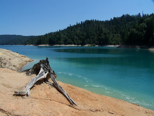
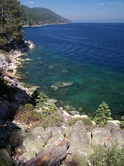
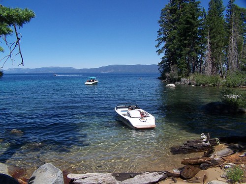
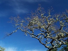
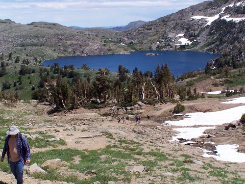
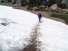
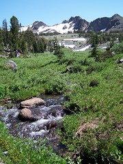
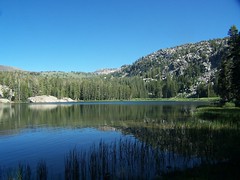
Even though I knew it had been an unusually dry winter, I was still surprised to see the reservoir so low in May. It had that bathtub ring look, with all the exposed dirt that is under water when the reservoir is full. But the teal water was beautiful. I took the shot at the top of this entry right at the beginning of the hike.
The rest of the hike was disappointing. The trail doesn't go right on along the water's edge, but up above it a bit, with trees and bushes blocking the view. I fought my way down a couple of times, but there were no nice beaches to get too.
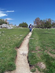
After I hiked about 6.5 miles, I headed back. At 13 miles round-trip, I at least got some good exercise.
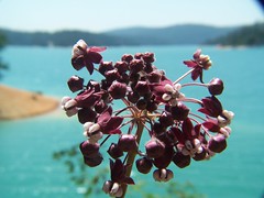
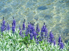
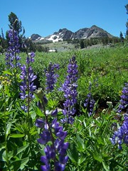
On the drive home, I pulled over at a field of lupine. I had an idea for a shot for the Sacramento Photographers pool photo contest on Flickr, the theme of which was purple. This is the shot I had in mind, with one flower up close, and the field of purple flowers behind out of focus. I was pleased with the photo, but it got no response, so I went with a different shot for the contest.
Study in Purple
Then I headed back across the dam for the reservoir and tried to find a place to photograph it. Security measures made that difficult. After that, I stopped in Marysville to grab a bite to eat.
I only started hiking regularly in April of 2006. This was my last hike of that first summer season. Shortly after this, I made to trip to Norway and Sweden, and when I came back, I broke my toe and stayed off the hiking trail for several weeks.
It's the hike I had planned to do when I was turned away from D.L. Bliss State Park because it had already reached capacity. That day I made a shorter hike to the same destinations. This time I was going on a weekday shortly after Labor Day--when the crowds have dwindled greatly, but Lake Tahoe is still in its prime. My friend Erik joined me.
We drove to D.L. Bliss State Park, paid our entrance fee, and parked by the trailhead. The trail began close to the water's edge horizontally, but well above it vertically.
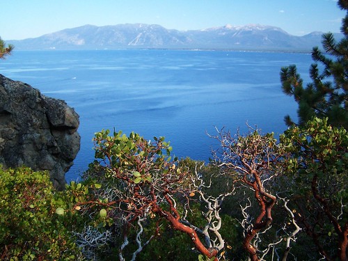
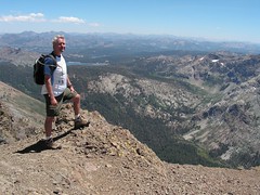
As we set out, we had great views of Lake Tahoe, although it was a disappointingly hazy day (because of a forest fire a good distance away). The trail climbed quite a bit and went away from Lake Tahoe, and we were in forest. But then we descended all the way to the water's edge, and soon came to the point I had stopped at on the aforementioned hike from the opposite direction. The views of the lake from this point, just northwest of Emerald Point, are quite spectacular.
Then I was back on familiar trail. The trail cuts off the tip of Emerald Point through the forest and arrives at the shore of Emerald Bay, with its views of the emerald water, Fannette Island, and the ferry taking people out to the island's teahouse. The trail along the north side of Emerald Bay stays close to the water, and there are frequently ladders down to the water, where people can pull in their boats and climb up to the trail.
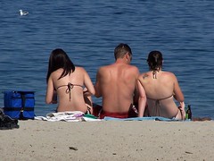
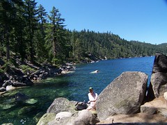
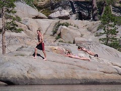
We passed the boat-in camp and then got to the area with all the people--the beach near Vikingsholm and the spur trail to Lower Eagle Falls. We went from dirt trail to paved paths. We made our way up to see Lower Eagle Falls first, then came back to take pictures all around Vikingsholm (but we did not bring money to pay for the tour). Then we headed to the beach.
California Hiking said that the two weeks after Labor Day are a great time to go swimming here, when the water is as warm as it gets all year, and the crowds are down. So we were in swimming trunks, ready to go in the water. Erik swam quite a bit. I was in and out briefly. Too cold for me. I preferred to lie in the sun on the beach.
Beach Goers
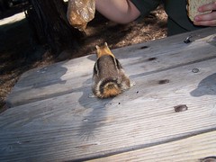
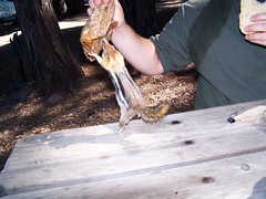
I don't remember if it was before or after this (I suspect before) that we stopped at a picnic table to eat lunch. There an aggressive chipmunk went after my sandwich. Erik picked it up to get it away from the chipmunk, but the determined chipmunk held on. I was trying to quickly take some photos, but didn't get the flash turned off. We held the chipmunk off, but letting our guard down a moment later it made off with the remainder of the sandwich.
Then it was back on the trail for an uneventful return to the car. Back at the trailhead, we had the benefits of having paid to enter a state park--flush toilets and sinks with running water. So much nicer than the smelly pit toilets at forest service campgrounds.
Hike Summary
Date: 12 September 2006 Trailhead: Rubicon Point Approximate distance: 9 miles
My plan on this day was to hike from D.L. Bliss State Park along Rubicon Trail on the western edge of Lake Tahoe south to Emerald Bay, Vikingsholm, and Lower Eagle Falls. But even though it was a Thursday, D.L. Bliss State Park had already hit its limit for visitors for the day, and I was directed to Eagle Point Campground, on the southern side of Emerald Bay.
I parked at Eagle Point and headed off in the direction of the trail. I saw a small use trail leading from a picnic table that I thought was a shortcut to the main trail. I followed it, and soon found myself working my way through trees and undergrowth down the side of a slope. I struggled a ways through this before coming out on a clear trail.
I was starting at the point on the southern side of the mouth to Emerald Bay and was hiking west to the innermost part of the bay. I had glimpses of the emerald water and Fannette Island to the north as I hiked along, gradually dropping in elevation.
View of Emerald Bay and Fannette Island
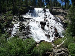
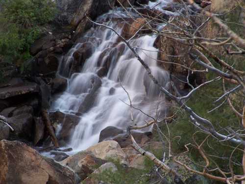
As I got close to the innermost part of the bay, I started encountering people. I crossed a bridge over a creek and hit a junction with the short spur to Lower Eagle Falls, which I took. It's a steep (but brief) climb up to an overlook of the falls. There were lots of people here, and plenty of evidence of where people had left the trail for closer views of the falls. Then I dropped back down to the trail and continued to the north, having already reached the westernmost portion of trail.
Lower Eagle Falls
There I ran into large crowds of people who were parked in a lot above off of CA 89 and had come down to use the beach and visit Vikingsholm. I certainly looked out of place with my hiking boots on and my backpack filled for an all-day hike around people in swimsuits and flip-flops. There were several boats at the pier.
Vikingsholm
But it wasn't long before I was away from the crowds. Hiking east along the north shore of the bay I was much closer to the water, and my view of the bay was not obscured by trees as often as it had been on the south side. At one point I passed through a campground--a boat-in campground.
As I got close to Emerald Point, the trail veered north away from the water. My map showed the trail splitting two ways, with one continuing on along the water's edge around Emerald Point, and the other cutting across farther inland. I figured I would take the latter way out, since it was the only path I saw, and take the other way back for variety.
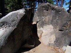
At one point the trail here passed through the middle of a boulder that was split in two with just enough room for a person to squeeze through.
Narrow Passage
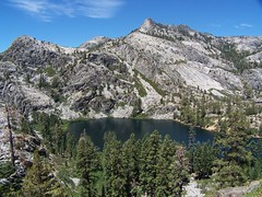
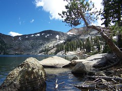
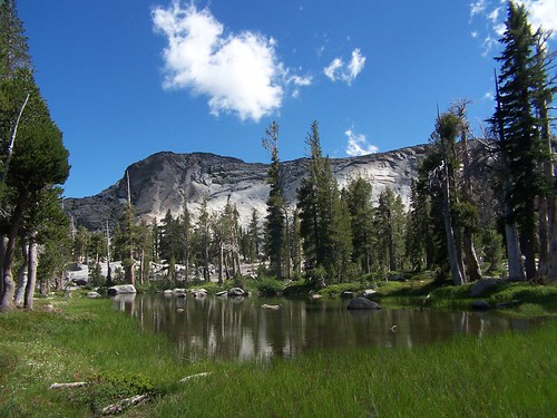
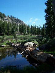
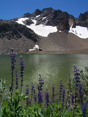
Finally I came out next to the water along the shore north of Emerald Bay. I passed one particularly gorgeous cove that had one boat anchored in it and a lovely beach. What a place to spend a vacation (picture at the beginning of this account).
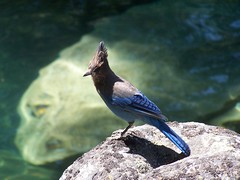
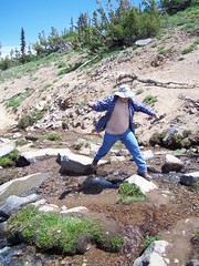
When I reached a point with an expansive view of the lake and shore with some nice boulders, I stopped to eat my sandwich. As I was sitting there eating, several Steller's jays flew in and landed on rocks around me. I was able to get some good close-up shots.
Stopping Point
Steller's Jay
Then I returned. I tried to find a way out to the end of Emerald Point, but never did succeed. So I ended up just passing through everything I had seen earlier.
Hike Summary Date: 27 July 2006 Trailhead: Eagle Point Campground
The Velma Lakes are a popular destination for hikers into the Desolation Wilderness coming from Lake Tahoe. The two trailheads that offer easiest access to these lakes are both along CA 89 on the west shore of Lake Tahoe, at Bayview Campground and at the parking lot for the short hike (1000 feet) to Upper Eagle Falls just above Emerald Bay on Lake Tahoe's western shore.
I made the hike to Middle Velma Lake in 2006 from Bay View Campground. The advantages of starting there are that it's easier to find a parking spot, you don't have to pay for parking (it's $3 at Eagle Falls), the climb is on an easier surface (mostly dirt), and early on there are some nice views of Lake Tahoe and Emerald Bay..
But this year I chose to approach the area via Eagle Falls, in order to see Eagle Falls and Eagle Lake. This route is more direct, but a lot rockier. I wanted a bigger challenge this year also, so I planned to add a lot onto my hike. Last year it was just Middle Velma Lake. This year I planned to visit 6 lakes, Eagle, Dicks, Fontanillis, Upper Velma, Middle Velma, and Lower Velma Lakes. It was an ambitious plan. I didn't end up making it to the last two lakes, but I still experienced an all-day, butt-kicker of a hike.
As I hit the road, I heard the traffic report on an overturned 18-wheeler on westbound I-80 between West Sacramento and Davis that had traffic backed up through downtown Sacramento. I was trying to get on eastbound 50, but as I came up onto Watt from American River Drive, my way was blocked by all the traffic backed up waiting to get on westbound 50. So I just exited on La Riviera and headed to another freeway entrance, where I had no problem. I've got a dozen different ways to get to anywhere in the area, and am ready to adjust my route according to the traffic situation at hand.
As I headed out on 50, past Folsom, El Dorado Hills, Cameron Park, and Shingle Springs I saw the usual blight of uniform, low-density, tract housing. I can certainly understand why someone would want to live in the foothills, even if they work in Sacramento. But I don't understand why people want to live in such uniform tract housing, going to major chain stores and restaurants, and obliterating all local identity. Tract housing is quite uniform in class, and people who live in such generic communities seem to identify more with people similarly isolated in soulless communities around the country, united by their cable and satellite television channels, rather than having a connection to the people around them, of all class levels, and the history of the land around them.
That's probably not a fair characterization of the people who live there, but when I was driving by I was upset over the news I had read in the Sacramento Bee about the unanimous decision by Placer County supervisors to approve the building of 14,000 low-density housing units in defiance of the regional growth plan approved by the Sacramento Area Council of Governments in 2004. As I got to less suburban Placerville and beyond, my spirits lifted.
The parking lot for Eagle Falls had a few open spots when I arrived, which was a lucky thing. I filled out my parking permit and paid my $3, and also filled out my Desolation Wilderness permit, but I left it in the car. I hiked up to Eagle Falls before realizing I had forgotten it, and returned to the car. The lot was full by then. A woman looking for a parking spot asked me if I was leaving. It would be about 7 hours before I left.
It's a steep climb, but only 1000 feet to Upper Eagle Falls, which was signed "Eagle Falls." But there's also the more impressive Lower Eagle Falls, below, and on the other side of the highway. There's a bridge across the top of the upper falls, and then just 500 feet later I reached the Desolation Wilderness boundary.
This has to be one of the most popular hikes into the Desolation Wilderness, with most people stopping at Eagle Lake, just 1 mile from the trailhead. It's a steep climb, but easy enough if you pace yourself, and the lake is gorgeous. Horsetail Falls also attracts lots of tourists who spot it off US 50, but because it can be a dangerous hike for novices, the Forest Service does not make permits available at the trailhead. You have to have planned ahead to hike all the way to those falls.
Eagle Lake
Eagle Lake, surrounded by towering granite cliffs, was a treat, and there were a good number of people there on a Thursday, around noon. In the afternoon on a weekend it would probably be overrun.
I didn't stay long, but continued up the trail. From Eagle Lake the trail rises on a ledge with fantastic views of the lake from above. After a while it turns into a forest and I lost my views, but gained some shade. It briefly dips to cross a creek that might dry up later in the year, then continues climbing. The trail comes out into an open granitic terrain where cairns and rows of rocks on either side indicate the trail. At one point the trail seemed to go several directions, but I think they all ended up at the same point.
Just Above Eagle Lake
Soon after, there's a brief drop, and then I was traveling along a ledge of a steep cliff, with a pond covered with lily pads at the bottom. On all sides of the canyon rose walls of granite. There's no problem with the footing here, but I didn't rush along, as a trip could have had disastrous consequences.
The trail rose up through some bushy areas, and across more granite, and suddenly I was familiar with my terrain. I was right at the junction with the trail coming from Bayview Campground, which I had hiked up the previous year. It was around 2.6 miles and 1620 feet of elevation gain to reach this junction.
I followed the familiar trail up and down until it split, left to Dicks Lake, right to Middle Velma Lake. Last year I went right; this year I went left. I began a short descent and arrived at a beautiful body of water in a short time. I assumed it was Dicks Lake. I stopped and took pictures, and then continued on the trail. I started climbing a lot towards the west. I knew it was a short distance between Dicks Lake and Fontanillis Lake, without much elevation gain. So I started checking my map and compass.
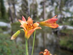
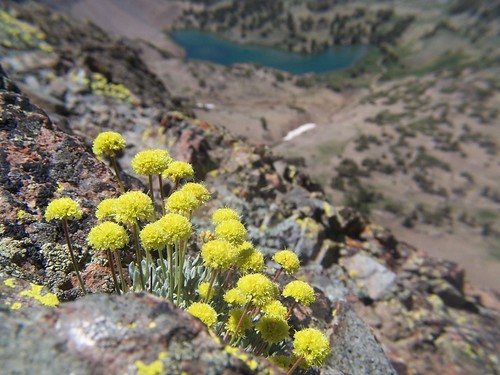
Tiger Lilies
I couldn't make sense of things. I could see from up on the slope Upper Velma Lake to the north, but couldn't figure out what trail I was on. It was a clear trail though, one which had been constructed, and couldn't be new (I don't think they would make improved trails in a designated wilderness area today). I was close to the top of my climb, and should have continued, but I didn't; I went back down to the body of water.
I now speculated that it was Fontanillis Lake and that I had missed the short spur to Dicks Lake. But soon that didn't seem to make sense either. I had been hearing people for a while coming from the direction I had just returned from, so I asked them when they reached me.
Nothing would have made sense of the situation until I was disabused of the premise upon which I was basing everything. I had not yet reached Dicks Lake. This picturesque body of water I had admired was just an unnamed pond.
For the second time that day, I started huffing and puffing back up a climb I had already made. This was a clear trail that had been helpfully signed, so I shouldn't have had to do that.
I passed the junction with the trail to Dicks Pass, and went on to Dicks Lake, off a short spur. I didn't stay long, but headed onto Fontanillis Lake. At this point, the flaw of my 6-lake route became obvious. It would be better to take 6 hikes, one to each lake, and spend some time at each one. Maybe I could bring a book and my goggles for swimming. At this point I was checking my watch and my map, and revising plans.
Dicks Lake
The trail approaching Fontanillis Lake from Dicks Lake gave me good views of the lake, then headed away from it. This is because there is no easy shore access from the south end of the lake, just high granite cliffs. The trail doesn't approach the shore until you get to the northern portion of the lake.
Fontanillis Lake
At that point, I had to rock hop the outlet creek from Fontanillis. My original plan had been to take a shortcut from Fontanillis Lake to Upper Velma Lake. It looked on the map like following the main trail north to a junction, then heading east, then heading south again to Upper Velma Lake would be about 2.3-2.5 miles. It looked like it was about .3 miles cross country following the creek that flows out of Fontanillis straight down into Upper Velma Lake.
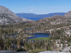
Upper Velma Lake from Just Above Fontanillis Lake
Before crossing the creek, I climbed up above to survey the situation. I could see the full flow of the creek down the granite into Upper Velma Lake. I decided to go for it. (Disclaimer: my blog is not meant to be a trail guide. Do not take this as advice on how to hike this area, or assume that it is safe because I survived. Stay on the trail.)
As I headed down, I kept thinking, "I hope I don't hit an obstacle that blocks my path, because I don't want to climb up all this granite again." It got steep in portions, and I had to sit down to lower myself a couple of times, but I made it, and quickly found the trail.
Upper Velma Lake
I had time to make it to Middle Velma Lake, at least--at this point it wasn't far off. I might have been able to make it to Lower Velma Lake as well. But I figured I would save those for a more leisurely trip into the area with my friend Erik in the future. Instead, I headed back.
I came down to a creek crossing I had a little difficulty with the year before, but flew across this time. Then I started climbing. I didn't remember the climb back from here as being so long or as having so much elevation to gain from last year's experience. Of course, I hadn't tired myself out with that much climbing prior to the return last year.
By the time I got to the junction that splits the Bayview Trail from the trail to Eagle Lake, I was worn out. It was almost all downhill from there, but my knees and feet had had enough, and I had to be careful on the way down to use my tired muscles rather than punish my tendons and ligaments further. I started counting down the distance I had remaining: Eagle Lake meant 1 mile remained. The Desolation Wilderness sign meant 1500 feet remained. Eagle Falls meant only 1000 feet to go.
On the Descent
I stopped at Eagle Falls, now entirely in shade, to get a long exposure using a neutral density filter and my Gorillapod. Finally, I made it back to the now nearly empty parking lot, still with plenty of time to get over the mountains before it got dark.
Eagle Falls
Hike Summary
Date: 19 July 2007 Trailhead: Eagle Falls Approximate distance: 11.5 miles
Part of the adventure of this hike was just finding the trailhead. My friend Eric and I drove east on I-80 to Truckee, then headed south to Tahoe City on CA-89. In Tahoe City we turned right at the light to continue following CA-89 down the west shore of Lake Tahoe. It's a beautiful drive, with views of the mountains and Donner Lake from I-80, views of the Truckee River and people rafting down it down CA-89 to Tahoe City, and then views of Lake Tahoe farther down.
We were looking for Barker Pass Road, to take to the parking lot and trailhead at Barker Pass. But we never did see any sign visible from CA-89 for that road. After going past it a couple of times, we checked the map yet again. Erik recognized the Kaspian picnic area right near the road as something he had seen a sign for, and we were able to find the road based on that. I believe the sign we could see from CA-89 also said Blackwood Canyon. But it was only after turning onto the road that we were able to see a National Forest Service sign that indicated it was Barker Pass Road.
At one point the road splits, with a dirt road continuing ahead directly east, and the paved road curving around south, crossing a creek, and then heading east again. A sign right in between them unhelpfully told us "Barker Pass Rd." We tried the paved road, then the dirt road, and then returned to the paved road.
The paved road was the right choice. As soon as the pavement ends, you are at the trailhead. There is an area to park up and to the left. There are no facilities.
We headed up the trail through the forest, and were immediately panting. This is a short hike with moderate elevation gain overall, but the climbing portions follow a steep grade that forced us to go slowly and work for good footing.
We climbed through forest until coming out onto an open ridge with many wildflowers. To the west were dramatic views of granite slopes and peaks and a large lake, which from the map I would guess was Hell Hole Reservoir. To the east were jagged cliffs and portions of Lake Tahoe visible in the distance. Unfortunately, the haze made for poor photo opportunities. We could see a large plume of smoke rising over in Nevada, which I assume was responsible for the haze.
The grade on this ridge was easier than that through the forested portion, though we were buffeted by winds that had me holding my hat on. After a while the ridge widened out, and we started and easy descent, which became much steeper when we started to reenter forest.
Once the steep portion of the descent was over, we had an easy stretch, with only slight ups and downs. Towards the end was a small path leading to the left, which we walked past. Soon after we hit a 4WD road with a sign propped against a tree indicating that down it to the left was Ellis Lake, straight ahead on the trail was Ellis Peak, and there was no indication of where the road went to the right.
We went straight ahead and started another steep climb on a trail not shown on my map. It came out at a 4WD road. We headed up it to the left to its end, where it does a small loop for vehicles to turn around. From there California Hiking (2001-2002 edition) said that we should see the peak plainly visible. But I knew from Kevin Gong's hiking website that this is a false summit, and the true one lies beyond it (and I should have told Erik that earlier, as I was ahead of him at this point). What I didn't know is that there is a clear trail that leads to the true summit on the east side of the ridge with great views of Lake Tahoe. I didn't spot the cairn indicating where it started.
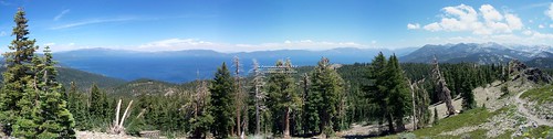
Instead, I climbed up to the false summit, then climbed down to start back up the true summit. About midway I ran into the trail. Up at the summit, I had fantastic views of most all of Lake Tahoe, from the north end to the south end. It was also windy again, so much so that I took my hat off and put in in my backpack.
Panorama of Lake Tahoe (To see this image in a larger size, click on it to be taken to its Flickr page, and from there click on "All Sizes")
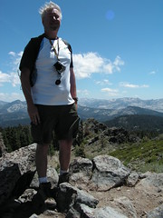
Me on Top of Ellis Peak
I stayed standing in the wind until I was sure Erik saw me, and was headed my way, then I dropped down to get out of the wind and eat lunch. Erik joined me, and after we were finished eating we took photos of Lake Tahoe and of Ellis Lake, which lies directly below the peak.
Then we started back on the clear trail, and took it all the way to the 4WD road this time. There was a cairn there, easy to miss a ways off road. To make it easier for future hikers to find, I lined up two separated rows of large rocks heading towards the cairn from the road to indicate the trail.
Then we headed down, leaving the 4WD road where a cairn marked the trail. We went down to the other 4WD road, the one signed for Ellis Lake. On my map, it looked like it was about 1/4 mile away. But California Hiking says that it is only 50 yards off on a short spur, and doesn't mention this 4WD road. After visiting the lovely lake and returning, we were able to piece it together. That trail we passed near the 4WD road on the way out goes about 50 yards to a depression with a small pond at the bottom of it. In a wet year, and/or earlier in the season, there might be enough water there for it to be confused with the lake. One could easily have seen it was not the lake from the true summit, but if you stopped at the false summit, you might not have seen Ellis Lake from above.
At Ellis Lake
Anyhow, I'm glad we figured things out, because we both really enjoyed Ellis Lake, and walked completely around it. Ellis Peak rises directly up from the edge of the lake with sheer cliffs. I jokingly asked Erik if he would like to return to the summit, the short way.
After we returned on the 4WD road to the trail, we had the easy stretch to complete before starting the only real climb on the return. I often push myself while hiking, but we had plenty of time, despite our delay in getting to the trailhead, so I forced myself to go at a slow pace and avoid working up much of a sweat. Once headed back down the steep portion near the trailhead, I could feel it in my knees.
I met a couple just heading up the trail here, who asked if it was a long ways. I asked where they were headed. The man told me that they were told the trail just ended after a ways (I guess it does at Ellis Peak). I told them about the two destinations. I encounter people like this often, who just hike until they feel tired enough to return, not having any idea what lies ahead, what they might be missing, or what they would need to do to be prepared to get there. Nothing wrong with that, I suppose, but I don't think it will ever be my approach.
Hike Summary
Date: 17 July 2007 Approximate distance: 6.5 miles Links: Kevin Gong's hike report
I know there must be lots of great trails to hike nearby that are not listed in any of my several hiking books. In order to find these trails I sometimes study maps for promising looking areas, and then search for information about potential discoveries online. That's exactly how I found the description of this short and handy trail on the Yolohiker website. I set off to hike it with my friend Erik.
The trail starts on land owned by the University of California and continues onto BLM land. The trailhead is just to the east of the dam for Lake Berryessa on winding CA 128 midway between Napa and Winters. We parked on the north side of the highway, the opposite side of the trailhead, and carefully crossed the road. You can start from one of two gates for this loop hike--on the east side of the creek bed, as we did, or on the west side. Dogs are allowed for part of the trail on west side, but not on the east.
We followed the trail south down the canyon next to the creek bed. Even though it was rainy season, the creek was not in continuous flow. There were pools of water, and evidence of previous flow between them. I would imagine that much of the year the creek bed is bone dry.
We hiked down past the old foundations of a house that are marked on the map available from Yolohiker, and soon afterward started climbing up to Blue Ridge. Most all of the climbing in the hike is accomplished in a short distance. There were lots of stairs connecting portions of trail on an incline. It was more intense than I was expecting from a hike with modest overall elevation change (1500 feet). Erik was lagging behind me on the climb, which gave me a good excuse to stop and catch my breath frequently.
Finally we were on Blue Ridge, and it definitely is a ridge, with steep drop offs and nice views to each side. The trail on this ridge is not so smooth--often times we were crawling over large boulders. To the north were excellent aerial views of Lake Berryessa, definitely the highlight of the hike.
We hiked all the way north along the ridge until it was time to descend. The descent was very steep at first, so much so that footing was sometimes difficult. Then we came across a prison crew in orange jumpsuits working on the trail. They were building switchbacks to replace this excessively steep portion of trail. I nodded and smiled at one of the prisoners as I would to a fellow hiker. He just stared at me in a way that was unsettling.
Then we got to the part of the trail they had already completed and had an easier time following the gentler grade of the switchbacks. It didn't take us much time to get back to the car, after which we drove up the road a little ways to stop and view the dam before returning to Sacramento.
Hike Summary
Date: 2 January 2007 Approximate distance: 4 miles Links: Hike description from Yolohiker.
I learned of this park from Top Trails: San Francisco Bay Area, but I planned my own route for this hike that was longer than the one described in the book. China Camp State Park is in Marin County north of San Francisco, wedged between the city of San Rafael to the west and San Pablo Bay on the east.
My friend Erik joined me on this hike. We parked in the fee area at China Camp Point. Most people parked on the side of the road, rather than in the parking lot, to avoid the fee. But since we were going to use the restrooms the state maintains and the trails the state grooms, I thought it only fair that we pay our fair share.
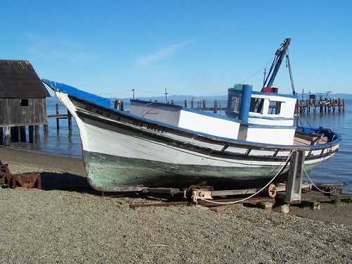
Before setting off on the trail, we walked down to the China Camp Museum on an old pier and saw the remains of the old Chinese fishing operations. Chinese immigrants once had a vibrant community here fishing for shrimp, but racist legislation restricted their operations so as to eliminate competition with white-owned fishing businesses and most were forced to find other work.
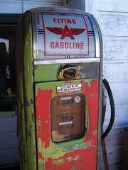
Old Gas Pump
Then we headed out on our hike. We followed a trail along the coast for a ways before turning inland and up the hillside into the forest. We took Oak Ridge Trail to Bay View Trail. Bay View Trail was disappointing. Given the name, I was expecting views of San Pablo Bay, but the view that direction was blocked by trees. There were many bicyclists on this trail, and I only encountered one all day that respected the signs that indicate that cyclists should yield to hikers (and everybody should yield to horses).
At the end of the Bay View Trail we came down the hill to the Shoreline Trail and a campground. We stopped and ate at a picnic table and used the restroom at the campground, then continued on the Shoreline Trail. We left it at one point to cross a road and take a walk around Turtle Back Island, which is not an island, but a hill right close to the water. The short loop around it features many interpretative signs.
Oak Tree
Then it was back on the Shoreline Trail to head back to the car. As we got close to the end of our hike, we ran into some ladies just heading out. They asked if they could do a loop on this trail. I pulled out my map and showed them the loop we did, but also told them we had been hiking all day. They couldn't make it very far before sunset.
Back at the parking lot we dumped our gear at the car and took a stroll down to the picnic area at China Camp Point, where there are fine views of San Pablo Bay and Rat Rock Island.
Hike Summary
Date: 13 January 2007 Approximate distance: 10 miles Links: Official website
I read about this park in Top Trails: San Francisco Bay Area, which has a broad definition of what constitutes the Bay Area. I was looking for a low elevation hike that I could do in the winter and one that would be quite a bit closer to Sacramento than the hikes I had been doing at Point Reyes National Seashore. The hike described in the book was shorter than what I wanted to do, it followed a dirt road much of the way, and it was an out and back on the same route hike. But from the map available at the park's website, I was able to plan a longer hike in a loop.
To get to this park, you turn right on Imola Ave. and head east just as your reach the edge of the city of Napa coming from the south. It's right next to the State Hospital, and is formed from land that at one time belonged to the hospital.
From the parking lot, I headed over to Manzanita Trail. The first part of this runs along a chain link fence marking the boundary of the archery area, and there are plenty of warning signs. But before long the trail turns south, crosses a creek, and enters forest. At one point the trail splits, with Toyon Trail paralleling Manzanita Trail to the west, and then rejoining it. Toyon Trail had another such split, with Toyon Creek Trail rejoining Toyon Trail later on. It was my favorite part of the hike--a dark forest with lush growth and green moss on rocks and a creek just off the trail. I don't have any photos to show for it, as I didn't know how to capture the loveliness of such an area in a photograph.
I continued south on the trail as it kept changing names--Marie Creek Trail, then Chaparral Trail, until I got to Lake Marie, the goal of the hike described in the book. I hiked back on Skyline Trail and Buckeye Trail, passing an old house foundation marked on the map close to the lake. I had seen the ruins of some old stone fences earlier. This last portion of the trail was muddy, but occasionally there were great views of the Bay Area to the southwest, which I hadn't been expecting. There were also nice views of the city of Napa.
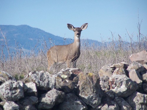
Somewhere along this trail, I passed quite a few deer, and got the only photo of the hike that I posted on Flickr. But I got quite a few more photos that day.
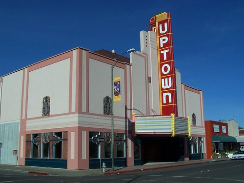
It was only about a 7-mile hike, and pretty easy, so I went into Napa to walk around and take some more photos and find a Wells Fargo ATM. I had forgotten my lunch in the refrigerator at home, and didn't have enough cash on me to get a meal. I did a lot of walking in town, but never did see a Wells Fargo ATM. So I went to this cool old burger place and asked if they took credit card, and they said no.
Uptown Theatre in Napa
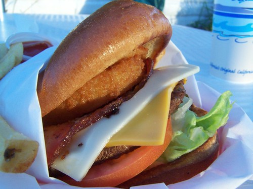
Frustrated, I drove to Vacaville and used an ATM I knew of there, and then went to Foster's Freeze. Having now walked more than 10 miles and having gone all day without eating, I felt justified in eating a decadent burger.
The Big Boss from Foster's Freeze
Hike Summary:
Date: 20 January 2007 Approximate distance: 7 miles Links: park website
This entry covers three different hikes, one to Winnemucca Lake in 2003 when I was terribly out of shape and knew little of hiking, and just looking for some photo opportunities, one to both Winnemucca Lake and Round Top Lake in 2006 when I was in better shape and just really getting into hiking, and one in 2007, when I was ready for new challenges.
All three times the hike started from the day use area at Woods Lake. This is a splendid lake at 8210 feet surrounded by forest that you can drive right up to on paved roads. There is a campground there, and a parking area for day users. The lake is slightly to the south of the are covered in my hike to Showers Lake--about 100 miles away from Sacramento, mostly to the east.
In 2003, I chose the hike to Winnemucca Lake out of California Hiking as it was only listed at 3 miles round-trip, and as difficulty level 2 of 5, and it was supposed to have great wildflower displays late in summer. I thought this was an easy chance for photo opportunities.
But "easy" is obviously a relative term. I wasn't in shape, I didn't know how to pace myself, and the hike is at high elevation. I was panting for breath on most of the climb, and stopping frequently. I remember a couple of women 25-30 years older than me passing me.
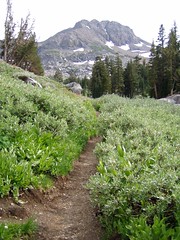
But the wildflower displays didn't disappoint. After crossing a creek on a bridge at the trailhead, the trail rises through forest and passes an old arrastra. Eventually I left the trees and found myself climbing a treeless area of mountainside with creek just below and wildflowers all over both sides of the trail.
Arrastra
Trail to Winnemucca Lake
Red Columbine
At the top, I arrived at the western edge of Winnemucca Lake, which still had plenty of snow around it. And that's about all I can remember of that hike.
In 2006, I went back with my friend Erik, only with the plan to make it a bit longer and more interesting hike by doing a loop that included Round Top Lake. We made the ascent to Winnemucca Lake, and passed a woman and a heavy set man who kept having to stop and was breathing heavily. It made me think of what I looked like hiking the trail three years earlier.
I must have gone in the middle of the week in 2003, as I don't recall the shores of the lake being nearly so crowded as they were in 2006. There are several different trails that access this beautiful area, and it is quite popular. At the lake some guy went for a brief swim (I don't think Winnemucca Lake ever gets warm enough for swimming). We went over to the northeast end of the lake, and much of the shore was marked as being off limits for restoration, as there has simply been too much traffic here. Of course, there were people ignoring the signs.
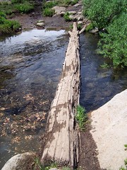
We headed back to the west end of the lake and had to cross the outlet creek to proceed to Round Top Lake. Erik had no problem crossing the log. I started to slip off and just had to rush on and jump to the other side.
Where I Almost Got Wet
We started a climb up from Winnemucca Lake with nice views of it when we turned back. At one point the trail was still covered with snow, which was quite nice to see, considering the extreme heat wave we were experiencing in Sacramento at the time.
Snowy Trail
Rock Hopping
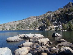
After the climb the trail made a slight descent along a narrow, but well worn, path to Round Top Lake. The shores here were also crowded, with both hikers and llamas. We continued around to the south end of the lake to eat lunch.
Well Worn Trail
Edge of Round Top Lake
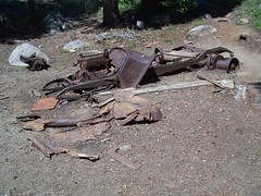
Afterwards we started our descent to Woods Lake. We passed through a great variety of beautiful settings, through forest, granitic areas, by creeks, and past a lush meadow. We came to some ruins of an old vehicle and who knows what else, and I believe it is here we probably mistook our trail, going along the creek to the left of the ruins, rather than to the right.
Old Car
We were soon clearly off trail, and just started working out way down to Woods Lake via whatever looked like the easiest way to go. I started taking a series of overgrown switchbacks, with Erik following. They were too regular to be accidental, and too overgrown to be the designated trail. We surmised that we were on an abandoned trail.
We met up with what seemed to be a clear trail and came up to a creek crossing with just a big log to get across. I didn't much like the idea of crossing there, and started down again cross country. But in talking to Erik, he said he had seen trail on the other side, so I climbed back up. Who knows if the creek could be crossed down at the level of the lake.
It was a wider log than the one we had crossed up by Winnemucca Lake, but I still needed the help of overhanging branches I could grab onto for balance. Once on the other side of the creek, we were on clear trail again and finished our descent. We came out in the campground by Woods Lake, and worked our way through it back to the parking area for day use. We checked out the shore of Woods Lake before getting in the car and heading out.
Back at Woods Lake
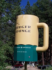
We made a detour on the way home to go into South Lake Tahoe and eat at Burger Lounge. I had the Black & Blue Burger (with blue cheese), and Erik had some vegetarian excuse for a burger.
Erik and I returned again in 2007, the day after we were placed on involuntary vacation when our employer ran out of work for us. This time we started up towards Round Top Lake first, for some variety. If you are heading into the campground from the day use area to find the trail to Round Top, you can get to it via a use trail next to the sign for camping spot #11. But if you park at the Wood Lakes Trailhead area, I think you will find a sign for it there, as we reached a sign pointing one way for Round Top Lake, and another for the parking area.
There was no mistaking our path this time. There is another path up, but it is marked with "No Trail" and warning signs about entering an active mining claim area. We saw the mine down below the trail, with a big "KEEP OUT" on it. We got to the log crossing, which was easier for me this time, as the water flow was down. We passed the ruins and discussed where we went wrong last time.
We passed through some gorgeous scenery once again, but I was disappointed not to be able to get a shot in better lighting of a meadow with Black Butte in the distance to the west. I guess when we passed it last time, it was when we were on the wrong trail.
The Sisters loomed up ahead, the peaks that rise up directly from Round Top Lake. In no time at all, we were at the lake. I called back to Erik, "That was too easy!" There weren't nearly so many people around the lake this time.
Round Top Lake
Erik Crossing the Outlet Creek
After exploring some photo opportunities, we headed back to the trail junction, and then went across the north shore of the lake to start up the unofficial use trail to the summit of Round Top.
After reading about it in one of my hiking books the year before, I had avoided this. But then I joined the Sacramento Hiking Meetup Group. I've sill never made it on a hike with them, but I attended one planning meeting. The leader of the group talked about this particular hike, and how even as a beginning hiker she found it easy, although, as she said, she had to come down from the summit on her butt.
So we started up. At points there were multiple paths, usually one heading directly up, and another taking more of a switchback route. I chose the switchback route whenever possible, so that the footing was more secure. It was steep, but pretty safe, up until the final ascent. Then the path became unclear, and I was using my hands as well as my feet to climb the side of this mountain. I met a couple descending, and asked them if was worth the effort. They told me yes, and said there was a crowd at the summit (6 people).
Just Below the Summit
Finally, I got right up below the summit, but one of the guys hanging out there said, "You're not there yet!" It was only about 4 feet higher to the very top, but the footing was uncertain, and the drop-off was unnerving. I made it up and just sat down. I didn't feel comfortable standing. I sat and ate my bean and cheese burrito. There were great photo opportunities, and I thought I should record a video by turning in a circle to give a panoramic view of the setting, but I didn't do that or take much for photos.
As it turns out, this was not the true summit, which is actually just a few feet higher to the east, but requires you to go down and back up a steep-sided cleft, which "separates the brave from the wise," according to Tahoe Sierra. One man chose to be brave, and I watched him with some anxiety trying to return to where we were, hoping that I wouldn't see him plummet to his death. He did, after a good long time, make it back safely.
When the group that was there got up to go, I started following them, thinking that Erik might have abandoned the climb far below, and that it would be handy to be able to follow other people down. But Erik arrived about that time, and, of course, he deserved to experience the reward for that effort. While he rested, ate, and took pictures, I went just a little ways down to an area where a rock wall had been piled up as a windbreak, and hung out there, as it was awfully windy. This was also a beautiful, but more secure feeling, area.
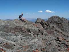
Me on the False Summit
Erik came down and we took some photos of each other up on top of the world. As we started down, a young boy and a man he called grandpa came up. The boy asked me if it was safe up where I was, and if there was a trail. I told him it was safe where I was, but it got a bit precarious beyond that, and I hadn't seen much of a trail, I just climbed the side of the mountain.
Erik's Photo of Me
My Photo of Erik
There is only one point at which there are cairns to indicate any sort of a path. We descended to that, and rather than going back how I had come up, I suggested to Erik that it looked like the other side was a bit easier. I started down, but we came to a point that made Erik uncomfortable, so it seemed safest just to go back the way we had ascended. I panted up back to Erik and past, and descended the way I had come up.
The descent was actually easier than I expected. I did inadvertently kick a big rock on the way down that went tumbling a long ways, and I just hoped it didn't hit anyone ascending. I sat down a couple of times to get down larger gaps, but it wasn't too bad. I got to a point where I could follow a switchback pattern that was pretty easy. Erik chose a more difficult and direct route down, as did the grandfather and grandson following him, as did the three guys hiking up the other direction. My route was definitely easier.
At the base of the extreme portion I waited for Erik, and saw a woman taking photos. She came up all this way, but was not going to make the final ascent. Since she was only wearing tennis shoes, that was probably for the best.
Then I started down to Round Top Lake. I went pretty quickly. It was steep, and the rock was loose, but by doing a zig-zag pattern on the trail with my feet at an angle to the grade I had secure footing and made good time. Down at the lake, I saw a guy with skis and ski boots strapped to his back. Farther on I could look up and see the path he had cut through the snow above Round Top Lake.
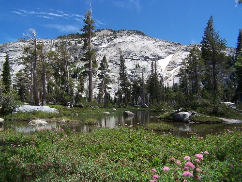
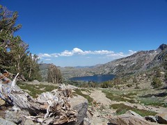
We started the slight ascent from Round Top Lake before making an easy descent to Winnemucca Lake with dramatic views. The sky was somewhat hazy in that direction, however. This time, there was no snow on the trail.
Winnemucca Lake
Down at Winnemucca Lake, I had to cross that log I had barely made it across the previous time. This time, however, I was going the opposite direction, starting on the narrow end, and moving towards the wide end. On the other side I set up to film Erik making the crossing.
Winnemucca Lake
We then made the short and easy descent back to Woods Lake. Climbing to the summit of Round Top made this a 2,171 foot climb, but it was still pretty short in distance, at only 6.4 miles.
Back at Woods Lake
Hike Summary
Dates: 30 July 2003, 30 July 2006, 13 July 2007 Trailhead: Woods Lake Approximate distances: 2.8, 4.4, & 6.4 miles Links: Kevin Gong's hike report