Some of my photos are now for sale at ImageKind.

Nature Index
(My hiking and camping adventures in Northern California.)

Culture Index
(NorCal cities, highways, restaurants, museums, architecture, historic attractions, vintage neon signs, roadside attractions, etc.)
Showing posts with label desolation wilderness. Show all posts

Friday, July 31, 2009

El Dorado National Forest: Pyramid Peak's Summit

One of the most dramatic scenes in all of the Desolation Wilderness is Lake Aloha in the Desolation Valley (from which the designated wilderness area gets its name). Lake Aloha is not a natural lake--it used to be a series of small lakes named the Medley Lakes, until a dam was built in 1875 and raised in 1917, creating Lake Aloha, until water levels drop in late September and it divides again into a series of lakes. The valley floor is an immense stretch of granite, and the vast expanse of blue water of Lake Aloha set off against the silvery gray of the stark granite is awe inspiring. I had seen it from the southern, eastern, and northern sides, but I wanted a view of it from the west, from high above it, on Pyramid Peak, the highest point in the Desolation Wilderness at 9,983 feet.

There are three ways to reach the summit of Pyramid Peak described on this handy website. Although it is the longest route, going via Lake Sylvia and the Lyons Creek Trail involves the least climbing (about 3300 feet of it), and at around 12 miles round trip is not as long as many hikes I take.

Seeing as how it is off trail and requires a good bit of scrambling, though, I felt it best to hike this with my friend Erik, rather than alone. We set off in October of 2007, but there was snow on the ground, and ultimately we decided not to go off trail, and instead we made a visit to Lyons Lake.

20071006 Lake Sylvia
Lake Sylvia, October 2007

For attempt #2, we set out late in July of 2008. I had studied the map and a photograph from that website mentioned earlier, and thought it would be easy enough to find the way. We marched off to Lake Sylvia via the Lyons Creek Trail, and then it was time to climb to "the obvious notch SSE of the lake."

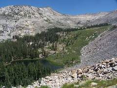
I've got to be honest. Erik and I are enthusiastic hikers, but we don't have much experience, and don't seem to be naturals at this either. We have some problems. Looking from the shore of Lake Sylvia, neither of us could spot a notch that was obvious. In fact, we had to get out the map just to clarify that north of the lake was Mt. Agassiz, and not Pyramid Peak--Pyramid Peak doesn't look like much of a peak or a pyramid from Lake Sylvia (although it does from the east). Additionally, the map made it look like we should just skirt the shore that we arrived at before starting up, which is what we did.
20080726 Lake Sylvia
We should have been farther to the right in this photo

We tried to find the easiest way up, going gradually from west to east, climbing at a slant to what we decided was most likely our notch. But after a lot of work, and having to climb down and back up again on talus and slab to get around impassable objects, we reached a very steep portion with smaller rocks mixed with dirt--not good footing at all. We sent some rocks tumbling, and finally gave up, and went down the talus and slab portion with the largest boulders.

As we got down to the lake, I heard people discussing the way up and saw them pointing, and soon they started up. They headed towards the same notch we had been aiming for, but they started considerably more to the east. Rather than start climbing from the southwest corner of the lake, they started from the middle of the south shore, about where the trees end. We stayed and watched them, and more people who followed, and a man hiking down. They avoided entirely the steep portion with poor footing that had stopped us, and their route looked easier. Three guys who came later, though, climbed right up to where we had been, and made a very laborious ascent up the ridge from there, sending many rocks flying, and exchanging terse words with each other.

We had worked too much to start the ascent over, so we instead enjoyed Lake Sylvia--it was my third time there, but the first time I really spent time at the lake. And we went off trail following Lyons Creek for a portion on the way back, which took us through some lovely meadows where the creek meanders and has trout swimming in it. The trout are not native to streams and lakes above 6000 feet in the Sierra Nevada, but have been stocked there since the 19th century, and survive in some lakes and streams even in national parks in the Sierra Nevada, which are no longer stocked.

So we once again failed to make it up to Pyramid Peak, but at least we had scouted out the route, and knew how to approach it on our next attempt, which wouldn't be until early September.
20080903 Climbing the Talus
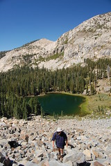
Erik on the talus

One bad thing about starting later in the season is that it means less time before sunset, and we got a late start from Sacramento too. We did much better on this effort, making our way, rather slowly, up the talus to the notch, and continuing up from there. There was no clearly blazed use trail, but the general way seemed obvious enough, and every once in a while we would come across a section of use trail on the steep climb. We got very high up, just below the peak and the final scramble up talus. But we were pressed for time at that point--there was a good chance that if we continued to the peak, we would not make it back to the car before dark. It's not like the peak was going away anytime soon, so there really was no pressing reason to risk it. After resting and checking out the outstanding view of a pond on the slope up above Lake Syliva, we headed back. We made it back to the car just after sunset, while there was still a good bit of light. That was it for climbing Pyramid Peak in 2008.

20080903 Just Below the Summit
The summit of Pyramid Peak to the right

20080903 Betwee Pyramid Peak & Mt. Agassiz
Ponds between Pyramide Peak and Mt. Agassiz

For 2009, I briefly considered a different approach--taking the shorter route (with more climbing) from U.S. 50, which is more popular, or camping at Lake Sylvia so as to get a very early start on the climb. But no, I had to finally do what I had set out from the trailhead three times before intending to do, and not done. No turning back this time, no excuses.

So at the end of July I set off, alone this time, and on a weekday, with the hope that it would be just me and the mountain. I took a mechanical pencil along to jot down the time at various points along the trail so I would have a good estimate of how long my return would be.

8:45 Set out from the trailhead along the familiar Lyons Creek Trail.
9:25 Passed junction with Bloodsucker Lake Trail.
10:37 Reached fork in trail, one way heading to Lyons Lake, my way towards Lake Syliva.
10:47 Reached Lake Syliva
10:52 Started up the talus from the south shore of the lake.

We had successfully completed this portion of the hike the year before, so I hadn't been too concerned about it, until I actually started it. Looking up the huge slope of talus was pretty intimidating, and I started questioning my decision to go on a weekday. There had been campers at the lake, but nobody was around climbing the way I was going. As I started up, someone at the lake started playing the harmonica. It was rather strange, climbing by myself over huge rocks, with just the sound of a distant harmonica and the wind in the trees now and then.

I took my time, and took breaks along the way up, looking down at the lake. I noticed that someone was standing on the north shore apparently watching my progress the whole time.
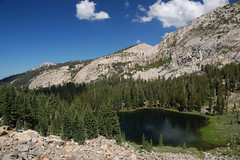
20090730 Lake Sylvia from the Talus
Taking a break

Closer to the top, there is solid mountain on the left and right, with talus in between, and above that dirt with loose rock. The left side next to solid mountain looked best to me, so I went up that way, but farther up there was a distinct use trail on the right side next to the solid mountain. Sometimes I skipped around sketchy looking portions that were definitely heavily traveled, but looked terrible for footing. I reached the notch at 11:37, so it took 45 minutes for me to climb up from the lake.

All accounts I have read of this hike are pretty dismissive of the next portion, saying the peak is obvious, and you just head up. But really, the route you take up the steep slope can make a big difference in how difficult the hike is. There are portions near the start that have ups and downs, rather than just continuing up, which make going more difficult, and there are sections of talus. But it is possible to navigate around them, and take an easier way up. The patches of use trail help.

I had mixed success in finding the easiest route. I would find a patch of use trail and then lose it, and then find it again, sometimes closer to the ridge than I had been traveling, sometimes farther away from it. I began to suspect that there were two distinct use trails, and I kept alternating between them.

I had to stop to rest a couple of times on the way up, and I ate my sandwich, the only food I had brought on the hike. Where I stopped there were lovely views of Lake Sylvia and a pond just below the notch on the other side from Lake Sylvia. Father up, I could see a couple of cabins in a beautiful meadow down to the southwest. I think these are the cabins in Upper Forni mentioned in Robert S. Wood's 1970 guide to the Desolation Wilderness.

1:00 Or a little before, I reached the spot that Erik and I had stopped at last year. I forgot to check my watch until a little later.

Nothing to do from here but face that boulder and talus climb. Again, it appeared intimidating, but also quite beautiful, with the rocks bespeckled with green and pink/peach lichen. There were a few trees out in the middle of the talus, indicating soil in that area, so I thought there might be some easier hiking. I headed towards one on the left, only to end up veering back towards two on the right. Near them was some soil where it was easier going, but it was a short patch. I knew what was down over the ridge to the left--a sheer drop. I thought maybe there was an easier ascent over the ridge to the right, but I figured it might also be a sheer drop that way, and the latter theory proved correct.

I was really panting and my heart racing, but I reminded myself it wasn't just the effort, it was because I was approaching 10,000 feet in elevation and the air was thin. I was finally going to stop and, but having just reached much smaller rocks, I could see the summit was very close. I decided I'd rather rest with a view.

1:23 I reached the summit, 4 hours and 38 minutes after departing from the trailhead. There were several deep enclosures up there, where people have dug up the rocks and put them up as walls, undoubtedly nice for getting out of the wind on some days (not a problem that day). There was a container with the summit register, a cardboard crown for being king of the mountain, and various other bits. According to the register, one other group had been there before me that day, firefighters from Sacramento who came via the more popular route from U.S. 50.
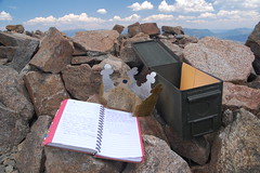
20090730 There is no try.

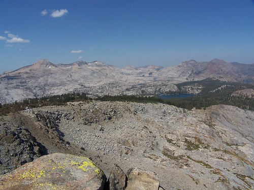
But what about the view? I don't know any way to capture it in a compelling photograph, but it was stunning. There were too man lakes visible for me to be able to identify them all. Lake Aloha, of course, predominated, but I could also see Lake of the Woods, many small lakes, a fantastic cascade of water running down the granite between, I believe, Desolation Lake and Ropi Lake. Even portions of the Echo Lakes, Fallen Leaf Lake, and the south end of Lake Tahoe (and a couple of casinos) were visible. Even from that high up, I couldn't fit all of Lake Aloha in view with a wide-angle lens.

20090730 Partial View from Pyramid Peak.
Part of Lake Aloha

I stayed for half an hour at the summit, and then started the long, but relatively uneventful, trek back. As I started down from the notch to Lake Sylvia, I fell on my butt, and got a small cut on my hand. I took it as a reminder to be cautious on that portion. I remember working my way down it pretty quickly last year, but I think I was definitely slower this year. I made it to the lake by 3:25, which meant I had plenty of time. The only reason I had to hurry back was hunger. I reached my car at 5:23, and headed off for dinner in Placerville.
Monday, July 13, 2009

Lake Tahoe Basin: Meeks Bay to Rubicon Lake

With my friend Erik's wife out of town for a while, we decided to try and get the most hiking out of the extra time by going camping. That way we could hit the trail first thing in the morning rather than wasting time driving from Sacramento. And we chose a trailhead that is a good long drive away from the state capitol.

Our big hike was planned for the second day, but we were going to do some hiking the first day as well. On the way up to South Lake Tahoe, we diverted over off to do an off-trail, or at least off of any official trail, hike to an area that locals prefer to keep a secret, and I now know why. So I won't say any more about that.

Next we got our campsite at Bayview Campground. The place was pretty busy with day hikers using the parking for the Bayview Trail and overflow parking from Inspiration Point above Emerald Bay across the road, but the campground itself was nearly empty. It's only $15 a night, less than other campgrounds around Lake Tahoe, mainly because it has no plumbing.

We took advantage of the site to hike up to Granite Lake on the Bayview Trail, a lake I had skipped over on my two much longer hikes up the Bayview Trail to the Velma Lakes. I took a quick swim.

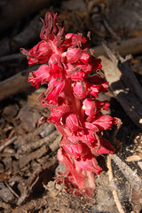
20090708 Snow Plant
Snow Plant on Bayview Trail

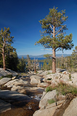
Then we headed down and over to Cascade Falls. We were there a bit late in the day--the big waterfall down to Cascade Lake was in shadow, but it's a difficult subject to photograph under optimal conditions anyhow. The creek spreads out all over the granite with lots of mini falls in the area above, and we spent a good bit of time scrambling on rocks and exploring that.

20090708 Above Cascade Falls
Above Cascade Falls

When we got back to the campground, there was a bear making an inspection of all the campsites for food, and a bunch of damn-fool campers following after it with their cameras. I took out my camera too, but I didn't take a single step in its direction. Of course, I didn't do what I should have done either--scare it off with loud noise. It is much better for bears if they remain afraid of humans rather than getting comfortable around them.

20090708 Camp Visitor
Black Bear

We watched the sunset from Inspiration Point, but it was not dramatic as I had hoped it would be. Then it was back to the camp site to build a fire.

20090708 Emerald Bay
Inspiration Point

In the morning we watched the bear make its rounds again before we headed off to the Meeks Bay trailhead, right across the highway from Meeks Bay Campground. Most of our hike repeated a hike I took in August of 2007 from Meeks Bay to Stony Ridge Lake, so I'll be brief in my description of that part of the hike. Please see the other blog entry for a more detailed description.

The hike starts on a closed dirt road--nice, soft dirt. It's flat, and we were moving as fast as we could to keep warm, as it was cold in the morning and I didn't want to bring my jacket when I wouldn't need it for most of the day. There were many lovely wildflowers there, and many locals just like to walk this first section with their dogs.

At about 1.3 miles there was a signed junction with a trail leading uphill off the right edge of the trail and road continuing on while turning a bit to the left. We started climbing, fairly steeply, on the narrow trail. Once up to where it joins the creek, the trail climbs at a moderate pace, and the area around us was lush with ferns, wildflowers, and mosquitoes. Eventually the trail drops down to the south and crosses the creek over a large wooden bridge. On the other side the trail climbs alternately west and south before curving around on a slope above the creek dropping rapidly off to the right.

20090709 Alpine Lily
Alpine Lily

All of the lakes on this hike are connected by creeks, so on the way out and up, we were always going to where the water was coming from, only we were taking the more gentle grade, while the water was taking the more direct path. As you approach each lake, you will find that you and the creek get closer and closer together in elevation.

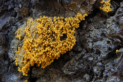
20090709 Unidentified Fungus
Fungus Just Before the Junction

Just past a signed junction with General Creek Trail we found Lake Genevieve, right where I left it two years ago. It's a nice lake framed by mountains on the south and west sides and with open areas to hang out on the east side. But the next lake is framed a little more dramatically, and is larger.

20090709 Lake Genevieve
Lake Genevieve

So we made the short hike up the moderately graded trail to Crag Lake, which has two nice little islands in the south end. There are lots of nice areas to hang out along the east shore, although they are divided by a rocky outcropping that we hiked around.

20090709 Crag Lake
In Crag Lake

From there we rock-hopped across a creek and started up a bit more steeply. At one point the trail turns sharply left and there is a clear trail heading down to the right, and we could just see some water in a lake below. There is no signed junction here, but that is Hidden Lake below. I went there last year, but it was very steep, and I didn't want to waste the energy this year, as we had a farther destination in mind.

20090709 Shadow Lake
Grassy Shadow Lake

So we headed off on the trail to Shadow Lake. By the time you see Shadow Lake on the left, most of it is already behind you. As a result, it looks smaller than it actually is. I remember thinking in 2007 that it was close to becoming a meadow. Certainly the south end of it looks that way, but on our return we went off trail to the south end of it, and saw that there is a good bit of water.

20090709 Shadow Lake
Shadow Lake

I promised Erik that it was just a short ways up ahead to Stony Ridge Lake, but it was farther than I was remembering. When we got to that lake, we hiked a little ways along its long shore before stopping to rest and to eat. I thought it would be a good idea to rest because we had one big climb left to Rubicon Lake, and then that would be it for climbing for the day. The beauty of this trail is that there are very few ups and downs. Instead, it just consistently climbs on the way out, so the net elevation gain is pretty close to the cumulative amount of climbing that you do, and it's almost all downhill on the way back.

20090709 Stony Ridge Lake
Stony Ridge Lake

After eating we continued on along the lengthy west shore of Stony Ridge Lake and started to encounter what I found to be the most interesting scenery on the whole hike. Off to the left we saw a large pool of water with several grassy circles--nearly perfect circles--surrounded by grassy swamp, except that a large protrusion of bulbous, rounded granite stuck out into it. On higher ground where the trail runs there was lush vegetation intermixed with large granite boulders, and towering to the southeast was an imposing solid granite wall.

20090709 Stony Ridge Lake
Stony Ridge Lake from Above

After running close to this cliff, the trail started away from it, and almost over to the creek cascading down a steep, fractured cliff. Then we immediately headed back the other way on a switch back. As we climbed hire we were afforded lovely views of the great length of Stony Ridge Lake. Finally the trail curled up to the left in a passage between granite cliffs and up to small and lovely Rubicon Lake.

20090709 Rubicon Lake
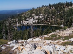
Rubicon Lake

I searched around for a nice granite shelf to hang out on for a while. After talking about it a while I couldn't resist the impulse to take a quick swim. It was too cold to stay in the water for long, but I just wanted to be able to say I swam in Rubicon Lake, 8.1 miles in distance and 2,080 feet in elevation away from the trailhead. While drying out on the granite I spotted something swimming close to the opposite shore, and Erik identified it as a beaver.
20090709 Rubicon Lake
South End of Rubicon Lake

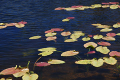
We explored around the lake a bit--there were many lily pads on the east side, to which we did not make it, and a few on the south edge where we were taking photographs.

20090709 Lily Pads

Initially I wanted to wait longer so I could photograph Rubicon Lake and Stony Ridge Lake in the afternoon light, instead of the harsh overhead light of the middle of the day, but I realized we had a long ways to go, so we started back.

At first, the return trip seemed very easy--it was all downhill and not too steep either. But the sheer length eventually began to take its toll. All the way down past Lake Genevieve and across the wooden bridge, when we could finally see Lake Tahoe I was surprised by how far away and how far below it appeared. And the last part of the hike was just soldiering on, putting one foot in front of the other.

By the time we both made it back to the car it was a full 10 hours after we had set out--certainly our longest hike, and a very satisfying day.

Tuesday, October 23, 2007

El Dorado National Forest: Lyons Creek Trail in Snow

20071006 Lyons Lake
Lyons Lake

I recently read a couple of books by John Muir, and his mountaineering exploits inspired a desire in me to hike to another mountain summit. From his descriptions, October seemed a perfect time to go. So I proposed to my friend Erik that we hike to the top of Pyramid Peak via the Lyons Creek Trail. He was concerned about the difficulty of the climb and the weather, but I sent him a link to a website that made it sound pretty easy, and assured him that although it had been unseasonably cool, the forecast for the weekend was for warm weather and clear skies. He agreed to go.

I was hoping there would be a bit of snow on the peaks, just to make them even more beautiful, but as we turned off of U.S. 50 and headed up on Wrights Road, it became apparent that we would have snow along the whole trail. Figuring this would make the climb trickier, we decided on a side trip to Lyons Lake as a back up plan. On our Desolation Wilderness permit I put down our destination as Lyons Lake or Pyramid Peak.

What a total transformation a blanket of snow makes. When we hiked this trail back in July, it was a wonderland of wildflowers and butterflies. Had we hiked it at the end of September, we would have seen mostly the brown and wilted remains of that earlier display, but just a week later everything was gorgeous again with a pristine layer of snow.

We hiked along following the footsteps of people before us until we caught and passed them--three backpackers. After that we were the first humans to trod on the topmost layer of snow, although I could often see one set of footprints that had a thin covering of fresh snow on them. There were plenty of animal tracks, which kept me wondering about what sort of animals made them. Some looked very much like dog tracks, but being unaccompanied by human tracks, Erik surmised that they were from foxes or coyotes.

It was above freezing even when we started on the trail, so the snow was melting and Lyons Creek was flowing, but it was much lower than it had been in July, and crossing it was no difficulty at all. Shortly after that we came to the junction in the trail, and, unlike last time, we headed on towards Lake Sylvia, rather than Lyons Lake.

Soon after Erik said something about a dog. A hiker behind us had caught up to us, and his dog was running ahead. We came to another creek crossing, and while I was studying the easiest way to rock hop across, the guy with his dog just flew on over it as though he were crossing a bridge, rather than stepping on the tops of snow-covered rocks. We had one more such crossing before coming to Lake Sylvia.
20071006 Lake Sylvia
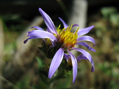
Lake Sylvia

Up at the lake, the other hiker's foot prints headed off to the south, in the direction of the recommended route for the off-trail climb up Pyramid Peak. I started following them, thinking that's where he must be headed, and he seemed to know exactly where he was going, so if we followed his tracks we would likely be taking the safest and easiest route.

Erik was uncomfortable with going on though, what with the snow, and we had crossed portions of the trail that had snow covering ice. I'm going to shift all of the responsibility for us shying away from making the climb to him. I'm sure if I had been alone I would have climbed it, waited until sunset on the peak to get the best photos, hiked down again in twilight, taken a refreshing swim in Lake Sylvia, and then returned to the trailhead by moonlight, just as Muir would have done. But being concerned for Erik, I decided to postpone my epic feat.

We ate a little, and then took some photos before heading back to the junction to climb to Lyons Lake. Had we planned on visiting both, I would have chosen to visit Lyons Lake first, as the lighting is better for photos at Lake Sylvia later in the afternoon.

When I first hiked up to Lyons Lake last year, I had trouble finding the trail at points along the steep climb. But this time, even with snow, I found it easy to follow. I think my problem before was just that I was so inexperienced. It's a challengingly steep climb, but mercifully it isn't all that long.

20071006 Lyons Lake
Lyons Lake

Lyons Lake is in a cirque, and I always find cirques dramatically beautiful. A cirque is a bowl shape in the mountains carved out by glaciers with an opening, or lip, from which the glacier flowed out. So we hiked up to this cirque through the lowest part, the lip, where Lyons Creek flows out of Lyons Lake. The rest of the lake is surrounded by high cliffs.

20071006 Lyons Lake
Lyons Lake

It was my third visit to the lake in 16 months, so some of the drama was diminished, but it was every bit as gorgeous as I expected it to be. After taking some photos, I crossed the dam to check out more views. Most of these small mountain lakes in the area have small, old dams at their outlets to increase the holding capacity of the lakes and control the outflow of water. The dam is just made of rock in mortar, and the surface is uneven, so I was slow crossing it since it was covered with snow. There's a pond below the dam, which shows the natural level and end point of Lyons Lake before the dam was built.

20071006 Me Crossing the Dam
Erik's Photo of Me Crossing the Dam

I circled the pond and decided to just cross the outlet stream again below it to get back to the main trail, rather than go back the way I came. I waited for Erik to join me so I could show him the spot I found easiest to cross, but I had to wait a while as he kept taking photos of me from the opposite side of the pond. He demonstrated great sagacity in spending his time that way, as those photos will be quite valuable when I'm famous.

I descended pretty quickly, much more quickly than I could have last year. Back at the junction, I waited for Erik. I looked back at one point, and there was that dog again in front of Erik. The other hiker soon came along. He asked us if we had gone "all the way up" to Lyons Lake, to which we answered yes. Erik asked him if he had climbed Pyramid Peak, to which he answered yes. The summit of Pyramid Peak is at least 1500 feet higher than Lyons Lake. And the dog was still running ahead and then running back after all of that climb, with seemingly endless energy. We found out later (he kept passing us, as he would stop to take in the surroundings, and then start on the trail again) that the dog was only 4 months old. That impressed Erik, who solemnly informed me that he could not have made that climb when he was 4 months old.

It was quite a bit warmer in the afternoon than it had been in the morning, and the snow was melting or melted in many places, leaving pools of water on the trail, or just making it muddy at points. But we still made good time back, and arrived at the trailhead earlier than I anticipated. The other hiker got back to his car as I was getting ready for the drive home, and commented that it was another awesome hike. I'd have to agree. Even without the great scenery, just getting out and using my body to its full capacity feels great.

Sunday, September 16, 2007

El Dorado National Forest: Echo Lakes to Lake of the Woods

20070916 Desolation Valley
Desolation Valley


From what I understand (and that's no guarantee of accuracy), the most popular entry into the Desolation Wilderness for backpackers is from the southern end of Lower Echo Lake. There are two advantages to this entry point: the car does most of the climbing, as it is less than 700 feet of elevation gain up to popular Lake Aloha, and one can take a boat taxi across the Echo Lakes and cut 5 miles off of the hike, round trip.

Despite the popularity of this area, it is one of the few approaches to the Desolation Wilderness I had not taken before this hikee. I've been meaning to do it for a long time, but after not going earlier in the season, I was going to put it off until next year, as Lake Aloha is partially drained late in summer to supply water to the downstream population. Unlike the many other natural lakes in the area with small dams built to increase holding capacity and control the outflow of water, Lake Aloha did not exist before a dam was built--this was the Medley Lakes area of Desolation Valley. A dam was built in 1875 and raised in 1914, creating Lake Aloha for part of the year. But late in the season it is drained, and isolated pockets of water--formerly the Medley Lakes--remain.

I changed my mind about putting off this trip another year after the hike I took with my friend Erik the previous week to Ralston Peak. From there we could see that many of the other lakes in the area were full and quite beautiful. So I suggested this for the next weekend, and Erik agreed.

The Echo Lakes lie north of U.S. Route 50, just short of the high point of the pass on the way to South Lake Tahoe. Right after the Tahoe at Sierra ski resort, we turned left onto Johnson Pass Road, which heads right down to join U.S. 50 again on its descent to South Lake Tahoe, as we found out because I went right past Echo Lake Road, and had to turn around. I suspect this road might have been one of the routes immigrants took during the Gold Rush.

Back on Echo Lakes Road, we drove to the parking lot just above Echo Chalet and the dam for Lower Echo Lake. The hike took us down past the pit toilets maintained by the U.S. Forest Service next to Echo Chalet, and they were especially fragrant that morning. Before heading up on the dam, there is the sign with Desolation Wilderness permits. Then we crossed the dam, and the bridge across its outflow, and started up the trail. I'm not sure if the boat taxi operates after Labor Day, but even if it does, there was no question that we would hike the 5 extra miles to save the money.

After crossing the dam, the trail climbs up some short switchbacks, and stays above the Echo Lakes the rest of the way, with some minor ups and downs. To the right rise large, rounded swells of granite, stained orange and black from minerals that leach out during the spring snow melt. To the left between the lakes and trail lie private cabins, many with small docks and roofs on posts to cover boats. Quite a few looked as though a lot of money had been put into them recently. Where there was enough soil to provide a foothold, conifers sprouted up.

20070916 By Lower Echo Lake
Along Lower Echo Lake

The trail was clear and wide, and had interesting artifacts. There was a point at which it looked like a large, rounded granite outcropping that would have been impossible to cross had been blasted to clear out a trail, and then there was concrete filling in part of the path. A couple of places had short metal rods sticking out of the rock. Erik speculated that there may have been railing at these points at one time.

Once past Lower Echo Lake, the lake views ended, as the trail along Upper Echo Lake is not as close to the water. We hiked through forest on dirt, with the cabins now much closer to the trail. The end of Upper Echo Lake is marked by a sign for the boat taxi.

After that, we climbed out of the forest onto granite scree. Below us to the left we had nice views of Tamarack Lake appearing temptingly close, with Ralston Peak, the destination of our hike the week before, rising up behind it. Turning around we had our best views of both Echo Lakes. We continued on past the spurs to Triangle and Tamarack Lakes, up into forest again, where we found our spur to Lake of the Woods.

We crossed Haypress Meadow and then started climbing steeply to the top of a ridge, and then it was steeply down (quite a bit more than we has climbed on the spur) to Lake of the Woods, with dramatic views of it through the trees backed by a granite dome and the peaks of the Crystal Range, most prominently Pyramid Peak.

20070916 Lake of the Woods
Lake of the Woods from Above on the Trail

Down at the lake we found some signed campsites, and a small concrete foundation. I'm not sure why that was there, but a book on the Desolation Wilderness from the late '60s mentions that the forest service put in pit toilets and picnic tables in parts of the Desolation Valley Primitive Area (its original designation) when few people were visiting, only to take them out when the number of visitors increased dramatically.

20070916 Lake of the Woods
Lake of the Woods

Behind the campsites a piece of glacier-worn granite juts out into the lake, and we went out on that to eat lunch on a sloping shelf into the water. It's exactly the kind of spot where I like to go swimming, and then lie back and dry out on the warm granite afterwards. The only problem was that it was in 60s and windy, and the water was too cold. The season for swimming in the mountains had already passed for 2007.

20070916 Lake of the Woods
Granite Rest Stop

I had planned on Lake of the Woods being the final destination of the hike, but Erik had never been to Lake Aloha before. Since it was so close, I suggested that we proceed, even though I knew the water level would be low.

We followed the trail around the north edge of the lake, then started up just next to a high granite dome. Along the trail it was surprisingly lush for a hike into the heart of the Desolation Valley, but the satellite images show that this was just a narrow band of trees between Lake of the Woods and Lake Aloha, with plenty of open granite beyond them on either side.

We reached the junction with the main trail from Echo Lakes. I had expected to be able to see Lake Aloha from there, as the map shows it lying quite close to the lake, but we were still in the trees. A little bit farther along there was a junction with a post indicating only that behind us were the Echo Lakes. But another hiker there told us that the trail to the left went along the south side of Lake Aloha and quickly ended, while the trail to the right went along the north shore of the lake.

We headed towards the north side of the lake, and quickly came across the dam, with a depression of dried mud in front of. We explored several of these depressions where water had formerly been before finally coming upon a large body of water that had not been drained and had not yet evaporated.

We had started the hike under clear skies, but as the day went along it kept getting cloudier. At this point I noticed that the clouds coming over the granite peaks of the Crystal Range that rise up directly from the west shore of Lake Aloha were ominously dark, so I suggested to Erik that it was time to start back. I had told him earlier that the junction with the trail we would return on had to be at the north end of the band of trees along the northeastern edge of the lake. I returned to the the trail and started in that direction, while Erik was taking pictures behind me.

After a while I stopped and waited for Erik. Then I shouted to Erik. Then I started walking back on the trail while shouting to Erik. Then I started running back on the trail shouting to Erik. I stopped and wondered if maybe he had gotten ahead of me off trail, but that didn't seem likely, as I should have been able to see him between the trail and the lake. I considered just continuing on, counting on him to follow the trail signs back to the car when he realized we had gone different ways. But instead I kept heading back until I found him and a man with two llamas. He had headed back on the trail the way we had come, until he encountered the alpaca-loving man who told him he had not seen me coming that way before him. I told him we should hurry back in case it rained, since we didn't bring jackets, and promptly headed off. Later he told me he had two trash bags we could use as ponchos.

We marched back through forest and cross some areas that must get swampy when the snow is melting, as there was a sort of boardwalk along one stretch, and then a raised area of dirt held between logs on another stretch. We passed by and above small Lake Margery before reaching the spur we had taken earlier to Lake of the Woods. From that point we retraced our steps back to the spur for Tamarack Lake.

We were heading southeast, while the ominous clouds were slightly to the north, and it appeared we would avoid any rain, so when we reached that junction, we headed off to Tamarack Lake as I had originally planned. I told Erik that taking this spur, which actually heads off to three lakes very close to one another, would put us back at the car by 4:30. It was 2:45 then so I was estimating the remainder of the hike would take us 1 hour and 45 minutes. I ended up being off by by a full hour.

Tamarack Lake certainly looked close, and it was. We headed across an open area filled with bits of broken up and breaking up granite everywhere, following cairns to find the trail. Once to Tamarack Lake, I headed south, with Erik following my lead, towards where I thought the other two lakes were. But we came to a steep drop off, and I couldn't see any lake at the bottom of it, so we headed back towards the southern end of Tamarack Lake. At some point we hit something that looked like a trail, and two people hiking back the other direction reassured me.

I believe this is just an unofficial use trail. It shows up on my map, but so do other unofficial, unmaintained use trails. Once on the other side of the seasonal outlet creek for Tamarack Lake, bone dry when we were there, it was easy enough to follow.

20070916 Ralston Lake & Ralston Peak
Ralston Lake & Ralston Peak

We climbed up and then had the dramatic view of Ralston Lake backed by Ralston Peak, and we could see where we had been the week before looking down on the spot we were at then. Unfortunately, we were looking into the sun, which meant that the camera could not capture the beauty that our more sophisticated eyes were taking in.

There were two paths down to Ralston Lake, one to the east to the north shore, and the other to the south to the dam at its outlet creek. We took the latter, which was more steep. The dam, dedicated to Ross E. Pierce by the Mt. Ralston Fish Planting Club in 1960, had a center section that was broken off.

We crossed the dam and climbed up the granite on the southeast side of the shore a ways for the views. The sun was mostly covered with clouds then, but occasionally the wind would blow them away, and the lake would be hit with a greater intensity of light, revealing a beautiful emerald color in shallow portions of the water.

From there we set off to find Cagwin Lake. My map showed the trail going along the north side of the then-dry outlet creek for Ralston Lake, but I knew enough by then to trust the physical evidence of the land before me over the map, and the trail to Cagwin Lake clearly lied on the south side of the outlet creek. We followed it, and found a sure sign that we had gone the right direction--an El Dorado National Forest sign naming Cagwin Lake and indicating it was at 7680 feet. We hadn't seen signs for any of the other lakes.

We went back the way we had come, and got off trail after crossing the dry outlet creek from Tamarack Lake. There were cairns we sometimes spotted, and eventually following those we got back to our spur trail, just before it joined the main trail back to Echo Lakes. The views we had of the Echo Lakes were marred by the shadows cast by clouds. I hadn't taken a photo earlier on the way out, thinking the view would be better in the late afternoon sun.

Back on the main trail, I revised my estimate of when we would make it back to the car. I checked it by the time it took us to make it back to the sign for the boat taxi, and we were not doing well. Unless the distance on my map was off, which is always a possibility, we were going really slowly. So I cranked it up from there, setting the pace for Erik, as always. Some people pay personal trainers as much as $75 an hour for such a workouts.

20070916 Steller's Jay
Steller's Jay on the Dam

For some reason, 5:30 became the magic time for me. I made it back to the car just before it, and felt a sense of accomplishment for achieving this arbitrary goal. Erik came along a few minutes later after calling his wife at Echo Chalet, and we headed home.

Hike Summary

Date: 16 September 2007
Trailhead: Echo Lakes
Approximate distance: 13.7 miles

Saturday, September 15, 2007

El Dorado National Forest: Ralston Peak

20070909 Me on Ralston Peak
Erik's Shot of Me on Ralston Peak

Had I known what a spectacular overview of the lakes of the Tahoe Sierra this peak afforded, I would have hiked it earlier. Instead, I waited until I had run out of other ideas for hikes with nearby trailheads that lead into the Desolation Wilderness, and then chose to hike this trail out of convenience. My friend Erik joined me again.

The parking lot for this trail is just off of U.S. Route 50 to the north, shortly after (when headed east) Twin Bridges and Horsetail Falls, just before the final climb to the pass before dropping down into the Lake Tahoe region. A sign nearby indicates the area is Camp Sacramento.

From the parking lot, we hiked up a dirt road that curves around past a cabin and then to the signed trailhead where there were Desolation Wilderness permits available. After filling one out, we started into the forest.

For 45 minutes we hiked up a moderate grade on a dirt trail with few rocky sections. The grade was easy on our legs, and the dirt was easy on our feet. But eventually I knew things would get difficult, as it is a 2800-foot climb to the top of Ralston Peak, accomplished in only 4 miles. At the end of that 45-minute stretch, we hit the steep portion.

The next 30 minutes was slow going leaving us short of breath as we plodded on the overly steep trail wondering why there weren't more switchbacks. When we reached a ridge with a dramatic view of Pyramid Peak off to the west, we got some relief, as the trail took us on moderate ups and downs. But this respite was short-lived, and soon we hit another steep stretch. This second difficult portion proved to be much shorter, however, taking only about 10 minutes. From there to the high point of the official trail, our climb varied back and forth between moderate and steep as we passed through an area where the trees were more sparse. This would probably be a nice wildflower area earlier in the season.

At the high point there were large and obvious cairns off to the east of the trail, and a clear use trail beyond them. The trail up to the peak is not official and is not maintained by the forest service, but there were plenty of cairns left by other hikers to suggest a route, and the terrain was not difficult, being not all that steep, only sparsely sprinkled with trees, and with lots of dirt rather than jagged boulders to cross.

We followed along from one cairn to the next until we came to a large amount of talus right at the peak. I wasn't sure if we should just climb straight across that to the highest point, or continue along the dirt to the south of it and find an easier path up. I tried the latter, with Erik following. We soon came to a ridge with dramatic views of Echo Lakes, Fallen Leaf Lake, and Lake Tahoe. Climbing up the spine of this ridge, we eventually had to clamber across piles of talus anyhow on the way to the summit.

At the summit, the view is spectacular, although it was marred that day by all the smoke in the air from the Plumas fire. There is the aforementioned view of major lakes off to the east. At the foot of Ralston Peak directly to the north--close enough to give me the urge to hike down to them for a swim--lie Tamarack, Ralston, and Cagwin Lakes. In the distance to the north lie Mt. Tallac, Gilmore Lake, and Susie Lake. Off to the west is Pyramid Peak, looking more like a pyramid than it does from any other direction I have viewed it. Visible below that to the north and east are vast Lake Aloha, Lake of the Woods, and a couple other lakes of the dozen or so small ones south of Lake Aloha.

20070909 Desolation Valley
Pyramid Peak, Lake Aloha, & Lake of the Woods

Actually, there wasn't so much a Lake Aloha to see on the day we were there, as there was a series of small lakes. Originally, that was what was there--the Medley Lakes. But in 1875, a dam was built, and in 1917 it was raised, creating the inexplicably named Lake Aloha. Late in the year, water is released from the dam to feed lower lakes, Pyramid Creek, and the South Fork American River, and ultimately Sacramento. Only instead of bare granite, or trees, grasses, and wildflowers springing up in any foothold they can find in between the Medley Lakes, now when the water recedes we are left with large expanses of cracked, dried mud.

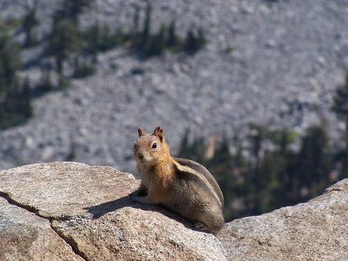
It still looked lovely from our distance. I broke out the binoculars my father gave me for Christmas and found the trail up Mt. Tallac, and boats in lower Echo Lake, Fallen Leaf Lake, and Lake Tahoe. We also took pictures of the abundant golden-mantled ground squirrels. Just like the ones we experienced on the summit of Mt. Tallac, they were aggressive and would climb across us in search of food we brought along.

20070909 Golden-Mantled Ground Squirrel

When it was time to head back, we just went directly across the talus the short way, rather than how we had come. There were a few cairns and a patch of trail on the other side of the talus as we started back, but the trail soon disappeared, and I wasn't seeing cairns as we had on the way up. After some time I checked my map and compass.

My Desolation Wilderness map is not always accurate. Although this is not an official trail, the map did show a trail to the peak. However, the trail it shows branches off of the main trail farther north than where we left the main trail, and then goes southeast to the peak. We were heading mostly east and a little bit south, so I figured we needed to go more to the north to follow the trail shown on the map back to the official route.

Soon enough we saw some hikers coming along the main trail, and found it, although not at the same point we had left it originally. I thought we were farther down the trail to the south, but instead, we were north of the point we had branched off before, as I realized when we started climbing, rather than descending the whole way.

We got back to that point, and then it was steeply downhill from there. Going steeply downhill can be slow going, but since it wasn't a rocky trail, we made excellent time. We made it back to the car by 2:30, whereas on the last hike we did together we made it back to the car at 7:00.

It's definitely a hike to repeat, particularly since the smoke didn't let us experience in its full glory. I'd also like to try it when the water level of Lake Aloha is higher, and there is more snow on the surrounding peaks.

Wednesday, August 29, 2007

Lake Tahoe Basin: Meeks Bay to Stony Ridge Lake

20070828 Crag Lake
Crag Lake

Meeks Bay is along the west edge of Lake Tahoe, somewhere close enough to the middle north/south that I wasn't sure whether it would be faster to reach it from Sacramento via I-80, heading down from Truckee, or from US 50, heading north from South Lake Tahoe. For the record, Google Maps said I-80.

I took US 50, but with a plan. Before I have gone on these blitzkrieg hikes: drive up there as quickly as possible, get a long hike in without dawdling too much, and drive home the same evening. This time I wanted to dawdle. So I took a more leisurely drive up, stopping to photograph sites on US 50 that have become such familiar mileage marks to me. And I explored South Lake Tahoe, then went to the Taylor Creek Visitor Center and followed the short trails there, which lead back to other turnoffs, Tallac Historic Site & Valhalla.

For the evening, I got a campsite (#153) at Sugar Pine Point State Park for $25. There's a campground directly across the highway from the Meeks Bay Trailhead, but it was just off the road, separated by a chainlink fence. I'm not sure that is the Meeks Bay Campground, though, as when I was leaving the area I saw the sign for it that seemed to lead to protected area below the road.

I set up my new REI tent with no problem, but this was my first night in a sleeping bag on the ground in 18 years. To be fair, I had slept on a kitchen floor of a tiny San Francisco apartment in August of 1998 when all of the inn keepers turned me away (where can you find a good stable these days?), and that was more uncomfortable. But I didn't have chronic back trouble then.

Despite having bought a pad to go under my sleeping bag, and laying the tent on soft dirt with pine needles that gave no resistance to the stakes I anchored it with, I had a hard time sleeping with the discomfort. That could have been a good thing--there was a total eclipse of a full moon that night. But I was under the mistaken impression it was the next night. I'll catch that one next lifetime.

I was just anxious for 6 a.m., when quiet hours ended, to come. It started to get light sometime after 5, and just about 6 some birds began cawing loudly, as though they knew it was now permissible. I jumped right up and set about getting ready, brushing my teeth, eating, packing things up, etc. Then I was off to the trailhead.

Surprisingly, with all that and the preparation for the hike, it took me until 7:35 to head out. It was cold, but I quickly warmed myself up with a brisk pace, and took off my jacket after 15 minutes (I was already wearing shorts). The trail starts as a sandy, unpaved road just off of CA 89, next to private property, with plenty of signs to indicate that. There isn't room for a lot of cars. It seems like it should be a popular hike, with all the lakes you can access, but then it took me a long time to get around to hiking it.

I passed one person headed the other way early on this road, and that was the only person I saw until I started back to the car. The path continues southwest with minimal elevation change until reaching a junction sign marked for the Tahoe-Yosemite Trail. The road continues off a short distance to the left to the former site of Camp Wasiu, according to Tahoe Sierra, while the trail begins to climb to the right.

After a good climb, the trail leveled off and there was a meadow off to my left, filled with dead trees in the western half of it. The meadow near Shadow Lake that I saw later on was much like this, making me wish I knew more about the processes going on in these mountains.

After this the trail followed along Meeks Creek, although it was often not visible, and crossed over the Desolation Wilderness boundary, gradually curving farther towards due south. After crossing a large bridge over Meeks Creek, which could have been walked straight through or stepped over this late in a dry year, the trail began climbing again. At one point it veered to the east away from the creek and then looped back west to it, all so the hiker can make a more gradual ascent that the water's rapid descent.

As is often the case, when I approached the closest point on the trail to the creek, that meant I was just about to hit the lake from which the creek was flowing. I hit a junction sign, marked for General Creek and Phipps Pass (my direction) at Lake Genevieve. It surprised me to see the lake this soon, only 1 hour and 50 minutes into the hike. My map indicated that I had traveled 5.5 miles, which would mean I went much faster than I usually climb in the mountains. But I have two books here at home that say it was a shorter distance, 4.7 miles according to one, 4.6 miles according to the other.

Lake Genevieve was a delight, with a mountain ridge behind it, and a peak farther back. This would be the common backdrop for the first three lakes. The lake itself was a bit grassy and muddy for my tastes, without large sections of granite along the shoreline, or islands of granite.

I continued on the trail down the eastern shore of the lake and past it, only to once again be surprised with how rapidly I reached a lake. It was less than 10 minutes from when I started off from Lake Genevieve until I hit Crag Lake. Crag Lake is about the same width east to west as Lake Genevieve, but more than twice the length of it north to south. It's a bit closer to that dramatic backdrop, and thus prettier. Also helping is the granite western shore of the lake, which rises too steeply for exploration of that side.

I stopped atop a rock at the north end of the lake right next to its small dam and outlet creek to take the photograph placed at the start of this blog entry. Then I wandered down the eastern shore, looking for access points, but trees and bushes came right up to the lake. About half way down there was a rise of granite boulders, and from here it was possible to see the lake well, but farther along it was trees and bushes kissing the lake's edge, leaving no good area to hang out and swim from.

Passing on, I expected to quickly come upon a junction with a short spur to Hidden Lake. I began climbing and had to rock hop the creek that I was following from lake to lake. It was a minor crossing, but it was nice to see some water flow. I kept climbing, much longer than I expected.

Finally, I saw an unmarked junction. There were rocks laid across the path to the obvious trail to the right, and a cairn over on the trail on the left, indicating don't go right, go left. But I could see Hidden Lake below me at the end of that spur to the right, so I took it.

It's too steep for a good trail, and with lots of loose dirt and small rocks. It would be very easy to slip here, and I don't think the forest service wants people going this way. Midway down, the trail split, with an easier grade to the north end of the lake and a more difficult one to the south end. I went down to the north end.

I don't believe this is the trail on the map, as that heads directly south to the north end of the lake from a junction to the north. This trail headed from a junction directly east of the lake. The contour map also showed less than 20 feet of elevation change on the spur, whereas this was about a 100-foot drop. But I didn't see any other junction or spur trail, even looking again when I came back that way.

20070828 Hidden Lake
Hidden Lake

Hidden Lake is smaller than the other two, and that peak rises directly above it, so close that it is difficult to take it in. It had a nice little granite rock island. After wandering the use trail along its eastern shore, I made the steep climb back up to the main trail and continued my journey.

Soon I was next to the creek with a large depression to the east, and I expected to see Shadow Lake as I came over a ridge. But instead I saw a large meadow, once again with dead trees at one end. Looking back, there was a small lake off the northern end of the meadow, with reeds growing in it. Shadow Lake will not be a lake much longer, as the meadow will eventually win out, only to be supplanted later by forest, if I remember my 8th grade earth science course correctly. As I was passing and photographing each of these lakes I was sizing each of them up for swimming potential, and Shadow Lake had the least potential.

20070828 Shadow Lake
Shadow Lake

From here, only my final destination for the hike waited ahead of me, Stony Ridge Lake. I made it to the lake with plenty of time left in the day, and had a decision to make. Should I press on to Rubicon Lake? I thought (not knowing of the map's inaccurate marking of distance) that I had traveled a little over 7 miles. It looked like Rubicon Lake would add at least 1.5 miles, making for a round-trip hike of over 17 miles, plus a lot of additional climbing, as the map showed switchbacks up a steep slope to the lake. (Looking now at the mileage from another source, it would have been about a 16.2-mile hike, which is about what I wanted to do that day.)

I decided to stick with my original plan, and hang out at Stony Ridge Lake, waiting for the sun to shift in the sky. Like Shadow Lake, Stony Ridge Lake lies to the east of the trail, making it a better subject to photograph in the afternoon, whereas the first three lakes all were off to the west of the trail.

But I did choose to hike up the length of the lake to its south end, which is smidgeon under 1/2 mile of hiking. I'm glad I did, because near the south end was the spot I had been looking for, smooth granite shelves sloping gently down into the water, the ideal place to hang out next to the water and to lie on while drying out after a swim. I ate a sandwich, and then, not having seen anyone, decided to go skinny dipping.

20070828 Stony Ridge Lake
My Hang-Out

Stony Ridge Lake is easily the largest of the 5 lakes I visited that day, and it looked deep. The stony ridge rises directly from its east shore, shading it in the morning, and the mountain I had been admiring all day rises up from a little ways off the west shore of it, shading it in the late afternoon, all of which suggested to me that the water was likely to be cold.

It was. I initially was shivering. Although that soon passed, I never did get comfortable in it. But I swam longer than I usually do in such cold water. I'm trying to tough it out for longer periods, and jumping into cold showers at home and at the gym to get myself used to that initial shock.

Afterwards, I lied on the warm granite in the sun with my hat over my head until dry enough to put my clothes back on. I took some photographs, and admired the puffy white clouds that had arisen to the north--admired them until I noticed their dark undersides. I had heard on the radio the day before that there might be a chance of rain for South Lake Tahoe that day, which meant there might be thunderstorms in the mountains.

I did stop to take a couple of pictures on the way down, but I went even more rapidly than I had come up. I finally saw somebody else on the trail as I approached Crag Lake on the return, a backpacking couple. From then on I encountered a few others, some day hikers, some backpackers.

When I reached the road I looked at the sky before me and thought, "I had time to go to Rubicon Lake." But as I turned around I saw that back where I had been was completely overcast with dark clouds, and as I drove to South Lake Tahoe, it kept getting more and more ominous over the mountains. Coming down from the pass on US 50, I ran into the rain, and there was a lot of water on the ground from earlier rain. I wonder how the people I passed who were still heading out fared.

Hike Summary
Date: 28 August 2007
Trailhead: Meeks Bay
Approximate distance: 13.4 miles

Friday, August 24, 2007

El Dorado National Forest: Highland Trail to Forni Lake

20070824 Grass-of-Parnassus
Grass-of-Parnassus

One of the least used entrances to the Desolation Wilderness is a trail that leads from the Van Vleck parking area to Forni Lake. This trailhead lies more than 25 miles from a major highway, and it does not offer the quick access to lakes and dramatic granite topography that other trailheads offer, but it is the quickest, if not the safest, route to dramatic Highland Lake.

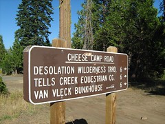
After picking up my friend Erik, we headed west on US 50 to the turnoff for Ice House Road, just before 50 turns into a twisting two-lane highway that runs alongside the South Fork American River and approaches the pass to cross over to the Lake Tahoe region. We drove north that road, past the turn off for Ice House Reservoir and several turn offs for enormous Union Valley Reservoir, until we reached the delightfully named Cheese Camp Road (no, I have no explanation), which was signed for the Van Vleck Bunkhouse and the Desolation Wilderness.

20070824 CHEESE CAMP ROAD
Cheese Camp Road

From here my directions said to drive to a dirt road on the right 500 feet before a locked gate. How would I know when I reached that point? There was a sign that said, "LOCKED GATE, 500 FEET AHEAD." It's a short but bumpy ride on the dirt road to the parking area, where there were day use permits for the Desolation Wilderness.

From there we walked back up the dirt road, then down the paved road to the locked gate and beyond it onto dirt road. There are several old roads out here, some for the Van Vleck Ranch, only one building of which has been preserved, I believe, and old logging roads.

We passed a junction with a fork to the right for the Red Peak Trail, then immediately after a fork to the left for Loon Lake. We continued up the road past a useless cattle guard (there being no fence on either side of it) and some odd piece of yellow equipment on the left with two large wheels, until we reached a weather station and a junction post.

What lies ahead on that road, I don't know. We veered off the to right at the junction and the weather station. Here the trail followed an old PG&E road that has not been maintained. It was single track trail, but with an unusually large gap between the trees, and occasional evidence that this was formerly a wider road. Some small trees have sprouted up, though, and some time in the future, the evidence that there was a road here should be thoroughly obscured.

We passed along quite quickly on this fairly level portion of trail. We were not overwhelmed with dramatic views, but I was delighted to see so many butterflies and wildflowers this late in a dry season. The terrain varied from dense forest to meadow, sometimes mixed with glacial erratics (big granite boulders strewn throughout the forest and meadows).

The first meadow we crossed had a brook bubbling through it, again surprising when everything has been so dry. It later had a boggy area to cross, which must be a major task when there is more water around. Posts with the word "Trail" aided the passage across all the meadows. Other meadows were filled with dead or dieing mule ears and California false hellebore. And yet in some of the forested areas, green ferns were thriving.

Just past one of those meadows of yellowing mule ears, we met the junction sign indicating Shadow Lake on the left fork, and Highland Trail, on the right. We took Highland. It had frequent posts too, only these were much narrower than the earlier "Trail" posts, and said "Highland Tr."

Not longer after we reached the Desolation Wilderness boundary sign, which was interesting only because it was not the same shape as all the others I have seen. From there, the easy hiking was over. The trail immediately started up.

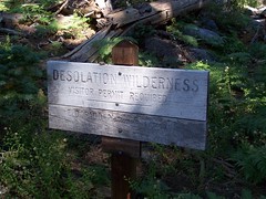
20070824 Desolation Wilderness
Desolation Wilderness Boundary

But in the brief section of the trail before it got ridiculously steep, I heard, and then spotted, a deer off to the left. Most of the Desolation Wilderness is, not surprisingly, desolate. Dramatic granite landscapes on which conifers struggle to find a foothold dominate the majority of it. This approach took us through much more forgiving, heavily forested areas, which can support deer and their predators, as evidenced by that deer, the only one I have seen in the Desolation Wilderness.

But that was only a few yards in. Then we started up a steep slope where trees were far more scattered. Not only was it steep, the footing was insecure--dirt and pebbles. I wasn't looking forward to descending this part. After the grunt up this portion, we leveled off to a lush area where the trail was mostly overgrown. Late in the year, it had been trampled down for us, but I imagine it is difficult to find the way across earlier.

Not that the path was easy to find for us. The trampled vegetation led us to the east past the talus on the slope to the north, and then up via a sketchy route. No cairns to mark the way this time, just guess work and then corrections. Once we got up close to the high point of the route to Forni Lake, there were indicators. Some obvious trail off to a viewpoint was marked as off trail by a line of rocks and tree branches, and cairns led us on to the short descent to Forni Lake.

This lake is described in Tahoe Sierra as "Hemmed in with vegetation" and "not particularly photogenic." It was not hemmed in with vegetation when we visited, given that the water level was so low. I walked out 25 feet into what was the lake earlier in the year, and now was just rocks coated with dirt, to take some pictures. The sound of fish splashing into the water was constant. At first, I just heard the splashes, and saw the concentric circles in the water, but soon I spotted the fish flashing out of the water to eat insects. Erik asked me why they were jumping out of the water and I told him that the little fishies were just so happy to be in a beautiful mountain lake that they were jumping for joy.

20070824 Forni Lake
Forni Lake

I thought we were going cross country from here to head towards Highland Lake, and my book told me to head off from the southeast part of the lake. My topographic map, on the other hand, made it look like we should head out from the northeast corner of the lake. I split the difference and headed directly east (the northeast corners would have been correct).

We picked our way cross country, going up wherever it seemed easiest to go up. Then we hit a ridge. There was a depression directly in front of us, and I did not want to go down to head back up again, but it looked like we should have gone up into that lower area. Consulting together and looking at the map, it looked like we should be climbing the ridge on the opposite side of that depression. I chose to skirt around it to the south, lengthening the horizontal distance, but avoiding a lot of additional climbing.

We worked our way over and then TA-DA! There was a trail. Had I read the description of this hike thoroughly, this wouldn't have been so surprising. It is not marked on my Desolation Wilderness trail map, but the trail up to the ridge overlooking Highland Lake is not a use trail, but a trail that was created at one time and even marked with blazes on trees, but which is now unmaintained and hard to follow in places.

We followed the trail up as best we could, searching for cairns often. And then came the ridge. This trail had been one without drama, and then, before me, was all the drama I could ask for. We were on the ridge of a cirque that dropped about 800 feet below with all granite terrain, a beautiful lake (Highland Lake) at the bottom, and Lake Tahoe in the background.

20070824 Highland Lake
Highland Lake

My original intention had been to go down to that gorgeous lake and swim in it, but it had taken us a long time to get where we were after a late start on the trail, and it was a long way down, and back up. My book warned of the dangers on the way down,which meant to pick our way down safely would likely be slow going. And yet it was beautiful and tempting. I really wanted to swim in a mountain lake that day, and Forni Lake was so shallow that it barely had room for its fish. I let the urge go and left it for another day.

The descent to Forni Lake, mostly via the abandoned trail, was much easier than the ascent, and not just because we were going downhill. It was a better route, even though I couldn't always find it. At one point I was sure I was thoroughly off trail, and then I was just as surely back on trail.

The sometimes confusing descent to the lush area followed, not much more clear than the abandoned trail. And after that, the steep descent on the loose rocks and dirt. As I expected, I slipped a few times, but I didn't fall. My strategy on such loose footing is to keep my feet at a 45 degree angle to the descent, 90 degrees when it gets intolerably steep.

20070824  Aster or  closely related flower

Back down to the easy, but not short, stretch, I stopped to take some macro shots of flowers, and water a tree. After an otherwise lovely hike, the portion of the trail that followed dirt road seemed unduly long and ugly, but at least we were above the valley heat, to which we returned all too soon.

Hike Summary

Date: 24 August 2007
Trailhead: Van Vleck
Approximate distance: 10.8 miles

Wednesday, August 15, 2007

Lake Tahoe Basin: Mt. Tallac Trail

20070815 Me on Mt. Tallac
Me on Mt Tallac

One day my friend Erik and I made hasty plans to go hiking the next day. I quickly sent him an e-mail with some hikes I wanted to do in the next few weeks and let him choose one. Two were ones that represented new challenges I felt I was ready to tackle, but I didn't think he would care to try. Much to my surprise, he chose one of those: Mt. Tallac Trail to the summit of Mt. Tallac.

It's a 3225 feet climb from the trailhead to the summit, not counting any additional downs and ups on the trail (which are pretty minimal, thankfully). That's about 500 feet more of climbing than I have done before, and more than 1000 feet more of climbing than Erik has done in the little more than a year that I have known him. It's a hike I had read about last year, but felt I wasn't ready for then, and my plan had been to keep increasing my challenges until I was ready for it towards the end of the high Sierra season this year. Erik skipped some of the intermediate steps I used to build up to this.

The trailhead is at the end of Mt. Tallac Rd. off of CA 89, just across the road from the Baldwin Beach turnoff for Lake Tahoe, and just north of South Lake Tahoe. Everything was clearly signed and we easily made it to the parking lot, got out, then got back in to drive back to use Camp Concord's toilets, since there were none at the trailhead.

Once back to the trailhead, we set out. Initially it was just a dirt trail through forest. It would normally be dry this time of year, but it was even drier than usual in this dry year, and there weren't any wildflowers initially that I can recall.

But soon we began to ascend a ridge with dramatic views to the left (south) of Fallen Leaf Lake and the south end of Lake Tahoe. The trees along this ridge were burned (not from the recent Angora fire, which was on the south side of Fallen Leaf Lake), which gave us more views, but didn't provide us with much shade, and it was warm. I worked up a sweat right from the start of the hike.

20070815 Mt. Tallac
A View of Our Destination

The hike followed the ridge for a while before descending a bit to the right before climbing again, this time without the views. We passed a body of water that two people were stopped at, one with a nice camera. I thought, "Why are they bothering with this pond? They must think it's Floating Island Lake."

Next we came to a trail junction with the path down to the west end of Fallen Leaf Lake, and soon after I spotted another body of water. "Floating Island Lake at last," I thought. Only when I got closer I saw it was also pond-sized. I checked my map and realized that first body of water was indeed Floating Island Lake, and the second one was Cathedral Lake. They were both disappointingly small, and didn't look suitable for swimming. Cathedral Lake did have a nice backdrop, which I might have climbed around the south end of the lake to photograph, if I didn't have such a substantial climb before me.

Leaving Cathedral Lake, the trail turned much steeper, and Erik commented that he had the feeling the real climbing was just beginning. He was right. We climbed through patches of trees, sometimes sparse and sometimes dense, before coming out into an open area that was long and steep. The trail underfoot was loose rock, so the footing was sometimes difficult. We could see a long stretch of the trail on the exposed mountainside here, and saw quite a few people on it, going both direction.

20070815 Steep Trail
Erik Near the Start of the Long, Steep Stretch

About 1/3 of the way up this stretch I heard some people coming down answering questions from other people going up. I only caught tidbits: ". . . long way . . . up over those . . . about an hour . . . ." The last part didn't sound bad--one hour would put us to the top 15 minutes earlier than I had planned on.

This open stretch had dramatic views of Lake Tahoe and Fallen Leaf Lake. At the top of it, the trail turned away and the views to the east were gone, but they were replaced by dramatic views to the west of the Desolation Wilderness.

The trail in this portion varied, some easy portions, mixed with more steep portions. It was mostly a rocky meadow, with occasional stands of trees. At one point the trail veered off onto a vast slope of talus, and I thought we would have to continue on that. But it was only a detour around a large tree that had fallen across the trail.

I came across a father with 3 girls who told me, "You're almost there." Sometime later I got the same reassurance from two women. And sometime after that I was wondering, "When the heck am I going to come to the junction with the trail down to Gilmore Lake?" That junction marks the start of the final ascent. Right about that time, I saw the junction ahead.

The approach to the summit starts out clearly, although it goes uncomfortably close to a steep drop-off. As you get to the large talus nearest the peak, there isn't much of a trail. The easiest way up seemed obvious to me, and I kept moving at a good pace. Two men who were having a bit of trouble said, "Let's follow him--he seems to know where he's going."

Although the total amount of climbing was far greater, the final ascent to the summit was much easier and sitting at the summit itself was much more comfortable on Mt. Tallac than on Round Top. From the summit, I had amazing 360-degree views. I could see Lake Tahoe, Emerald Bay, Cascade Lake, Fallen Leaf Lake, Gilmore Lake, Susie Lake, Heather Lake (just a smidgeon), Lake Aloha, and two other lakes north by northwest that I wasn't sure of the identities of.

20070815 Desolation Wilderness
View of Lake Gilmore to the West

Erik would join me later, but I was not alone. There were a few people I had no problem sharing the peak with. Then there were Clint, Judith, Iris, Peter, Jenine, and Cherrie. I know their names because Clint wrote them with a Sharpie on the rock of the summit. Then they headed down to a ledge to throw 3 Frisbees off the top of the mountain into the forest below. They sat around a long time after that, text messaging people, using the cell phone, and throwing rocks at squirrels. One of them asked for the Sharpie and left another message that nobody wants to read.

20070815 Clint Sucks
Graffiti in Paradise

I wanted to avoid them, but I also wanted to take some photos from where they were at. I worked my way down and sat a ways off, waiting for them to leave. They talked about leaving, how they needed to get back for the football game by 5 or 5:30. They even proposed racing down. But it took far too long for them to clear out.

20070815 "Can you hear me now?"
Erik Ordering Pizza

Erik came down from the summit, where he had been talking to his wife on a cell phone, just before they left. We then moved down, as did a couple who asked me to take their picture for them. I had eaten a peanut butter sandwich at the summit before Erik arrived, and taken a video of a squirrel after it. I had my second sandwich down below, while Erik also ate his own peanut butter sandwich. The presence of all this peanut butter was too much for the squirrels. They were swarming, darting in to try and get some. I started to shoot some video of squirrels going after Erik's sandwich, but soon found they were after mine. While I was eating, one started to crawl on my shoulder to get at the sandwich. I pulled back. More and more came out, and started making noises to one another. Well, I assume the noises were to communicate with one another. They might have been directed at me: "Surrender the sandwich immediately!"

20070815 Squirrel after a peanut butter sandwich
Gold-Mantled Ground Squirrel


Then we began our massive descent. I started out the wrong way, but didn't much care, and picked my way across talus, while Erik searched and found the trail to start down. I had handled the ascent without much problem--it was just sweating and breathing hard and continually moving forward. But it didn't take me long on the descent before I could feel soreness in my muscles and knee joints. I stopped a couple of times just to give them a rest, although I wasn't winded. I hadn't needed to stop on the way up.

Cathedral Lake was my goal. I didn't wait up for Erik or look behind to see how far back he was, I was just intent on reaching Cathedral Lake, where I could take an extended rest stop on the shore. After that, I knew the rest of the descent would be easy. I passed the obnoxious kids and never saw them again.

Near Cathedral Lake, I slipped and fell. I wasn't hurt, but it got a dog at the lake excited. I went down to the shore of the lake, changed my water hose to my auxiliary canteen, relaxed, and waited for Erik. A man called out and asked if he could bring his dogs over to meet me to calm them down. I agreed.

Sophie was the problem, and he gave me a treat to feed her, to make her my friend for life. Then they went back to their area. He later threw a stick out into the lake. Although hesitant at first, Sophie swam out and retrieved it. After returning it to the guy, she came over on her own to see me again. She stood a couple of inches away from me, and then did what I knew she was going to do, shook all over to dry herself off, splattering me. That was fine with me--it was refreshing, and at that point, I'm sure I smelled worse than a wet dog anyhow.

When Erik came along, he also made noise while slipping (although not falling) and this time the dogs raced through the bushes up to investigate. A woman that belonged to the dogs had to bring them back.

It was an easy descent from there. Hearing the jangling of the dog collars behind us farther down the trail, I pulled over at Floating Island Lake to let them pass, while pondering the question with Erik of why this tiny lake was given such a name. There were no islands in the lake. My only guess was that the lake itself must appear like an island in the trees when seen from above. Or perhaps the island in question floated away entirely.

(According to Jeffrey Schaffer in Tahoe Sierra, "In 1890 this unique lake was noted as having a 20-foot diameter floating mat of grass and shrubs, whence the name. In more recent times there have been several floating, grassy mats, and more mats are ready to slough off from the lake's soggy northwest shore. It's a mystery why mats slough off at this lake and not any other.")

After we made it back to the car, I felt the need to indulge myself with a treat for this accomplishment, so we stopped at Burger Lounge in South Lake Tahoe on the way back, and I had a burger smothered in cheese and grilled onions and a Coke filled with high fructose goodness.

20070815 Smothered
Smothered

Hike Summary

Date: 15 August 2007
Trailhead: Mt. Tallac
Approximate distance: 9.2 miles
Other links: Kevin Gong's description of this trail