[Other Sacramento neon sites of interest:
Agilitynut's Sacramento page
Roadside Peek's Sacramento search
What the monkey did the 15th week of his year]
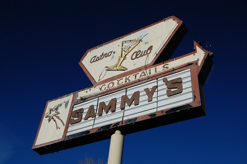
R.I.P Astro Club Neon
Radio City Music Hall was my first photograph of a neon sign, back in 1986, and I shot some neon at night in Italy in 1987. But my hobby of photographing vintage neon signs (and occasionally vintage signs that aren't neon, or new neon signs, but it is the vintage neon that is my favorite) started innocently enough when I was pursuing a totally different obsession.
My high school friend from Montana, Eric, came to visit me in Davis in July of 2000 while his wife attended a conference in Berkeley. He had got me started on the hobby of collecting "classic" or "vintage" video game systems--you know, what was, at the time, garage sale, thrift store, or dumpster items, and now is eBay gold. I took him on a whirlwind tour of thrift stores in the greater Sacramento area, and it truly is one of the best cities in the country for thrift store shopping.
In West Sacramento we stopped at the Goodwill (now long gone) and he pointed to the sign for Sammy's Astro Club and commented that it was cool. I handed him my compact 35mm camera and told him to take a picture of it. Later he pointed at a vintage plastic sign that we drove by and commented on it as well. That's what made me start noticing these signs.
That fall I got a new APS camera with 3X zoom, and it came with 10 rolls of film. I was used to shooting one roll of film a year. What was I going to do with all this film? I started exploring Northern California using guide books and taking pictures of old buildings. Architectural photography had always been my primary interest when traveling. But this time, I started shooting the old signs as well.
In 2001, I got a digital camera, but my hobby was put on hold that fall by severe back pain that knocked me out of commission for a year. I took a handful of neon shots in 2003 and 2004. And then in 2005, I read about Flickr in Consumer Reports, and decided to join to share my baseball photos and all the family photos I had scanned. But I wasn't using much of my pro account's capacity. And then I remembered my old neon shots.
I posted them and Mike, who goes by
illtakeyourphoto!, discovered them, and became my first Flickr contact. He used to live in Sacramento, and was also a vintage neon photographer. Through him I met several other people with similar interests, and it stimulated me to return to shooting neon.
At first I had no idea what I was doing with a camera, and was just interested in preserving the image of the sign. I ran around shooting everything. In the time since, I've had the luxury of going back and revisiting the subjects, and have been trying to improve my photographs. So here's a little rundown of what the city has, or, in some cases, had, to offer.
Click on small images to see larger ones, and sometimes additional information.
I've excluded Rancho Cordova, Elk Grove, Roseville, Folsom, Freeport, Davis, Woodland, and farther outlying areas for brevity, although they probably are considered part of the Sacramento metropolitan area. I'll write other blog entries for those (well, probably not Elk Grove, which I'm hoping will just disappear from the face of the earth).
I've divided the signs by 6 regions, Downtown, Midtown, East Sacramento, North Area, South Area, and West Sacramento. Within those regions I have put an additional header for a street that I have blogged or will blog separately. When I have already written a blog entry on a street, I have not included additional details in this entry, but have instead provided a link to that blog entry.
In the case of old signs that have had the neon broken off and been repainted before I got to photograph them, I have only included ones that I still find interesting. There are still a few of those I want to photograph but have not gotten to yet.
DowntownBefore the mass popularity of the automobile and the building of freeways, people had to live close together in an efficient manner, and "Kay Street" was the main street of Sacramento. But suburbia, modern "drive in shopping centers," and shopping malls killed K Street. Following the popular thinking of the time, city officials tried to revive it by choking off access to it--the pedestrian mall was a common fix used disastrously all over the country. The city is still clinging to this idea.
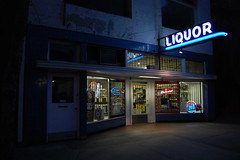
Fong Liquor Store
1126 I Street
Status: extant
Probably from the 1940s. In 1948, this was Fong Liquor No. 3, the other 2 being on J and K Streets.
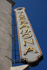
Ramona Hotel
600 J Street
Status: extant
Circa 1930.
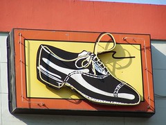
United Cobblers
912 J Street
Status: extant
This sign was a mystery to me for a long time. When I first photographed it, there was an art studio directly below it. I thought it probably went with the studio, and was new art. But it stayed when the art studio left and a tattoo parlor moved in, so that didn't make sense to me. I researched it and found that United Cobblers were located there from 1959 or 1960 until they closed in 1998. According to a Sacramento Bee article, the business moved a few times, and was likely originally founded in 1928.
But then the artist who created it, Derek Smith, commented on my photo on Flickr. He created it for the
Art in Public Places Project of the
Sacramento Metropolitan Arts Commission. It was commissioned by the Downtown Partnership, and meant to be "coherent with the business," which was United Cobblers, at the time.
So it's not all that old, but it is magnificent, and I'll leave it in this blog entry for anyone else who is wondering about its origins.
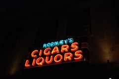
Rodney's Cigar & Liquor Store
1000 J Street
Status: extant
Rodney's has been at this address since at least 1982, but earlier was a block east, at 1100 J Street from at least 1948 to 1970. They don't appear in the 1938 Yellow Pages, so 1938 to 1948 is probably when they opened for business.
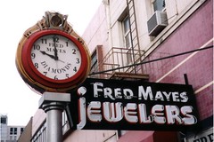
Fred Mayes Jewelers
1006 J Street
Status: base extant, but no neon and radically altered
The clock still looks the same, but all the neon tubes have been broken off the main sign and it has been painted over.
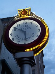
According to two sources I have seen, the clock dates from 1925. Dan Flynn's
Inside Guide to Sacramento says that the clock was originally for Tom B. Monk's jewelry shop at 1006 J Street. Monk was also mayor of Sacramento from 1938 to 1945. His shop operated here from the 1940s until 1963, when Fred Mayes bought the jewelry store. But Monk originally had his shop on 1009 K Street, and in 1925 the business was Wiesen & Monk Jewelers. By 1929, Wiesen and his new partner Bailey were operating elsewhere, while Monk continued to operate on K Street under just his name.
If the clock is from 1925, it was probably moved and has been altered a couple of times. It's likely that the neon was added at a later date, as neon signs were only introduced commercially in 1923.
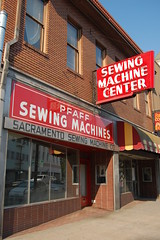
Sacramento Sewing
1022 J Street
Status: extant
The business operated here from at least 1953 to 1996. The 1948 Yellow Pages places them across the street, at 1021 J Street.
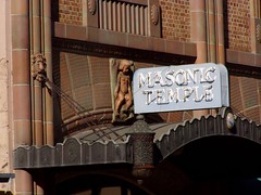
Masonic Temple
1123 J Street
Status: extant
Building circa 1920, but that predates the commercial production of neon signs in 1923.
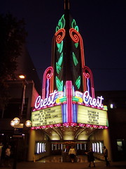
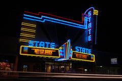
Crest Theatre
1013 K Street
Status: extant
While retaining the shell of the older Hippodrome Theatre, the Crest as it is opened on October 6, 1949. The theater was closed from 1979-1986, but seems to be doing well now. For additional photos of this gem of a theater, click
here.
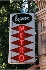
Espresso Metro
1030 K Street
Status: kaput
It couldn't have been a very old sign, but it was cool, and is now long gone.
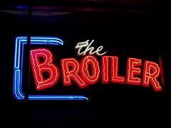
The Broiler
1201 K Street
Status: extant
This restaurant was an institution at 1013 J Street from around 1950 into the 1990s, but they picked up and moved to a new building. Now you have to walk inside the lobby to see the classic sign.
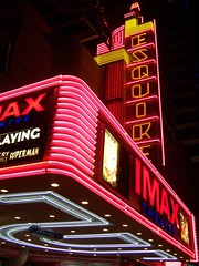
Esquire Imax Theatre
1211 K St.
Status: extant
Up the street from the Crest, the neon marquee for the Esquire Theatre is still there, even though the place was gutted and is now an Imax theater, and recently requested subsidies from the city. The original Esquire Theatre opened March 15, 1940. I have a few more photos of the theater
here.
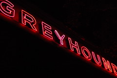
Greyhound Bus Lines
715 L Street
Status: extant, threatened
The building was constructed in 1937, but expanded and remodeled in 1947. Plans are to move the Greyhound Station to a new transportation center. I'm guessing this building would then be demolished, since a high-rise would be more profitable.
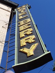
Hotel Berry
729 L Street
Status: extant
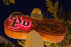
Posey's Cottage
1100 O Street
Status: extant
This was a longstanding meeting place of California politicians and lobbyists until it became the victim of construction--work on the light rail and other projects made it inconvenient to get to, and difficult to park near. It started losing $15,000-$30,000 a month and closed. Today some of the interior furnishings can be seen in the nearby California Museum. It moved around a bit when first opened, but settled at this address by 1961.
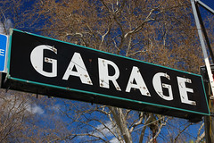
Downtown Garage
501 T Street
Status: extant, no neon
Currently JC Auto Service, this has been Hashisaka Brothers Garage (1960s), Tom's Auto Repair (1956), and Mike's Auto Service (1953), but the sign looks to be even older than that. I've seen a photograph of a nearly identical sign in a book on Stockton.
and around the corner:
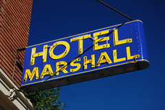
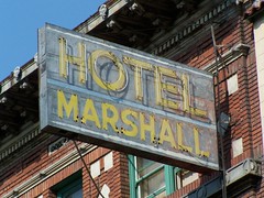
Hotel Marshall
1122 7th Street
Status: extant
Originally built as the Clayton Hotel in 1911, it was still listed as the "New" Clayton Hotel in 1947, but by 1948 was the Hotel Marshall.

1130 7th Street
The Hof Brau
Status: base extant, but no neon and radically altered
It operated here from at least 1938 to 1996.
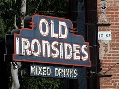
Old Ironsides
1901 10th Street
Status: extant
The bar opened shortly after prohibition ended in the 1930s.
E-Z Coin Wash
Corner of 10th and T
Status: extant, no neon

Dun Rite Shoe Repair
2022 10th Street
Status: extant, no neon
Now Schroeder's Shoe Repair, Dun Rite Shoe Repair dates back to at least the 1940s, when it was at 1325 1/2 5th Street. They appear to have moved to 10th around 1958.

Lim's Market
2100 10th Street
Status: extant, no neon
Dates back to at least 1948.
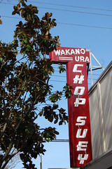
Wakano Ura Chop Suey
2217 10th Street
Status: extant
The restaurant has been there since the late 1950s, but is even older than that, as it used to be at 1219 1/2 4th Street, and even before that was at 1224 3rd Street in 1938.
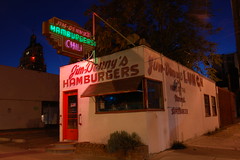
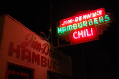
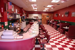
Jim and Denny's Restaurant No. 2
816 12th Street
Status: extant
Now called just Jim Denny's, it is listed in early directories as Jim and Denny's, after the proprietors, Jim Van Nort and Dennis McFall. It is a vintage diner with just a few stools at a counter that used to be open 24 hours to serve people near the bus station. From what I can glean from
Sacramento Bee articles, Jim and Denny opened their first restaurant at 907 16th St. in 1934, and opened the present location in 1940. Jim Van Nort cooked at the restaurant until 1988, when he retired and underwent coronary surgery. The restaurant only stayed closed a few months before opening under new ownership. I know it has been closed for at least one stretch since then, after another ownership change. Jim Van Nort died in 2001.
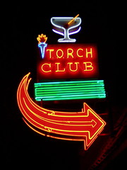
Torch Club
15th Street
Status: extant
The Torch Club is still in business after 70 years, just not where it used to be. In 1982, it was at 1612 L Street. In the 1960s, it was at 730 L Street. Before that it was at 601 J Street. Like every classic bar, it opened just after prohibition ended.
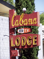
Cabana Lodge
16th Street
Status: kaput
The motel is still there, but the owner chose to get a small, plastic, back-lit sign rather than repair this one.
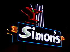
Simon's
1415 16th Street
Status: extant
Not vintage, although it certainly looked that way to me. Simon's only opened in 1984. Perhaps they reused part of the sign from the old Donner Club, which used to be there.
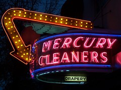
Mercury Cleaners
1419 16th Street
Status: extant
Circa 1946-1947.
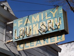
Family Laundry
2110 16th Street
Status extant
And right nearby is Harry's Cafe, which has a retro sign.
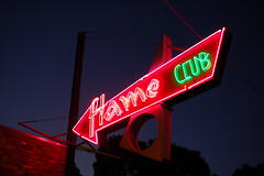
Flame Club
2130 16th Street
Status: extant
A bar opened here shortly after the repeal of prohibition under the ownership of Anthony J. Nevis, but I haven't been able to determine if it was called the Flame Club. Certainly the sign appears to date from the 1930s or 1940s. The first year that the city directories use business names consistently rather than the names of owners, 1953, has it listed as the Flame Club. It looks like a seedy dive bar from the outside, but it is currently patronized by the young and affluent, and has an extensive selection of microbrew beers.
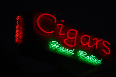
Cardenas Cigars
2201 16th Street
Status: extant
It's a vintage business, but this is a new location for it. I'm not sure if the sign is old or new.
Midtown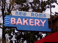
New Roma Bakery
1800 E Street
Status: extant
It has been New Roma since at least 1960, but the 1953 directory just lists the location as "J.G. Petrovich, baker."
Sam's Hof Brau
1630 J Street
Status: extant
It closed around 1993 and became Hamburger Mary's and then Hamburger Pattie's.
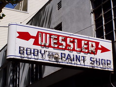
Wessler Body and Paint
2011 J Street
Status: extant
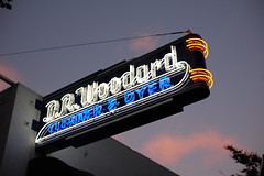
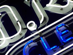
D.R. Woodard Cleaners
2201 J Street
Status: extant
Detail shot:
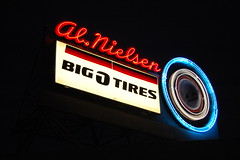
Al Nielsen
1615 L Street
Status: extant
I need to research this one. Possibly this is a vintage sign with a new "Big O Tires" addition.
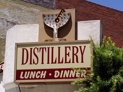
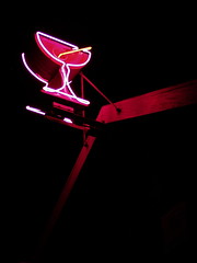
The Distillery
2107 L Street
Status: extant
Okay, there's no neon on this one, but I love those old multi-bulb cocktail glasses.
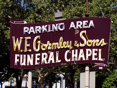
W.F. Gormley & Sons Funeral Chapel
2015 Capitol Avenue (formerly M Street)
Status: extant
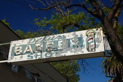
DeLux Barber Shop
1902 P Street
Status: extant
Now part of the Zebra Club.
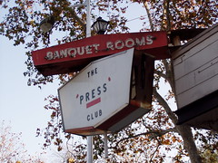
Press Club
2030 P Street
Status: extant
Only the "BANQUET ROOMS" part is neon, presumably a holdover from when this was Dick and Eddie's.
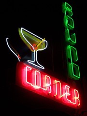
Round Corner
2333 S Street
Status: extant
The neon was recently repaired and it was given a fresh coat of paint.
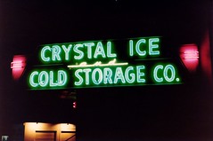
Photo by Ken Bennett
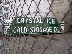
Crystal Ice
1812 17th Street
Status: ???
A friend at work gave me this photo. I never saw the sign lit--when I found it, it was leaning up against a wall behind a chained link fence. It is no longer there, but I believe my friend
Dave van Hulsteyn may have made a deal with a developer to restore it. My shot:
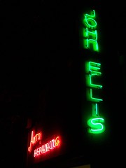
John Ellis & Son
910 19th Street
Status: extant
I think
Dave van Hulsteyn repaired this one recently.
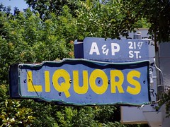
A&P 21st Street Liquor Store
1101 21st Street
Status: extant, no neon
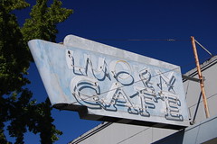
Lucky Cafe
1111 21st Street
Status: extant
Town House Restaurant of Sacramento
1517 21st Street
Status: extant
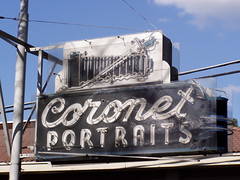
Coronet Portraits
2116 21st Street
Status: extant
Before moving into the upscale home at this location, Coronet Portraits was at 904 J Street in the 1950s, but the sign looks to be older still. I've never seen it that way, but here's a
shot of it lit.
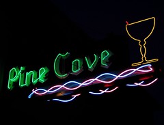
Pine Cove Tavern
509 29th Street
Status: extant
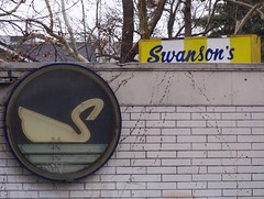
Swanson's Cleaners
830 29th Street
Status: extant
It's protected behind plastic, so it ought to work fine, but I've never seen it lit.
East SacramentoEast Sacramento is neatly defined by the borders of the Capital City Freeway (or , currently Business 80) to the west, U.S. Route 50 to the south, and the American River to the north and east.
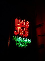
Luis's Mexican Food
1218 Alhambra
Status: extant, but threatened
Luis Leyva was a Mexican immigrant who 5 times was deported before landing permanently in the United States. After being chef at the Mexico City Cafe in Stockton, he opened up Luis's in 1965. He was well known for his charitable work, and for all the photos hanging in the restaurant of him posing with anyone of note who ate there. The restaurant closed in September of 2004, less than a year after Luis's death, and there are plans to demolish it and put in a drugstore.
Luis Jr. opened a restaurant called Luis Jr.'s in 2004 in the old Ramona Hotel building, only to have the Church of Scientology purchase the building to use as their Sacramento headquarters. The small sign there is similar to the larger sign for his father's restaurant, and hopefully he will take it with him and open a new restaurant after negotiating a buyout on his lease.
Regal Petroleum Corporation
3201 Folsom Boulevard
Status: extant, but no neon
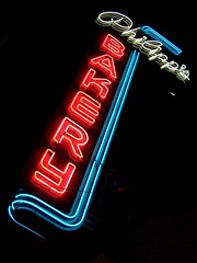
Philipp's Bakery
3300 Folsom Boulevard
Status: extant
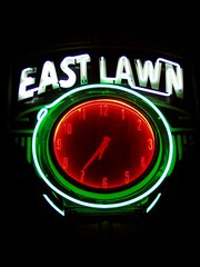
East Lawn Cemetery
4300 Folsom Boulevard
Status: extant
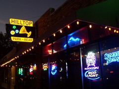
Hilltop Tavern
4757 Folsom Boulevard
Status: extant
Socal's
5200 Folsom Boulevard
Status: extant
The "Socal's" neon dates from the early 1970s, although the base of the sign may be that from the Clover Club bar that was here in the 50s and 60s.
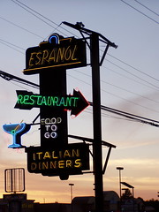
Espanol Italian Restaurant
5723 Folsom Boulevard
Status: extant
The building of Interstate 5 through Sacramento's historic west end (what remains of it is now Old Sacramento State Historic Park) forced the restaurant to move from the Commercial Hotel to the site of the old Square Deal Restaurant in 1965. The name derives from its origins in a boarding house for Basque sheepherders, but the Luigi Brothers bought the restaurant in 1959 and gradually converted the menu to Italian.
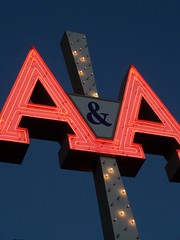
A&A Appliance
6800 Folsom Boulevard
Status: extant
Another shot:
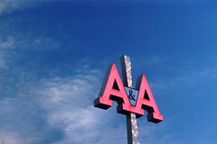
Photo by
illtakeyourphoto!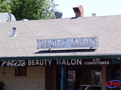
Petite Beauty Salon
5528 H Street
Status: extant
It was recently removed while they redid the roofing, but afterwards it was replaced.
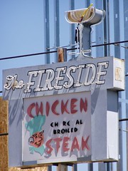
The Fireside
5539 H Street
Status: kaput
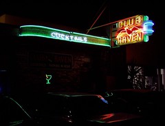
Club Raven
3246 J Street
Status: replica extant
The old sign was too far gone to be repaired, but Pacific Neon was able to build a replica that could fool anybody. Detail shot:
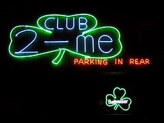
Club 2-me
4738 J Street
Status: extant
I'm not sure about the sign, but the bar looks old enough. Stop next door for a pasty.
Achilles Heel Tavern
4900 J Street
Status: extant
Now Chargin's Bar & Grill
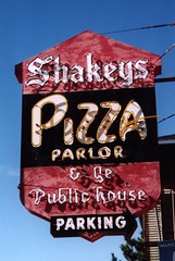
Shakey's Pizza
5641 J Street
Status: ???
This is the original Shakey's Pizza location, opened by Shakey Johnson himself in 1954. He sold out to a company from Southern California in the late 1960s. When the restaurant experienced a fire in January of 1996, it was never reopened. When the East End Bar & Grill opened there, the owners wanted to keep the original sign in addition to their own, but apparently there is some sort of ordinance against that. The city asked Capital Neon to store the sign for two months. A year later, they finally moved it to the Sacramento Archives and Museum Collection Center, where about 30 historic neon signs reside, including one for the Rosemount Grill.
Some of their collection of historic artifacts get shown at the Discovery Museum in Old Sacramento. I'm thinking I need to become a member and go at least once a month just to see what turns up.
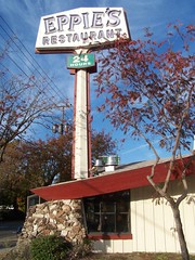
Eppie's
3001 N Street
Status: extant, threatened
The once extensive Eppie's chain is down to one operating restaurant, in West Sacramento. This site looks ready to reopen at a moment's notice, but has been closed since 2004. Somebody still has access to it, though, as there was a banner put up inside recently for this year's
Eppie's Great Race.
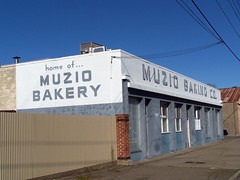
Muzio Baking Company
1708 34th Street
Status: extant
I'm not sure how "vintage" it is. I know they have been there since at least 1988.
South Area
BroadwayFrom 15th Street to Stockton Boulevard, Broadway was the old U.S. Route 99. I'm working on more detailed blog entries for that stretch.
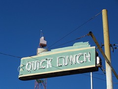
Quick Lunch
513 Broadway
Status: extant
Now Sim's Diner. This is a real oldie.
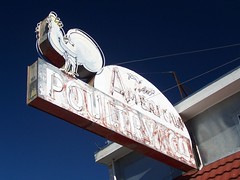
New American Poultry Company
519 Broadway
Status: extant
Right next door to Sim's Diner.
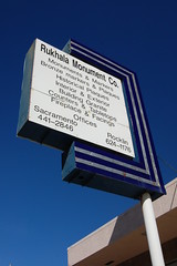
Rukhala Monument Company
1001 Broadway
Status: extant, no neon
It must have been a neon sign at one point, although there are no visible holes for the neon tubes now.
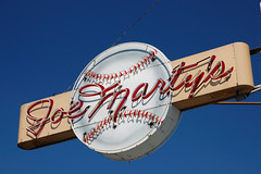
Joe Marty's El Chico
1500 Broadway
Status: extant
Joe Marty (1913-1984), former Major League Baseball Player and player and manager for the Pacific Coast League's Sacramento Solons, opened a bar on J Street in 1938, and in 1954 moved it into the corner of the Tower Theatre building, naming it Joe Marty's El Chico (before that El Chico Cafe had occupied the space).
I went to eat there and photograph the neon sign at night in July of 2005, only to discover that the venerable establishment had been closed by a small fire at the end of June, 2005. The owner, David Garibaldi, indicated to the Sacramento Bee that he was anxious to reopen as soon as possible, and proclaimed, "There's not a chance that this won't happen. Joe Marty's is coming back." All the historic baseball memorabilia had survived.
In December, the Bee ran a story indicating that despite frustrating delays and complications, the bar and grill would be opening again soon. An article in March, 2006 indicated that it would be reopen by the end of June.
But it never reopened, and there has been a sign outside for more than a year indicating that the space is for lease.
Tower Drug Store
1518 Broadway
Status: extant
Where founder of Tower Records, Russ Solomon, got his start selling music. It now houses the Tower Cafe.
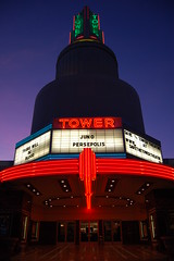
Tower Theatre
Broadway & Land Park Drive (2508 Land Park Drive)
Status extant
Opening night was 1 November, 1938. Unfortunately, the theater has been divided for multiple screens.
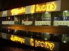
Pancake Circus
2101 Broadway
Status: extant
The building was built around 1963 or 1964 as Al & Myrle's Platter, I believe. It became Pancake Parade around 1969 or 1970, and Pancake Circus in 1970 or 1971.
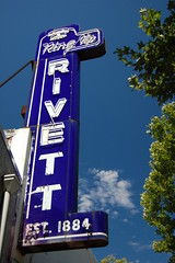
Ring Up Rivett
2300 Broadway
Status: extant
A flooring company recently closed after more than 120 years in business. They moved from downtown to Y Street (now Broadway) around 1925-1926.
Pet & Pigeon Center
3322 Broadway
Status: extant, but broken
It says "Pet & Puppy Center" on wood on the other side, but before the neon was broken, it said "Pet & Pigeon Center" on this side, according to someone who once lived above it. The long-vanished business went by both of those names, as well as Pet & Poodle Center, over the years.
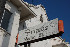
Swiss Club
3406 Broadway
Satus: extant, no neon, threatened
The elegant building dates from 1910, while the Swiss Club opened here sometime from 1953-1955. Kevin Johnson's company now owns the vacant property, and tried to demolish it, but was blocked by the city. Perhaps he won't have that problem if he wins the race for mayor (as looks likely).
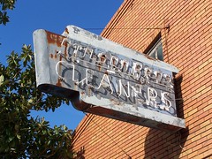
Stilson Brothers Cleaners
3519 Broadway
Status: extant
Jasper P. Stilson was working for Spurgeon's Cleaners in 1922, but by 1923 was operating Stilson Brothers cleaners. It's still in business.
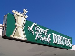
Land Park Pharmacy
4404 Del Rio Road
Status: extant
The Circus Tent
8011 Florin Road
Status: extant
Currently the Maine Line.
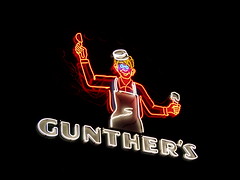
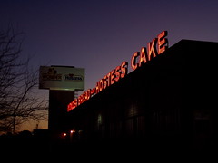
Gunther's Ice cream
2801 Franklin Boulevard
Status: extant
An absolute classic--both the neon sign, and the ice cream shop. According to the
Sacramento Bee, it opened 2 blocks away in 1940, and moved to its current location in 1949.
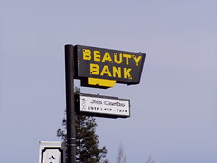
Beauty Bank
3639 Franklin Boulevard
Status: extant
I don't know anything about this sign or its age yet.

Chuck's Bottle Shop
5620 Franklin Boulevard
Status: extant
The font on the sign was changed when it was repainted and fixed.
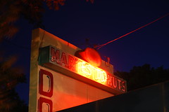
Marie's Do-Nuts
2950 Freeport Boulevard
Status: extant
This sign is circa 1970, although the doughnut shop is older, having previously been Cooper's Donuts.
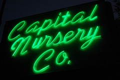
Capital Nursery
4700 Freeport Boulevard
Status: extant
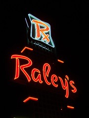
Raley's
4850 Freeport Boulevard
Status: extant
Another shot:
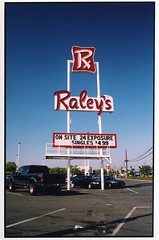
Photo by
illtakeyourphoto!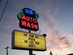
Gem Auto Wash
5150 Freeport Boulevard
Circa 1956-1958.
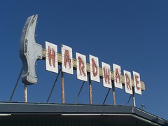
Hollywood Hardware
5303 Freeport Boulevard
Status: extant
Formerly at 5151. I guess this stretch of Freeport Boulevard used to be Hollywood North, as the old city directories list the following businesses in the area: Hollywood Beauty Shop, Hollywood Jewelers, Hollywood Pastry Shop, Hollywood Bottle Shop, and Hollywood Vogue Women's Apparel.
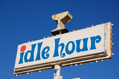
Idle Hour
6814 Fruitridge Road
Status: extant
Only the cocktail glass is neon, and it's not working, but the rest of the sign is delightfully whimsical.
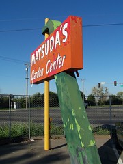
Matsuda's
8501 Jackson Road
Status: ??
I've been informed they are no longer Matsuda's. Whatever they become, I imagine they would just repaint the sign, as it no longer has any neon anyhow.
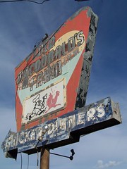
Old MacDonald's Farm
Jackson Road
Status: extant, neon broken
This is a long ways out of town, but I don't know what other blog entry I would include it in, so I threw it in here.
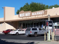
Muir Way Market
2736 Muir Way
Status: extant, no neon
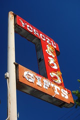
The Yorozu
2615 Riverside Boulevard
Status: extant
Moved from the 1300 block of Fourth Street, where it dated back to at least the 1940s.
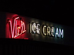
Vic's Ice Cream
3788 Riverside Boulevard
Status: extant
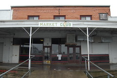
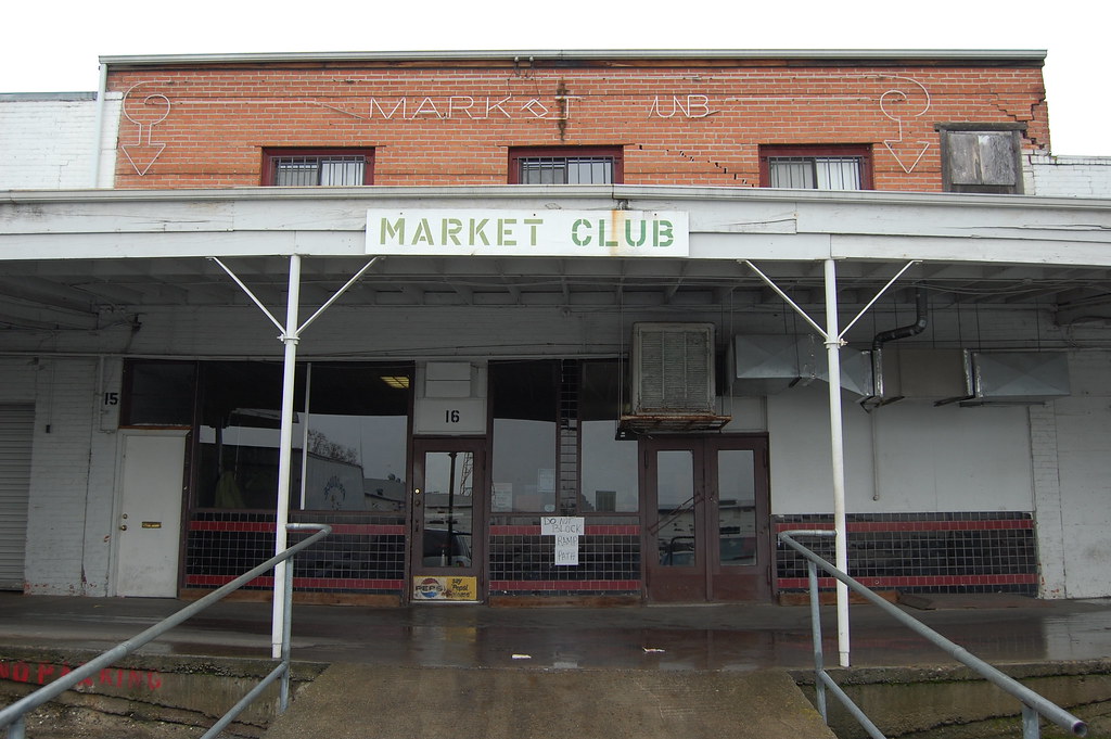
Market Club
2630 5th Street
Status: extant
This is a great old diner originally created to serve the workmen of the produce market. You probably can't see the neon up top unless you look at the
large version.
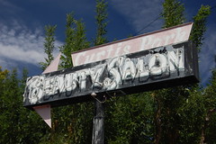
Curtis Park Beauty Salon
3440 24th Street
Status: extant
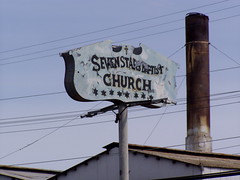
Seven Stars Baptist Church
4450 24th Street
Status: extant, no neon
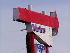
Metro
5531 24th Street
Status: extant, no neon
I haven't gotten around to researching this one yet.
Stockton BoulevardSouth from Broadway along Stockton Boulevard (3000 block and higher) was the path of old U.S. Route 99. I'll be writing a more detailed blog entry on this stretch eventually.
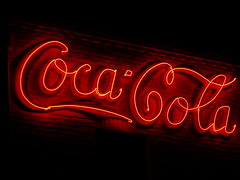
Coca-Cola Bottling
2200 Stockton Boulevard
Status: extant
The building dates from the 1930s.
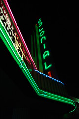
Colonial Theatre
3522 Stockton Boulevard
Status: extant
Opened June 7, 1940. Click on the photo to get a full description of the theater published on the day it opened.
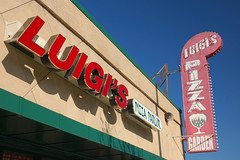
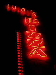
Luigi's Pizza Garden
3800 Stockton Boulevard
Status: extant
A great neighborhood tradition. Luigi's opened in 1953, and just opened another restaurant in midtown last year.
-----
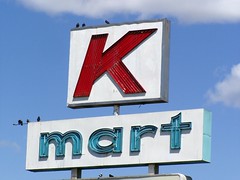
K-Mart
5100 Stockton Boulevard
Status: extant
Circa 1965-1967.
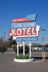
San Juan Motel
5700 Stockton Boulevard
Status: extant
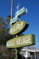
Holiday Mobile Village
7628 Stockton Boulevard (aka 7800 Whispering Palm Drive)
Status: extant
Another shot:
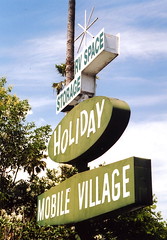
Photo by
illtakeyourphoto!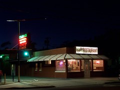
Trails Restaurant
2530 21st Street
Status: extant
It's a real beauty of a diner, with a great vintage neon sign, wheel wagon chandeliers, and general western theme. America's Mermaid,
Esther Williams was once owner or part owner of the restaurant, which opened circa the 1940s.
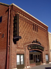
Guild Theatre
2828 35th Street
Status: extant
It used to be the Oak Park Theatre, and may have originally been the Victor, as their website claims, but my research doesn't back that up. In the early 1950s it became the Guild, Sacramento's first art house theater.
North Area

Ben's Big Burger
863 Arden Way
Status: extant
Now Geneva's Big Burgers, they have a wide menu with a lot of good food. There are some metal pieces on top of the building that I assume are remnants of an old sign.
Wonder Bread
1324 Arden Way
Status: extantAuburn BoulevardPart of old Highway 40 and the Lincoln Highway, and covered more extensively in another blog entry,
U.S. Route 40: Sacramento's Auburn Boulevard.
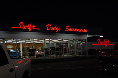
Swift Dodge
2301 Arden Way
Status: extant
Their website says they opened in 1966, and the building looks to be of that age, so I assume the signage is too, although it may have been added later.
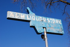
A&M Bottle Shop
1838 Auburn Boulevard
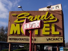
Sands Motel
2160 Auburn Boulevard
Status: extant (neon arrow only)
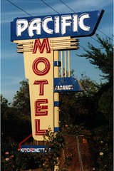
Pacific Motel
2224 Auburn Boulevard
Status: kaput
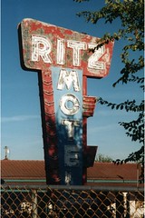
Ritz Motel
2228 Auburn Boulevard
Status: kaput
Another shot:
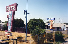
Photo by
illtakeyourphoto!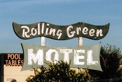
Rolling Green Motel
2230 Auburn Boulevard
Status: kaput

Tradewinds Motel
2844 Auburn Boulevard
Status: extant, neon not working

12 Mile House
5919 Auburn Boulevard
Status: extant
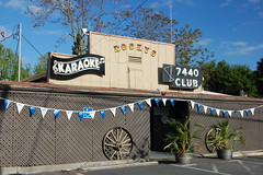
Seven Four Forty Club
7440 Auburn Boulevard
Status: extant
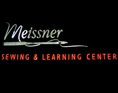
Meissner Sewing Machine Company
2417 Cormorant Way
Status: extant
Del Paso BoulevardThe route of old Highway 40, and before that, the Lincoln Highway, from the Sacramento River, to where the highway turned onto El Camino. This is my favorite part of Sacramento, because it was built in the Art Deco age. You can read much more about it in my never-finished blog entry,
U.S. Route 40: North Sacramento's Del Paso Boulevard, which has been described by friends at work as both "very detailed" and "really long."
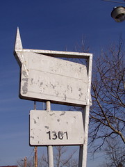
Original Auto Wrecking
1301 Del Paso Boulevard
Status: extant, no neon
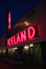
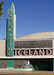
Iceland
1430 Del Paso Boulevard
Status: extant
By day:
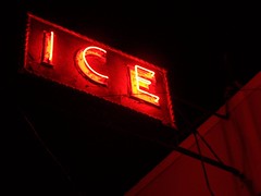
1434 Del Paso Boulevard
American Ice Company
Status: extant
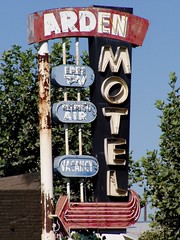
Arden Motel
1700 Del Paso Boulevard
Status: extant, but radically altered
Lil Joe's
1710 Del Paso Boulevard
Status: extant
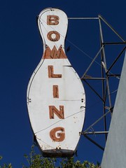
North Bowl
1721/1725 Del Paso Boulevard
Status: extant
The lower sign and the letters across the building in this shot are now gone:
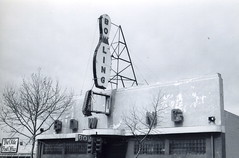
Photo by
illtakeyourphoto!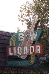
B&W Liquor
1910 Del Paso Boulevard
Status: extant, but radically altered
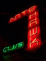
Nite Hawk
1822 Del Paso Boulevard
Status: extant
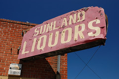
Sunland Liquor
2000 Del Paso Boulevard
Status: extant, no neon
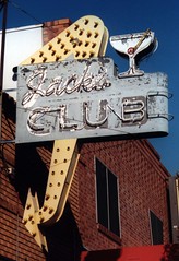
Jack's Club
2113 Del Paso Boulevard
Status: kaput
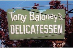
Tony Baloney's
2202 Del Paso Boulevard
Status: extant, but no neon and radically altered

Erwin's Frostie
2300 Del Paso Boulevard
Status: extant
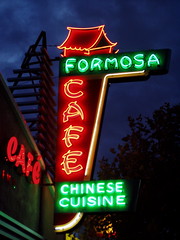
Cafe Formosa
2424 Del Paso Boulevard
Status: extant
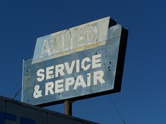
Allied Trailer Supply
1050 El Camino
Status: extant, no neon
Also along the historic Highway 40 route, between Del Paso Boulevard and Auburn Boulevard
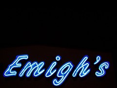
Emigh's Casual Living
3535 El Camino
Status: extant
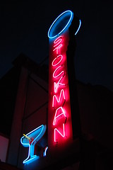
Stockman Club
10219 Fair Oaks Boulevard
Status: extant
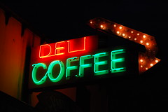
Fair Oaks Coffee House & Deli
10223 Fair Oaks Boulevard
Status: extant
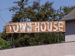
Town House
10236 Fair Oaks Boulevard
Status: extant
Four Oaks Bottle Shop
2142 Grand Avenue
Status: extant
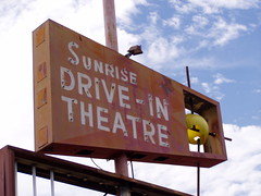
Sunrise Drive-In Theatre
8149 Greenback Lane
Status: kaput
And then there was one. When this drive-in closed in 2004--spurred by health and safety citations, after hanging on for so many years--it left Sacramento 6 as the only drive-in in town. Everything has been demolished for a new housing development. Just what we need--more people living in the suburbs and commuting in SUVs. Another shot:
Photo by
illtakeyourphoto!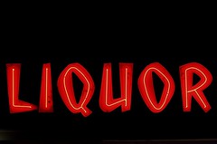
Orangevale Liquors
8940 Greenback Lane
Status: kaput
That's the address it was at when I photographed it, but originally it was across the street. The liquor store has returned to that side of the street in a new building, but the sign is gone.
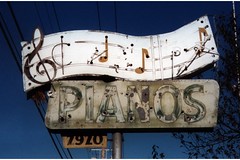
Western Piano Company
2920 Marysville Boulevard
Status: kaput
Another shot:

Photo by
illtakeyourphoto!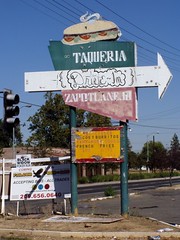
Eat & Run
3300 Marysville Boulevard
Status: extant, no neon
And later Del's Drive-In, Dena's Diner, Burger Time Drive-In, and Taque
ría Zapotlanejo. The place has been vacant since at least 2005.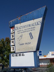
Crazy Hydraulics
3643 Marysville Boulevard
Status: extant, no neon
I'm sure it must have been neon at one point. Interesting shape.
Faith Tabernacle Pentecostal
2911 Rio Linda Boulevard
Status: extent
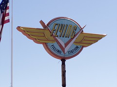
Flying V Filling Station
1576 Silica Avenue
Status: ??
No, there was no filling station at this address. This used to be home to Pacific Neon. Now Volvo Rents is there, and the sign is no longer in sight.
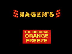
Hagen's Orange Freeze
2520 Walnut Avenue
Status: extant
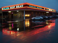
Sam's Hof Brau
2500 Watt Avenue
Status: extant
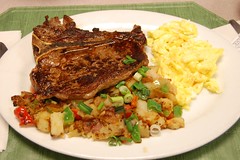
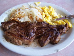
Now Plaza Hof Brau, the "Hof Brau" part of the sign is of 1959 vintage. This is my favorite restaurant--it is a delight inside and out and serves delicious food at low prices. I hope it stays just the same for another 50 years.
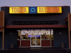
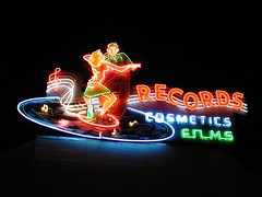
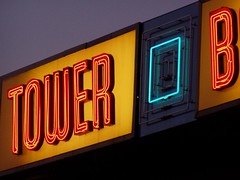
Tower Records
2514 Watt Avenue
Status: extant, but threatened
Russ Solomon started selling records out of his father's drugstore in the corner of the Tower Theatre building, but I believe this is the first Tower Records location, opened circa 1960. The delightful sign on the Tower Theatre is preserved, thanks to the city of Sacramento, but this one is in unincorporated land in Sacramento County, and county officials have not shown any desire to preserve vintage neon.
Tower Books
2538 Watt Avenue
Status: extant, but covered with a "FOR LEASE" sign
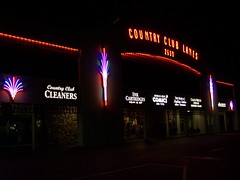
Country Club Lanes
2600 Watt Avenue
Status: extant
The bowling alley opened in 1959, and the rest of the complex was open by 1960. They've added some neon details to the front that weren't there when I first moved to the area, but the sign with the name is older, although I don't know if it dates back to 1959.
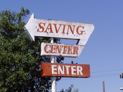
Saving Center
3438 Watt Ave
Status: extant, no neon
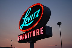
Levitz Furniture
4741 Watt Avenue
Status: extant, but threatened
The company just went out of business in early 2008, so I presume this sign is not long for this world. For the moment, though, it is fully functional and lighting at night.
North Highlands Bottle Shop
5540 Watt Avenue
Status: extant
West Sacramento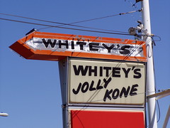
Whitey's Jolly Kone
1300 Jefferson Boulevard
Status: extant
Only the arrow is neon, but that's enough for me.

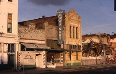
Astro Club
1267 Merkeley Avenue
Status: kaput
From sometime between 1965 and 1973.
Davis HighwayWest Capitol, formerly known as the Davis Highway, was the path of old U.S. Route 40, 50, & 99 and the Lincoln Highway. You can read more about this stretch of highway and the businesses along it in my blog entry,
U.S. Route 40: West Sacramento's Motel Row. Most of these signs have recently been torn down to comply with a West Sacramento ordinance.
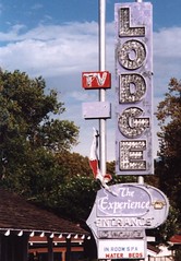
Imperial Lodge (later Experience Motel)
824 West Capitol
Status: kaput
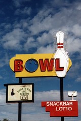
El Rancho Bowl (now Capitol Bowl)
900 West Capitol
Status: kaput
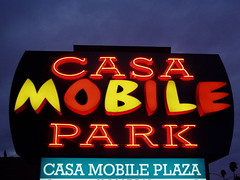
Casa Mobile
1050 West Capitol
Status: extant
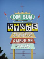
King's Restaurant
1500 West Capitol
Status: kaput
Dude Motel
1501 West Capitol
Status: kaput
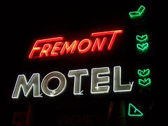
Fremont Motel
1550 West Capitol
Status: kaput
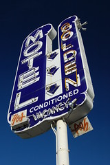
Golden Motel
1917 West Capitol
Status: in private collection
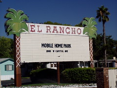
El Rancho Drive-In Theatre (later Mobile Park)
2000 West Capitol
Status: kaput
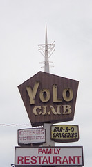
Yolo Club
2216 West Capitol
Status: kaput
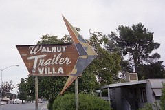
Walnut Trailer Villa
2355 West Capitol
Status: kaput
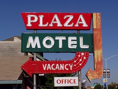
Plaza Motel
2701 West Capitol
Status: kaput
Another shot of it:
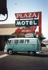
Photo by
illtakeyourphoto!
Willie's Market
109 15th Street
Status: kaput
It was probably originally something else, but in the early 1970s it was Willie's Market.
The Ones That Got AwayI've seen many pictures in old newspapers and books of splendid neon signs in Sacramento that disappeared long ago, but there are also some that disappeared recently that I could have and should have gotten photographs of, but I blew the chance. Some, fortunately, were photographed by my Flickr pals
illtakeyourphoto! and
Dave van Hulsteyn, and a friend at work gave me prints of some old photos he took. Others I have never seen photos of, but would love to. All of these signs would fall into the "kaput" category.
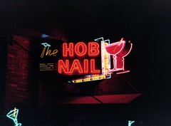
Photo by Ken Bennett
The Hob Nail
2708 J Street
Status: kaput
A friend at work gave me a print of this photo he took, and the one below. The nightclub Harlow's now occupies the space that used to be the Hob Nail. The Harlow's sign isn't bad, but it's not even close to being as cool as this one.
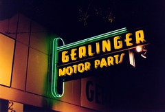
Photo by Ken Bennett
Gerlinger Motor Parts
2020 K Street
This company was in the process of expanding, with a huge new contract based on a railroad merger. They ran into some extra expenses and delays on their new building, and then the merger was nullified by federal authorities, and Sacramento's international railroad company went belly up.
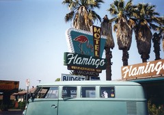
Photo by
illtakeyourphoto!Flamingo Motel
920 West Capitol
I think my first photograph of a Sacramento sign might have been the Brick Shot House just down the road from the Flamingo. It was a boring, plastic sign, but I was amused by the name. Meanwhile, I never got a shot of this one.
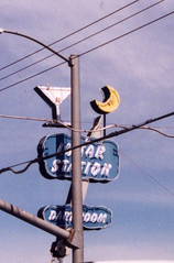
Photo by
illtakeyourphoto!Lunar Station
2791 Fruitridge Road
What a beauty, even when obstructed by a pole!
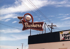
Photo by
illtakeyourphoto!Bushers
1844 Auburn Boulevard
Another one, like the Flamingo, on the old Highway 40 route that I have spent so much time researching.
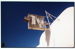
Photo by
illtakeyourphoto!An old TV repair shop
On Franklin Boulevard near 47th
I'll try to research this one soon.
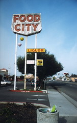
Photo by
illtakeyourphoto!Food City
4604 Franklin Boulevard
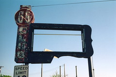
Photo by
illtakeyourphoto!Club Sixty-Five
2995 65th Street
This is another one I would have been very excited to see.
Photo by
illtakeyourphoto!Crown Cleaners
5541 H Street
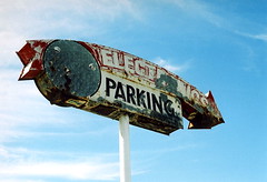
Photo by
illtakeyourphoto!Electronics store
2533 Del Paso Boulevard
It looks like they're converting this store into a church now.
Scan by
illtakeyourphoto!Sun Sun Cafe
307 J Street
Okay, this is actually a found photo from before I was born, but I really like it so I put it in here.
Freezette
330 16th Street
I remember seeing this one while shopping nearby at the Salvation Army. Even though the old drive-in was Taque
ría Jalisco, they kept the sign. I always meant to photograph it, but never did, and then it was gone.
RV lot sign
El Camino east of Del Paso Boulevard
It was ancient and rusting and beautiful.
White rooster sign
Fruitridge Road between Franklin Boulevard and Freeport Boulevard
My memory is pretty fuzzy, but I could have sworn I saw a great sign on an early thrift store run. But even though I looked for in my early days of shooting neon, I never saw it again.
Del Paso Theatre
2120 Del Paso Boulevard
I was out taking photos when I was surprised by the terrazzo sidewalk before a vacant lot. I researched at home and learned of the old Del Paso Theatre, and found out it had still been standing when I moved to the area, but I never saw it.


