Our big hike was planned for the second day, but we were going to do some hiking the first day as well. On the way up to South Lake Tahoe, we diverted over off to do an off-trail, or at least off of any official trail, hike to an area that locals prefer to keep a secret, and I now know why. So I won't say any more about that.
Next we got our campsite at Bayview Campground. The place was pretty busy with day hikers using the parking for the Bayview Trail and overflow parking from Inspiration Point above Emerald Bay across the road, but the campground itself was nearly empty. It's only $15 a night, less than other campgrounds around Lake Tahoe, mainly because it has no plumbing.
We took advantage of the site to hike up to Granite Lake on the Bayview Trail, a lake I had skipped over on my two much longer hikes up the Bayview Trail to the Velma Lakes. I took a quick swim.
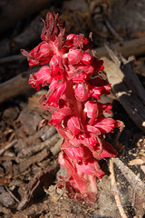
Snow Plant on Bayview Trail
Then we headed down and over to Cascade Falls. We were there a bit late in the day--the big waterfall down to Cascade Lake was in shadow, but it's a difficult subject to photograph under optimal conditions anyhow. The creek spreads out all over the granite with lots of mini falls in the area above, and we spent a good bit of time scrambling on rocks and exploring that.
Above Cascade Falls
When we got back to the campground, there was a bear making an inspection of all the campsites for food, and a bunch of damn-fool campers following after it with their cameras. I took out my camera too, but I didn't take a single step in its direction. Of course, I didn't do what I should have done either--scare it off with loud noise. It is much better for bears if they remain afraid of humans rather than getting comfortable around them.
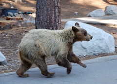
Black Bear
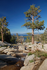
We watched the sunset from Inspiration Point, but it was not dramatic as I had hoped it would be. Then it was back to the camp site to build a fire.
Inspiration Point
In the morning we watched the bear make its rounds again before we headed off to the Meeks Bay trailhead, right across the highway from Meeks Bay Campground. Most of our hike repeated a hike I took in August of 2007 from Meeks Bay to Stony Ridge Lake, so I'll be brief in my description of that part of the hike. Please see the other blog entry for a more detailed description.
The hike starts on a closed dirt road--nice, soft dirt. It's flat, and we were moving as fast as we could to keep warm, as it was cold in the morning and I didn't want to bring my jacket when I wouldn't need it for most of the day. There were many lovely wildflowers there, and many locals just like to walk this first section with their dogs.
At about 1.3 miles there was a signed junction with a trail leading uphill off the right edge of the trail and road continuing on while turning a bit to the left. We started climbing, fairly steeply, on the narrow trail. Once up to where it joins the creek, the trail climbs at a moderate pace, and the area around us was lush with ferns, wildflowers, and mosquitoes. Eventually the trail drops down to the south and crosses the creek over a large wooden bridge. On the other side the trail climbs alternately west and south before curving around on a slope above the creek dropping rapidly off to the right.
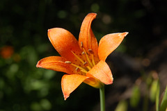
Alpine Lily
All of the lakes on this hike are connected by creeks, so on the way out and up, we were always going to where the water was coming from, only we were taking the more gentle grade, while the water was taking the more direct path. As you approach each lake, you will find that you and the creek get closer and closer together in elevation.
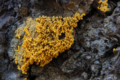
Fungus Just Before the Junction
Just past a signed junction with General Creek Trail we found Lake Genevieve, right where I left it two years ago. It's a nice lake framed by mountains on the south and west sides and with open areas to hang out on the east side. But the next lake is framed a little more dramatically, and is larger.
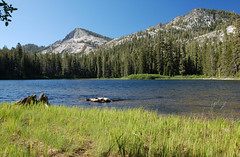
Lake Genevieve
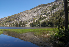
So we made the short hike up the moderately graded trail to Crag Lake, which has two nice little islands in the south end. There are lots of nice areas to hang out along the east shore, although they are divided by a rocky outcropping that we hiked around.
In Crag Lake
From there we rock-hopped across a creek and started up a bit more steeply. At one point the trail turns sharply left and there is a clear trail heading down to the right, and we could just see some water in a lake below. There is no signed junction here, but that is Hidden Lake below. I went there last year, but it was very steep, and I didn't want to waste the energy this year, as we had a farther destination in mind.
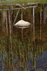
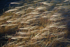
Grassy Shadow Lake
So we headed off on the trail to Shadow Lake. By the time you see Shadow Lake on the left, most of it is already behind you. As a result, it looks smaller than it actually is. I remember thinking in 2007 that it was close to becoming a meadow. Certainly the south end of it looks that way, but on our return we went off trail to the south end of it, and saw that there is a good bit of water.
Shadow Lake
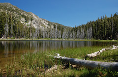
I promised Erik that it was just a short ways up ahead to Stony Ridge Lake, but it was farther than I was remembering. When we got to that lake, we hiked a little ways along its long shore before stopping to rest and to eat. I thought it would be a good idea to rest because we had one big climb left to Rubicon Lake, and then that would be it for climbing for the day. The beauty of this trail is that there are very few ups and downs. Instead, it just consistently climbs on the way out, so the net elevation gain is pretty close to the cumulative amount of climbing that you do, and it's almost all downhill on the way back.
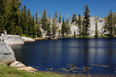
Stony Ridge Lake
After eating we continued on along the lengthy west shore of Stony Ridge Lake and started to encounter what I found to be the most interesting scenery on the whole hike. Off to the left we saw a large pool of water with several grassy circles--nearly perfect circles--surrounded by grassy swamp, except that a large protrusion of bulbous, rounded granite stuck out into it. On higher ground where the trail runs there was lush vegetation intermixed with large granite boulders, and towering to the southeast was an imposing solid granite wall.
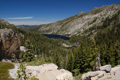
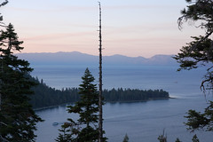
Stony Ridge Lake from Above
After running close to this cliff, the trail started away from it, and almost over to the creek cascading down a steep, fractured cliff. Then we immediately headed back the other way on a switch back. As we climbed hire we were afforded lovely views of the great length of Stony Ridge Lake. Finally the trail curled up to the left in a passage between granite cliffs and up to small and lovely Rubicon Lake.
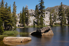
Rubicon Lake
I searched around for a nice granite shelf to hang out on for a while. After talking about it a while I couldn't resist the impulse to take a quick swim. It was too cold to stay in the water for long, but I just wanted to be able to say I swam in Rubicon Lake, 8.1 miles in distance and 2,080 feet in elevation away from the trailhead. While drying out on the granite I spotted something swimming close to the opposite shore, and Erik identified it as a beaver.
South End of Rubicon Lake
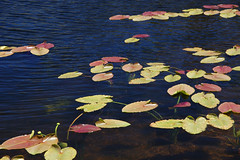
We explored around the lake a bit--there were many lily pads on the east side, to which we did not make it, and a few on the south edge where we were taking photographs.
Initially I wanted to wait longer so I could photograph Rubicon Lake and Stony Ridge Lake in the afternoon light, instead of the harsh overhead light of the middle of the day, but I realized we had a long ways to go, so we started back.
At first, the return trip seemed very easy--it was all downhill and not too steep either. But the sheer length eventually began to take its toll. All the way down past Lake Genevieve and across the wooden bridge, when we could finally see Lake Tahoe I was surprised by how far away and how far below it appeared. And the last part of the hike was just soldiering on, putting one foot in front of the other.
By the time we both made it back to the car it was a full 10 hours after we had set out--certainly our longest hike, and a very satisfying day.
No comments:
Post a Comment