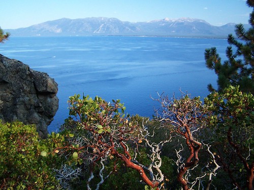
Lake Tahoe
I only started hiking regularly in April of 2006. This was my last hike of that first summer season. Shortly after this, I made to trip to Norway and Sweden, and when I came back, I broke my toe and stayed off the hiking trail for several weeks.
It's the hike I had planned to do when I was turned away from D.L. Bliss State Park because it had already reached capacity. That day I made a shorter hike to the same destinations. This time I was going on a weekday shortly after Labor Day--when the crowds have dwindled greatly, but Lake Tahoe is still in its prime. My friend Erik joined me.
We drove to D.L. Bliss State Park, paid our entrance fee, and parked by the trailhead. The trail began close to the water's edge horizontally, but well above it vertically.
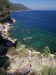
As we set out, we had great views of Lake Tahoe, although it was a disappointingly hazy day (because of a forest fire a good distance away). The trail climbed quite a bit and went away from Lake Tahoe, and we were in forest. But then we descended all the way to the water's edge, and soon came to the point I had stopped at on the aforementioned hike from the opposite direction. The views of the lake from this point, just northwest of Emerald Point, are quite spectacular.
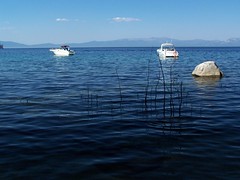
Then I was back on familiar trail. The trail cuts off the tip of Emerald Point through the forest and arrives at the shore of Emerald Bay, with its views of the emerald water, Fannette Island, and the ferry taking people out to the island's teahouse. The trail along the north side of Emerald Bay stays close to the water, and there are frequently ladders down to the water, where people can pull in their boats and climb up to the trail.
We passed the boat-in camp and then got to the area with all the people--the beach near Vikingsholm and the spur trail to Lower Eagle Falls. We went from dirt trail to paved paths. We made our way up to see Lower Eagle Falls first, then came back to take pictures all around Vikingsholm (but we did not bring money to pay for the tour). Then we headed to the beach.
California Hiking said that the two weeks after Labor Day are a great time to go swimming here, when the water is as warm as it gets all year, and the crowds are down. So we were in swimming trunks, ready to go in the water. Erik swam quite a bit. I was in and out briefly. Too cold for me. I preferred to lie in the sun on the beach.
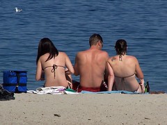
Beach Goers
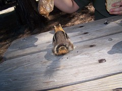
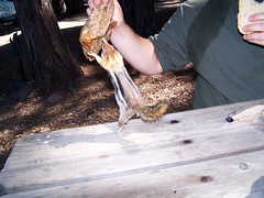
I don't remember if it was before or after this (I suspect before) that we stopped at a picnic table to eat lunch. There an aggressive chipmunk went after my sandwich. Erik picked it up to get it away from the chipmunk, but the determined chipmunk held on. I was trying to quickly take some photos, but didn't get the flash turned off. We held the chipmunk off, but letting our guard down a moment later it made off with the remainder of the sandwich.

Then it was back on the trail for an uneventful return to the car. Back at the trailhead, we had the benefits of having paid to enter a state park--flush toilets and sinks with running water. So much nicer than the smelly pit toilets at forest service campgrounds.
Hike Summary
Date: 12 September 2006
Trailhead: Rubicon Point
Approximate distance: 9 miles
1 comment:
That first photo with the manzanita in the foreground is just gorgeous.
Post a Comment