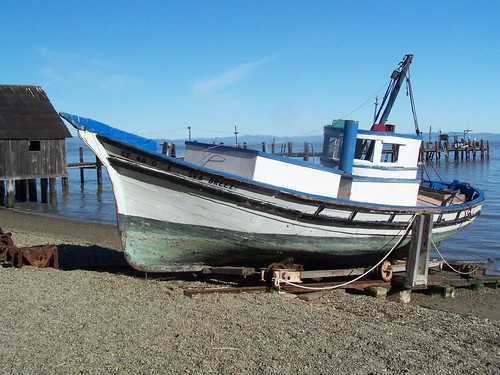
Old Fishing Boat
I learned of this park from Top Trails: San Francisco Bay Area, but I planned my own route for this hike that was longer than the one described in the book. China Camp State Park is in Marin County north of San Francisco, wedged between the city of San Rafael to the west and San Pablo Bay on the east.
My friend Erik joined me on this hike. We parked in the fee area at China Camp Point. Most people parked on the side of the road, rather than in the parking lot, to avoid the fee. But since we were going to use the restrooms the state maintains and the trails the state grooms, I thought it only fair that we pay our fair share.
Before setting off on the trail, we walked down to the China Camp Museum on an old pier and saw the remains of the old Chinese fishing operations. Chinese immigrants once had a vibrant community here fishing for shrimp, but racist legislation restricted their operations so as to eliminate competition with white-owned fishing businesses and most were forced to find other work.
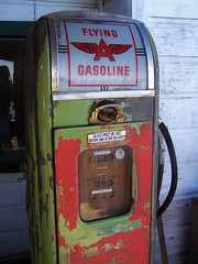
Old Gas Pump
Then we headed out on our hike. We followed a trail along the coast for a ways before turning inland and up the hillside into the forest. We took Oak Ridge Trail to Bay View Trail. Bay View Trail was disappointing. Given the name, I was expecting views of San Pablo Bay, but the view that direction was blocked by trees. There were many bicyclists on this trail, and I only encountered one all day that respected the signs that indicate that cyclists should yield to hikers (and everybody should yield to horses).
At the end of the Bay View Trail we came down the hill to the Shoreline Trail and a campground. We stopped and ate at a picnic table and used the restroom at the campground, then continued on the Shoreline Trail. We left it at one point to cross a road and take a walk around Turtle Back Island, which is not an island, but a hill right close to the water. The short loop around it features many interpretative signs.
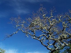
Oak Tree
Then it was back on the Shoreline Trail to head back to the car. As we got close to the end of our hike, we ran into some ladies just heading out. They asked if they could do a loop on this trail. I pulled out my map and showed them the loop we did, but also told them we had been hiking all day. They couldn't make it very far before sunset.
Back at the parking lot we dumped our gear at the car and took a stroll down to the picnic area at China Camp Point, where there are fine views of San Pablo Bay and Rat Rock Island.
Hike Summary
Date: 13 January 2007
Approximate distance: 10 miles
Links: Official website
No comments:
Post a Comment