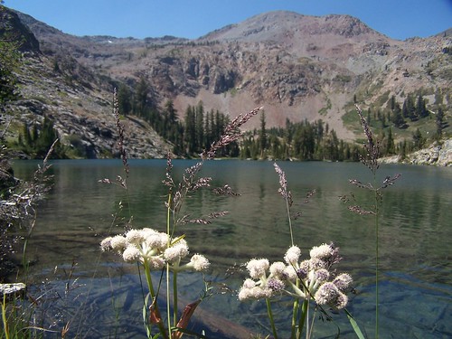
Alta Morris Lake
The trailhead and first 3.3 miles of this hike are the same as my hike to Lake Aloha via Susie and Heather Lakes, and you can read more about this portion in my entry on that hike. In brief, the trail departs from the Glen Alpine Springs trailhead just west of Fallen Leaf Lake, which is itself just to the west of Lake Tahoe off of CA 89. The beginning of the hike follows a closed road to the old Glen Alpine Springs Resort, then it continues as a footpath into the Desolation Wilderness, past the spur to Grass Lake, up across a creek to a second junction.
The left fork of this junction heads to Susie Lake, but this time I, and my friend Erik, who joined me for this hike, took the right fork. We climbed a short distance to another junction, this one with a post on the west marking two directions, and a post on the right marking two others. We went to the post to the right, but took the fork on the left from there, signed for Half Moon Lake.
The rest of the trail to the lake alternated between ups and downs, none of them particularly steep or long. Right away we were treated to dramatic views of a lake below--either Susie or Heather--and the dramatic ridges of Mt. Price and Mt. Agassiz, which still had snow on them. Unfortunately, the view was marred by all the haze in the air. I'm not sure what the source of the haze was--there were 3 large forest fires burning in California, but none of them close, and there were no large fires reported in Nevada.
Along this portion of trail there was still a decent wildflower display, with the usual fireweed and Indian paintbrush, but there was also several places we saw a lovely blue flower, gentiana calycosa. Before reaching the lake, we passed by a couple of ponds on the left side of the trail, the first of which was quite nice with a small island in it. Near Half Moon Lake there was a cairn off the left side of the trail marking where one can head off trail onto the rocks on the south shore of the lake, where there are some good campsites.
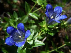
Gentiana Calycosa
But we continued along the trail, which soon became overgrown, although well trod. There are some marshy areas and areas covered with thick brush near the lake, so the trail swings out away from them and circles the lake to the northwest. Off the trail to the north, the mountain rises at a steep angle to form a dramatic backdrop. Just to the west of the lake lies Alta Morris. Dicks Peak and Jacks Peak rise directly from the edge of that emerald lake.
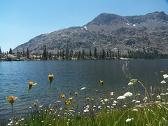
Half Moon Lake
At some point, the trail just petered out. I was interested in seeing Alta Morris Lake and going around the south shore of Half Moon Lake. It was dry enough that we probably could have easily gone on the strip of land between the two lakes, which looks like it is a bog in wetter years or earlier in the season.
But instead of that, I led Erik on around the west side of the lake, where a cliff rises from the water's edge. We had to climb up a ways to find a passable area, and even then it was not easy. We used our hands a lot for safety.
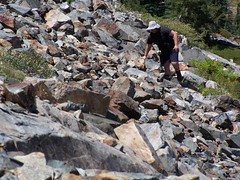
Erik Crossing the Talus
We stopped on a nice large rock to eat lunch and check out the view of the lakes from above, which was certainly more dramatic than the view of them from down below. We could see large rocks looming below the surface of Alta Morris Lake, and lots of emerald water. There was a bird diving under water for long periods, then zooming across the water. I didn't stay long before starting down to a nice granite ledge on the southeast shore of Alta Morris Lake. Erik followed me later after finishing eating and taking more photos.
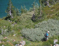
Me Below
I had to descend on talus, and found it easiest to do so sitting down most of the time. Once down to the lake level, I walked through some bushes and swampy area along the south end of the lake and over to the granite area I had spotted from above. As I was getting ready to swim, I could see Erik coming down the talus across the lake.
Then it was into the water. The lake looked so inviting for swimming, but it was awfully cold. Then only time I've swum in a lake this cold was Hemlock Lake, and that one I came out of just after going in. I didn't do much more swimming this time, but I did swim out to a flat rock about two feet below the water's surface, where I stood to survey the lake. You can see in in the bottom right corner of the photo below that Erik took.
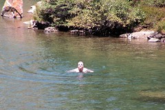
Me, Swimming
I was already back on shore drying off in the sun when Erik arrived. We saw that bird again, zooming along the water's edge as though it were in hot pursuit of something, and occasionally diving under water for long stretches. From the poor photo I took at distance, and its behavior, I would say it is a grebe of some sort, but I haven't been able to find an exact match.
Erik also went for a swim. At first the water felt cold enough that he reported feeling pain in his hands, but he got used to it. Once he was finished, we continued hiking over to Half Moon Lake and then along the rocks on the south side of it, navigating between inlets from the lake on the left and large ponds on the right. We crossed the outlet creek that flows to Susie Lake, and occasionally found signs of use trails or a campsite.
When we were close to the trail, we encountered a family of birds. I would take a photograph of the nearest large one, then take a step forward and take another photograph. Usually I find birds frustratingly difficult to photograph, as any little thing will send them off. But with this one, I was able to get close enough to take photos without using full zoom. I shot a video of it as well, but it didn't move much at all, so the video is no better than a photo. Erik was taking pictures of one of the smaller birds.
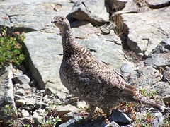
Unperturbed Bird
There was a man and a dog approaching from our left, which indicated that the trail we were working our way back to was probably there, so we headed that way and left the birds alone. They flew off, according to Erik, when the dog excitedly ran up to them.
I got back to the trail at that cairn I mentioned earlier. From there it was an uneventful return to the car. We made good time, and got back to the trailhead earlier than I was expecting. Then we dealt with the usual slow Sunday evening return to Sacramento from Lake Tahoe to Sacramento via US 50.
Hike Summary
Date: 11 August 2007
Trailhead: Glen Alpine Springs
Approximate distance: 11 miles
1 comment:
There are luxury boats accessible for various boating activities, whether you want to relax in the sun, enjoy a peaceful dip, or hang out with friends and family. Tahoe pontoon boats are ideal for spending time with friends and family. At Sunnyside Marina on Lake Tahoe, you can learn how to properly maintain your luxury boat as well as how to be safe on the lake by taking a boating safety course.
Post a Comment