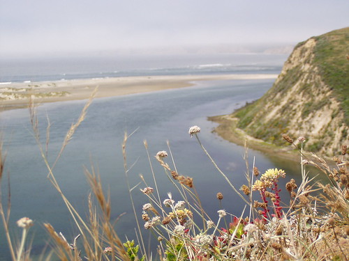
View from Drakes Head
I lived in Northern California for 9 years, 8 months, and 27 days before I ever set foot inside Point Reyes National Seashore. In the subsequent 11 months, I made it 12 more times.
The occasion of this, my first Point Reyes hike, was my friend Lucy being in California visiting her sister for a few weeks. I took a day off of work and met her to go hiking together.
First, let me tell you a little about my friend and myself. Lucy is an experienced hiker, mountain biker, and snowboarder. I had decided to take up hiking about 3 months before this, and have never tried those other activities. Lucy is spontaneous and outgoing. I like to research and plan things, and I'm shy around strangers. Lucy lives for adrenaline rushes. I prefer quiet moments of sublimity.
I researched several hikes that we could do and e-mailed descriptions of them to Lucy to see what she would like. She was less interested in beautiful scenery than she was in the depictions of how difficult portions of the hike were. She narrowed down the list, and I chose this hike from the finalists.
We arranged to meet at a small cafe in Inverness Park. As I remember it, I was about an hour late. That worked out just right, as Lucy arrived about 5 minutes later. After the closest thing to pain au chocolat that I have had in California, we headed to the Estero trail head.
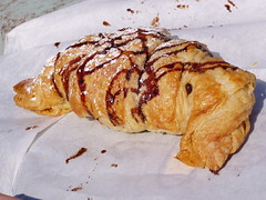
Breakfast in Inverness Park
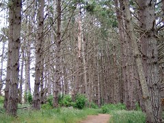
We hiked along open terrain until a forest appear ahead of us, with a deer in the middle of the trail. The forest section is relatively short, and soon we were in open territory again, with Lucy getting excited and running ahead of me anytime we encountered a hill.
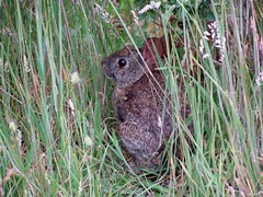
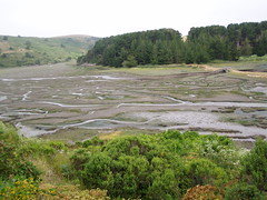
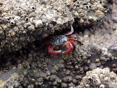
Then we descended to one of the branches of Drakes Estero. There was a lovely little bridge at one point, under which there were dozens of crabs. They quickly hid under rocks anytime I tried to get close for a photo.
Then we came to a fork in the trail. This was going to be a long hike for me if we visited both Sunset Beach and Drakes Head, so I suggested we skip Sunset Beach and do it on the way back if I felt up to it. So we pressed on to Drakes Head.
At this point we were just walking through cow pastures. Not having been to Point Reyes National Seashore and not having done much reading on it ahead of time, I was rather disappointed by that part. But I was thrilled when we reached the cliffs of Drakes Head.
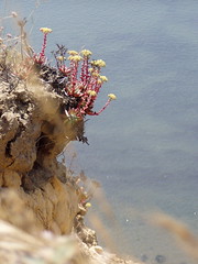
We had our lunch there, then started back. But we didn't see the point of going all the way back to the signed junction with Sunset Beach Trail, and instead tried to take a shortcut to meet up with it further along. Following what must be cow trails, we made it all the way down to a secluded beach (well, the whole hike was secluded on that Monday--we never saw anyone the whole day, although I think there was another vehicle at the trail head).
The beach we got to was not Sunset Beach, however. We headed in that direction, but came across a ridge of rock that stuck out into the water. We could climb on top of it, but it looked just a little too far to jump down. I suggested we just go back the way we came, but Lucy would have none of that. We were pretty sure the other side was Sunset Beach, because there were footprints visible on that side where someone had walked up to the barrier and turned around.
I decided to wade into the water and go around the barricade. But it was really slippery on the rocks, and I ended up sliding down to an area where the water was up to my waist. I also cut my hands up grabbing on to rock to try and keep from sliding down further. I made it, but I was soaked and a bit sore. I then braced myself and told Lucy to come down and I would catch her to stop her from falling.
She told me later that she thought that was a bad idea and wished I would just move. But as it turned out, it was a good idea. As she was trying to figure out how to pick her way down, the rock started to crumble underneath her, and she came sliding down. I caught her.
We stopped so I could put some bandages on my hands, dump water out of my boots, and change into my extra pair of socks (I had read somewhere that on a day hike, you should always carry an extra pair of socks). I really wish I had taken a photo of the area we made our difficult passage through, but at this point all I cared about was getting back to the car and changing (I had a couple of loads of laundry in the car that I had done the day before, so I had a full change of clothing).
When we got back to the parking lot, we hopped in her car and drove out to see the lighthouse. She was careening around those narrow roads at what I considered an excessive speed, and looking through her CD case and changing CDs at the same time.
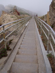
There's a lighthouse down there somewhere . . .
I'm not even sure if the lighthouse is open on Mondays, and I know now that it closes at 4 on days that it is open, so we didn't get to visit it. We heard the foghorn, but never saw a light. We ate dinner together in Inverness, where Lucy had her first cioppino. I love cioppino, but it was pricey, so I went with a more practical order, the modestly priced chicken Caesar salad.
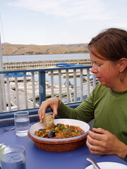
Thanks for a great day, Lucy. What doesn't destroy me makes me stronger.
1 comment:
Cute little crab. I had never heard of Cioppino so looked it up. She ate the cute little crab! What a beast! Just kidding.
I hope in a future entry you include photos of the killer rock you had it out with. If not, you'll have to repeat this hike only take lots of pictures.
B^D
Post a Comment