This was just my second hike in my newfound career as a hiker, and it proved how little I knew about hiking.
The Stevens Trail (apparently the Bureau of Land Management shares the disdain for the apostrophe that the National Forest Service and National Park Service feel) is just off of the Interstate 80 exit for Colfax, about 49 miles from Sacramento. It took me a little while to find the trail head using the directions from California Hiking.
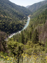
There are many hikes down to the North Fork American River from both the northern side and the southern side. They all share the traits of involving a big descent on the way out, which means a tough climb on the way back, and of being unsuitable for typical summer temperatures, as you are not at a high enough elevation to avoid the valley heat. This particular hike is one of the easier ones, but it wasn't easy to me at the time.
There were plenty of people on the trail that day, and observing them was interesting to me. I saw some people who had dropped a lot of money at REI, and were wearing everything you could possibly hope to for hiking and using expensive poles. Another woman jogged the whole trail and did not have water with her, which is still amazing to me.
The trail splits at one point. Bicyclists are supposed to go one way, and hikers another. I took the hikers' way. That led me to crossing a seasonal creek above a waterfall, and I was uncomfortable with the crossing. A slip would have pretty much been the end of me. There was no mention of danger in the description of the hike I had read.
Much of the trail had me a little uneasy because it was such a steep drop off to the side of it. I can't imagine traveling it on a bicycle.

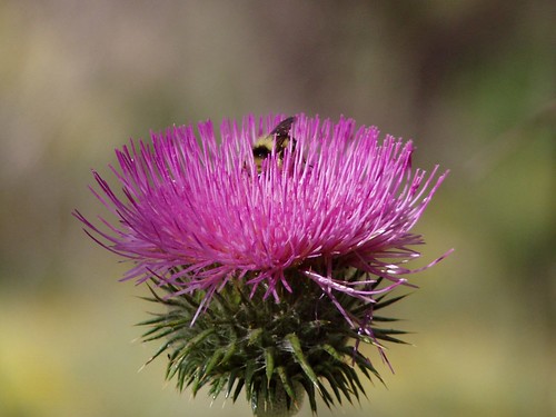
About midway down, I found some bull thistles, with a bee visiting them (pictured up top).
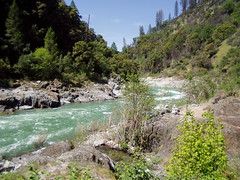
I got down to the river and ate my lunch next to the river on the sand. Then the fun started.
For water I had two canteens I had bought from an Army Navy Surplus store. I had frozen one overnight, so it would be cold throughout the hike. But it hadn't thawed much by the time I started my return trip. I was already out of water as I headed back up the trail, with just a chunk of ice rattling around inside my canteen.
I had no experience in pacing myself. At the gym, I went on the treadmill at a fast pace, and adjusted the incline to whatever I could handle at that pace. But there's no adjusting the grade on a hike. I went fast until I ran out of breath and had to stop and rest. And I kept doing that. I would put my canteen on my neck to cool me off and melt some of that ice, and then drink whatever few drops I could get out of it.
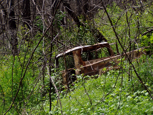
When I came to the split in the trail, I took the route for bikers. That led me to an easier creek crossing, and also took me pass an old truck rusting by the side of the trail. I have no idea how it got there.
I was stopping to catch my breath more and more frequently as I got towards the end of the hike. When I got back to my car, I reached into my pocket for my car keys. I didn't find them. I panicked. I thought they might have fallen out while I was sitting next to the river. But I found them in another pocket--I have no idea why I put them there.
Once I was able to open the car, I grabbed a bottle of water that I kept on hand in case of emergency, and drank the whole thing, even though it was hot. I made good time. My book said the hike would take 5 hours, and it only took me 3 hours and 20 minutes. But I was totally spent.
I've since done much more difficult hikes down to the North Fork American River and found them easier, like the Mumford Bar Trail, which has 2700 feet of elevation change, compared to just 1200 for Steven Trail. Pacing myself makes all the difference.
Hike Summary
Date: 7 May 2006
Trail head: Stevens Trail
Approximate distance: 9 miles
Links: official information
1 comment:
Glad you survived. I did the Stevens yesterday. It was in very pleasant weather so it was fairly easy, although I always puff on the uphill sections.
Post a Comment