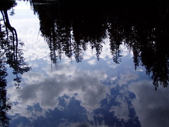
Lower Twin Lake
I was anxious to make this hike after reading the glowing description of it in California Hiking: "If you ever wanted to sell somebody on the beauty of the Northern Sierra, this trail would be the place to do it." But I was too anxious, and ended up with two aborted attempts too early in the season.
The first was on 16 June 2006. There were unusually high levels of snow that year, and the roads around Wrights Lake weren't even open yet. I parked on the side of the road just before Wrights Lake Campground, and walked in, having to cross large snowdrifts at points just to get to the trail head. So I didn't start up the trail, but just familiarized myself with the Wrights Lake area, as it was my first time there.
Wrights Lake
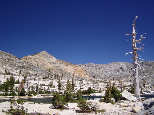
Just one week later, I was back again, as we had a full week of hot weather. The Wrights Lake area was now open and snow free, and I was able to hike up into the Desolation Wilderness, past where there is a junction with the Grouse Hemlock Trail. I came to a creek and just slogged on through it, changing my socks on the other side. But then I came to another, and could not find a place to cross it. I saw people on the other side, but there was no place I was comfortable trying to get across. So I just ate my sandwich next to the raging torrent and started back.
Impassable
Once down at the level of the lake, I made a small loop around the meadow to the west of Wrights Lake.
I waited a month before making another attempt, so that I could be sure to make it. This time I brought my friend Erik with me.
The trail starts from a stream flowing into the southeastern corner of Wrights Lake. There is a map there and day use permits for the Desolation Wilderness. Nearby is a nice bridge, but if you cross the bridge, you're heading the wrong direction. The trail winds through a low swampy area where there can be plenty of mosquitoes. Shortly after a junction, it starts climbing up through some open granitic terrain before moving into forest alongside a creek. This is where you do most of the climbing on the hike.
Shortly after passing the sign marking the boundary of Desolation Wilderness (permit required), you come to a fork in the trail, with the right fork heading to Grouse, Hemlock, and Smith Lakes on a shorter, but steeper trail, and the left fork heading towards Twin, Boomerang, and Island Lakes. We headed off to the left.
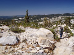
Soon we were out in open granitic terrain again, so we had to follow cairns, or ducks. The raging torrent that had stopped me on the previous occasion was just some wet rocks that we walked right over. As often happens, I began to worry that we were not on the right path, as following ducks is not easy. I could see a path quite a ways to the south, so we went over there. But as soon as we got there, I recognized it as the trail to Grouse Lake, which I had recently been on. So we returned to where we had been. I should have let Erik do the decision making, as I do this sort of thing all the time.
Eventually the trail became more clear, and we started climbing again. When the climbing subsided, we started to get some dramatic views. I had feared that the trail book's description would set my expectations too high, and I would be disappointed. But I wasn't.
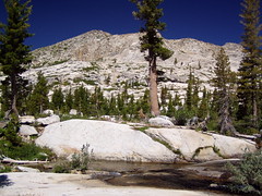
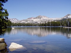
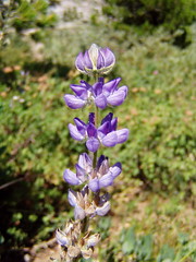
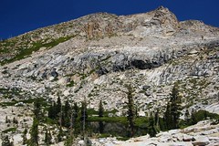
The first lake we reached was Lower Twin Lake, where there is a large painted X on an open flat area. This was apparently put there to assist in mapping the area from an airplane.
To continue on from there we had to rock hop across the outlet creek. I'm never too comfortable rock hopping, but on the way back I saw a man with a baby on his back make the crossing.
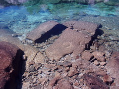
Lower Twin Lake
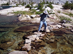
Rock Hopping
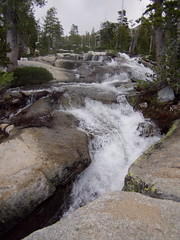
The trail skips Upper Twin Lake. Once you cross the creek and pass a low swampy area, you can head back to the south across the rocks and follow the north shore of Lower Twin Lake to Upper Twin Lake, where there is usually a waterfall coming from farther up Mt. Price.
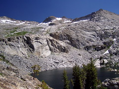
Upper Twin Lake
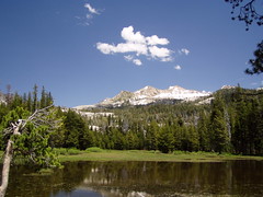
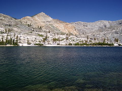
Sticking to the trail, we soon reached Boomerang Lake.
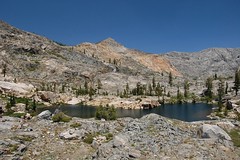
Boomerang Lake
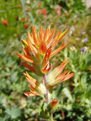
The trail skirts along the lake on a narrow path between the water and rock outcroppings. We crossed the lake's outlet creek and passed through a depression with a good display of wildflowers before beginning to climb again on loose rock.
The final lake we reached was Island Lake. There we ate lunch, and I used the panorama feature on my camera for the first time, the only way to begin to do the area justice in a photograph. Unfortunately, it was also the last time I used that feature, as the camera met a premature death a couple of weeks later.
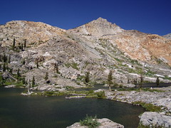
Island Lake
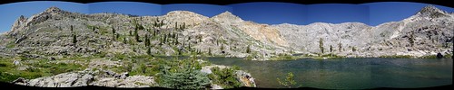
(To see a larger version of the panorama, click on the picture and then click on "Large" on the Flickr page.)
This is a popular hike for obvious reasons. It's one of the shortest and easiest hikes to really dramatic views and a number of lakes--the swimming is good at Island Lake (I haven't tried the others). I've been lucky to be able to make it several times without going on a weekend, when there would be the most people sharing the trail.
To make the hike a bit longer and more challenging, Erik and I have added variations in our return visits. Leaving the trail just after Lower Twin Lake, we climbed up to a notch, and then down to Umpa Lake, which was excellent for swimming.
Umpa Lake
We also climbed up above Island Lake (to the south on Mt. Price) to check out a pond on my map, and found some spectacular scenery.
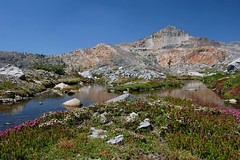
A Pond on My Map
It's a hike I don't think I will get bored of anytime soon.
1 comment:
Looks like you had a great time! I believe that pond you found below Mt. Price is known as Silver Dagger Lake or Shangri La. I will be staying at Wrights lake in a couple of weeks and am very excited.
Post a Comment