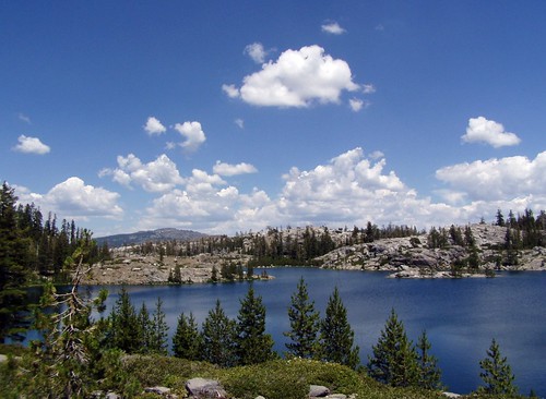
Island Lake
Just about an 80 mile drive northeast of Sacramento lies Carr Lake. It is a short walk to the lake from the parking area, there is a PG&E campground there, and trails head off from this spot to a large number of small mountain lakes. I would be up there quite regularly, if it weren't for the last section of dirt road you have to take to get there. I did okay on it in my little Metro--certainly it wasn't as bad as the road from Soda Springs to Cascade Lakes I took for my hike to Heath Falls--but I'm not planning to make that drive in the same car again.
My destination was Penner Lake, just 3.2 miles away (as listed on trail signs and in Tahoe Sierra, California Hiking indicates it is even closer, but my old edition is often inaccurate). It should have been an easy hike for me, except that I was sick.
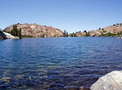
I walked pass tiny Carr Lake on the right following the Round Lake Trail. Then the trail follows a long section of the shoreline of large Feeley Lake on the left. When I came to a pretty little pond on the left I was supposed to make a left turn on the Crooked Lakes Trail, but I proceeded on Round Lake Trail on the south side of Island Lake a short ways before realizing my mistake.

Feeley Lake
I went back and crossed the ridge of land that separates Island Lake from the pond that doesn't rate a name. There were plenty of people throughout this area enjoying these readily accessible lakes. There were fewer along the rest of the hike, which involved more climbing.
The trail then passes by Crooked Lakes, but I don't recall seeing much of them from the trail other than a pond. The map indicates that there is a large number of ponds and small lakes scattered about this area.
Then came the climb up to Penner Lake. Because I was sick, this took a lot out of me. But the destination was well worth it. Unlike the crowded lakes close to the trail head, there were just 3 people here--women who had been camping there.
Penner Lake
Despite being worn out, I stopped on the drive home to walk the Sierra Discovery Trail, a very easy, wheelchair accessible trail with interpretative signs that took me to a waterfall on the Bear River. I was amused by the signs warning to evacuate the area when the sirens go off. When PG&E releases a large amount of water, the river area floods, apparently.
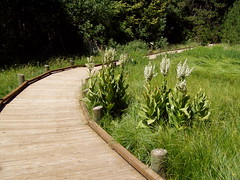
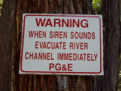
Sierra Discovery Trail
On the drive home, I really started to suffer. My illness had me stuffed up, and on the drive down my ears wouldn't pop with the elevation change, and became painful. I made one stop at the vista point near Emigrant Gap where you have a nice view of Lake Spaulding.
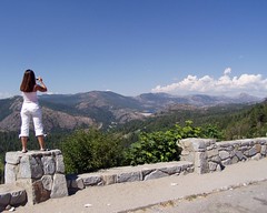
Vista Point
Hike Summary
Date: 9 July 2006
Trail head: Carr-Feeley
Approximate distance: 6.4 miles
1 comment:
The Siren
Post a Comment