Wildflowers by the Side of the Road
This hike didn't work out as I had wanted it to. I would have preferred to hike to a beach somewhere, but the tides were wrong for my day off, so I thought it would be a good time to see another part of Point Reyes National Seashore in my quest to hike every mile of official trail in the park. My friend Erik joined me.
We started at the south end of Olema Valley Trail, taking it just .5 miles to Teixeira Trail. There is no parking area or toilets at the start--I just parked on the side of CA 1. We immediately crossed Pine Gulch Creek, and then it got boggy. We were sinking into the flooded meadow and getting quite wet. As soon as we got a little higher, I took off my shoes and wrung out my all synthetic socks (which don't hold moisture the way cotton does). My sneakers were filthy, and didn't quite come clean when I ran them through the dishwasher later. From the short Teixeira Trail, we then followed Ridge Trail, which involved some easy climbing. I thought by the name that we might have some great views. But I think a better name for it would be Just Below the Ridge Trail. We never had views towards the ocean side
We followed it to the Greenpicker Trail, and took that down to the Five Brooks parking and staging area. My original plan had been to loop back on the Olema Valley Trail. But it appeared that it would be all boggy like that area we started on. We could have gone up Stewart Trail and returned on the Ridge Trail we had taken before, but it was already going to be a very long hike and that would have added length and more climbing. So I thought it best just to return on the side of the road of CA 1.
The only problem with that was there wasn't much of a side of a road. We usually walked on the road, and just stepped off when we heard cars coming. I also gathered aluminum cans, as there were many of them littering this scenic highway, including at regular intervals MGD cans that must have been tossed quite recently. When we had to many to handle, I found a plastic bag. But eventually I just had to stop collecting them.
This was a really long hike for Erik, so I thought I would try to shorten it for him. Since we were hiking along the road, I figured I could just go on ahead and get the car and drive back to him. Unfortunately, I was too far ahead of him when I decided to do this for him to hear me if I had called out to him and let him know he could take it easy. So I just rushed on as fast as I could, other than stopping for a couple of photos. I got to the car and drove back until I saw him, thus saving him at least a little bit of effort on this long hike.
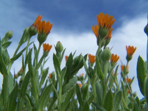
As it turned out, the only two photos I really liked from the trip were from the side of the highway.

Enchanting Stretch of CA 1
Hike Summary
Date: 8 March 2007
Trail head: Olema Valley Trail & CA 1
Approximate distance: 14.6 miles
Map: South District Trail Map
1 comment:
I enjoyed this account. The bog. Just Below the Ridge Trail. Funny. And I love the two photos! I like the way you captured the sky behind the flowers. I can almost smell the trees along CA 1.
Post a Comment