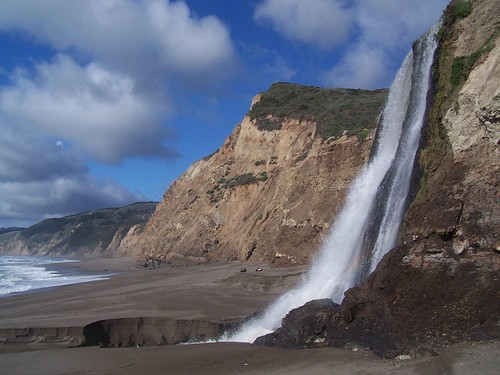
I was anxious to hike to Alamere Falls just as soon as I read about it. What could be more spectacular than a waterfall that lands right on the beach and flows into the ocean? But everywhere I turned for information there were warnings about the dangerous cliffs one has to scramble down to get to the falls.
After getting my bearings through a few other hikes at Point Reyes National Seashore, I felt more prepared to plan my route. According to California Hiking, the park service recommends getting down to the beach at Wildcat Camp, and then hiking down the beach from there. From the Palomarin trailhead, that's about a 13-mile round-trip hike, as I estimated it from the map. The shorter trail that leads down the crumbling cliff is not marked on the official south district trail map (available from the official website), but it is clearly signed (and labeled as dangerous and unmaintained). Taking it makes it only an 8.4-mile hike. If you go the longer way via Wildcat Camp, then you have to be sure of your tide tables, as the ocean will come right up to the cliffs at high tide. I didn't decide which way we would hike for sure, but would leave that determination for when we saw the actual conditions.
Finally, all things aligned well. It was a day in February when the weather was supposed to be decent (although it is always unpredictable at Point Reyes), it was soon after some rains that would have the falls running at full force, and the low tide was at the right time.
My friend Erik joined me, and we made the very long drive to the Palomarin trailhead. If it were a weekend, we could have gotten there faster, but it was a Tuesday, and I didn't want to deal with Bay Area traffic, so we left I-80 at Vallejo, and went via Novato and Olema.
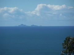
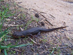
There were some great views right from the beginning of the hike of the Farallon Islands (which unfortunately don't seem so interesting in a photo). Then we headed away from the coast, and amused ourselves with newts and banana slugs.

When we got to the sign for the unmaintained and dangerous trail, we took it to see the falls from up above and determine if it would be easiest to drop down there. Really, it is not dangerous to get to a viewpoint of the falls--it is just getting down to the base that involves a tricky descent. We decided against trying it, and headed back to the main trail to take the longer route.
After getting to Wildcat Camp, it was easy to get down to the beach, but we had to cross Wildcat Creek. It was shallow enough for me to wade through in my boots, but Erik had tennis shoes on, so we had to find a spot for him to rock hop.
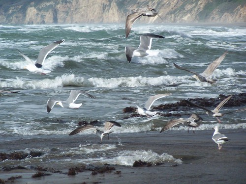
I got a shot at the beach there that I've long wanted to try. I knew the seagulls would all fly off as I approached them, and that's the shot I wanted:
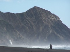
Then we started heading down the beach. This was about 1 hour before low tide. There were signs that one person had been there--or at least one horse that presumably had a person with it, as there were hoof tracks in the sand. And we soon came upon horse and rider.
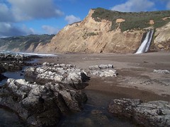
I was getting more and more excited as we approached the falls, and stopped to take photos frequently. When we got there, we quickly chowed down some food before going to work taking photographs. I didn't think it was a good idea to cross the water to the south side, where we would get the best lighting, but Erik didn't think it looked too difficult, so I let him go before me, and then I followed. Good thing, because that's where I got my favorite shots, the one at the top of this blog entry, and the one below using my wide-angle lens as I squatted down on some rocks offshore:
Here's a short video clip showing the extent of the falls:
1 comment:
Tom, I've visited your blog briefly several times, and enjoyed each visit. I always enjoy what I see and read, and always think I will come back regularly to catch up on the whole show. I like the way you use blogger, flickr, and vimeo together.
Post a Comment