I just started hiking regularly in the spring of 2006. I started with short and easy hikes and gradually built up my endurance for longer and more difficult hikes as the summer progressed. Over the winter I continued to hike, making some of my longest treks (around 15 miles). But there isn't a whole lot of climbing to be done on the trails that are suitable for winter hiking in Northern California.
So I planned this hike as my first major climb of 2007 over Memorial Day weekend: a little over 2000 feet of climbing over the course of 5 miles to the north peak of Mount St. Helena. My friend Erik accompanied me.
I expected this to be a popular hike on this weekend, and the parking area on the east side of the highway was full. But I was able to squeeze the Metro into the area on the west side, where the trail head is in Robert Louis Stevenson State Park. The hike starts up some nice, steep switchbacks before arriving at the cabin site of Robert Louis Stevenson, where there is a marker. From there we started up another climb, before doubting ourselves. There were guys climbing up on the other side of the cabin site, where we figured the trail must be. But they assured some hikers behind us that they were on the right path. The hikers headed the other way were headed towards a rock climbing area.
It was just a little ways up from the cabin site to a gravel road. This would be our trail the rest of the way except for one shortcut. It was all at a moderate grade.
I prefer narrow hiking trails to wide open roads, and Erik prefers to be in the forest. But there are some spectacular views of the wine country along this road.
The shortcut goes more steeply up to rejoin the road, so you can avoid a big loop. Near the top, there is a junction with a road to the slightly lower south peak.
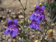
On north peak there is quite a bit of telecommunications equipment, and there were a good number of people too. Most of them were on the highest point where there is a US Coast & Geodetic Survey marker. We hung out at a slightly lower point, where we ate and photographed flowers at the cliff's edge.
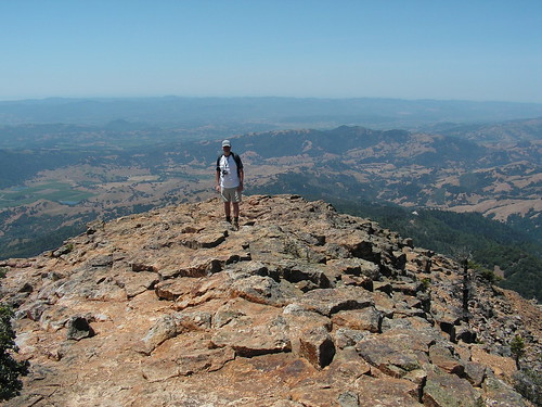
Erik's Photo of Me on North Peak
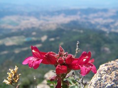
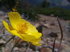
On the way back I got quite a bit ahead of Erik, so I stopped to take photos of flowers frequently, and I hung out near some rock climbers, hoping to get a photo of them when they were distracted (which didn't work out).
We turned off the road for the narrow trail a bit too early, and found a deep cave. Erik was curious about it and stayed a while, but I just returned to the road and kept on to the right trail.
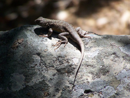
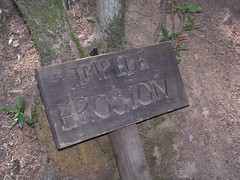
Back on the switchbacks on the narrow trail, I stopped to photograph a sign that had amused me on the way up: "IMPIDE EROSION." Just past the cabin site, I got my best photo of the trip, of a lizard on a rock.
In the end, I found the hike disappointingly easy, and my only soreness the next day was on my Achilles tendons, where my hiking boots cut into my skin.
Hike Summary
Date: 27 May 2007
Trail head: Mount St. Helena Trail
Distance: 10 miles
2 comments:
I guess Erik didn't go too far into the cave?
Great work.
Post a Comment