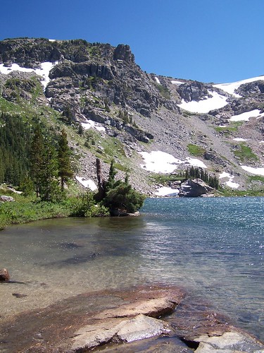
Emigrant Lake
This was supposed to be an easy hike, at just 8 miles and a difficulty rating of 2 out of 5 in California Hiking. My friend Erik joined me for my first go at this trail.
The trail head is at the dam for Caples Lake, and the first section of the hike is along the southern shore of the lake. We passed several fishers.
Towards the end of the lake the hike turns right and heads due south, but Erik and I never made it to this part. I don't know how, but somehow we got off trail. I went back 10 days later and successfully completed the hike to Emigrant Lake by myself, and was unable to determine exactly where we went off trail, or how we could have possibly gotten off track.
But soon we were following cairns that other lost hikers must have left behind. We got to a creek, and I remembered that the description of the hike mentioned a rock hop across a creek. So we went up and down the creek to find the best place to get across.
We never did find a good one. Instead, we made a rather difficult crossing. As usual, power yoga guru Erik relied on balance to carefully cross, and I relied on leaping once I got to a boulder close enough to the opposite bank.
I usually carry a map on my hikes, but didn't bother with one this time, when it would have been most handy. I thought I remembered the map showing the lake to the southeast of the eastern end of Caples Lake, rather than due south, as the official trail goes. I assumed the creek we had crossed was the outlet creek for the lake, and if we just stayed near it, we would eventually arrive at our destination.
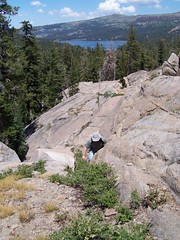
So we set off and ended up doing a tremendous amount of climbing. Here's a shot when Caples Lake was still in view. Later we would not have such a useful reference point.
There are advantages to getting lost. We were a long way off the beaten track in some magnificent country. There were fabulous meadows and at points the richest wildflower displays I have encountered. But I wasn't taking pictures at this point. We were working as hard as possible to still try and make it to Emigrant Lake.
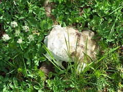
Skull
We would get an idea from what we saw in the distance that we might be close to the lake, only to go over and discover it wasn't there. After a final such effort, our focus became trying to make it back to the car. I was nervous about being able to do that before nightfall.
I had regularly been checking my compass, so we did know the general direction to head back in. That and Erik's sense of direction were our only guides, as I don't seem to have such a sense.
We got to a point where things were looking a little familiar. I climbed up some rocks and ran ahead to see the view, and could see a view we had definitely seen much earlier (and that I could compare to my photo of it on my digital camera), which confirmed we were going the right way to get back.
We made a long descent and had to cross two creeks. Then, much to our surprise, we hit an obvious trail. We followed that and came to a very easy and signed creek crossing. We had a good laugh about how simple it was in comparison to the difficult one we had made on the way out.
On the other side, the trail followed a damp creek bed where we were constantly bombarded by mosquitoes. I had read about this portion of the trail, but we had not been through it on our hike out. We arrived at the southeastern edge of Caples Lake, and back onto familiar trail.
From then on it was just a matter of trudging on. Both of us had dead tired legs. It was the most exhausting hike I had ever been on, and left my feet sore. I was hiking so often in the weeks after this that I didn't have time for my feet to fully recover. They stayed sore for 3 months.
I've studied the map often since this hike, and I believe I know where we were. If we had continued on, we probably would have reached Round Top Lake eventually, a destination we hiked too by a much easier way later.
In 10 days, I was back by myself and had a quick and easy hike to Emigrant Lake. The lake was lovely, but the trail itself was not nearly so beautiful as the area we had explored cross-country.
2 comments:
I have noticed in other posts that sometimes your fingers type "trial" instead of "trail." It sounds like your trail did indeed turn into a trial this time! But as you pointed out, sometimes the trials bring with them a beauty we would miss on the safer, easier path.
Hello I just went on a backpacking excursion about 5 miles up from Caples Creek. There, I noticed a most odd carving out of the rock up there, it is so intriguing and looks like an old indian reserve or something. Have you seen this? I think it's called Castle Point? I am looking for info on it as to what is is or what is was and if you can get up there. Do you have any info?
Post a Comment