I read about this park in Top Trails: San Francisco Bay Area, which has a broad definition of what constitutes the Bay Area. I was looking for a low elevation hike that I could do in the winter and one that would be quite a bit closer to Sacramento than the hikes I had been doing at Point Reyes National Seashore. The hike described in the book was shorter than what I wanted to do, it followed a dirt road much of the way, and it was an out and back on the same route hike. But from the map available at the park's website, I was able to plan a longer hike in a loop.
To get to this park, you turn right on Imola Ave. and head east just as your reach the edge of the city of Napa coming from the south. It's right next to the State Hospital, and is formed from land that at one time belonged to the hospital.
From the parking lot, I headed over to Manzanita Trail. The first part of this runs along a chain link fence marking the boundary of the archery area, and there are plenty of warning signs. But before long the trail turns south, crosses a creek, and enters forest. At one point the trail splits, with Toyon Trail paralleling Manzanita Trail to the west, and then rejoining it. Toyon Trail had another such split, with Toyon Creek Trail rejoining Toyon Trail later on. It was my favorite part of the hike--a dark forest with lush growth and green moss on rocks and a creek just off the trail. I don't have any photos to show for it, as I didn't know how to capture the loveliness of such an area in a photograph.
I continued south on the trail as it kept changing names--Marie Creek Trail, then Chaparral Trail, until I got to Lake Marie, the goal of the hike described in the book. I hiked back on Skyline Trail and Buckeye Trail, passing an old house foundation marked on the map close to the lake. I had seen the ruins of some old stone fences earlier. This last portion of the trail was muddy, but occasionally there were great views of the Bay Area to the southwest, which I hadn't been expecting. There were also nice views of the city of Napa.
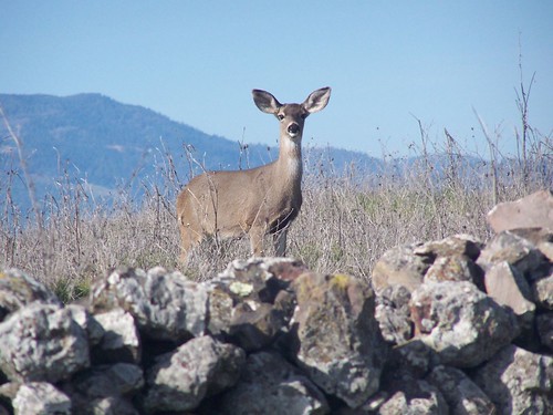
Somewhere along this trail, I passed quite a few deer, and got the only photo of the hike that I posted on Flickr. But I got quite a few more photos that day.
It was only about a 7-mile hike, and pretty easy, so I went into Napa to walk around and take some more photos and find a Wells Fargo ATM. I had forgotten my lunch in the refrigerator at home, and didn't have enough cash on me to get a meal. I did a lot of walking in town, but never did see a Wells Fargo ATM. So I went to this cool old burger place and asked if they took credit card, and they said no.
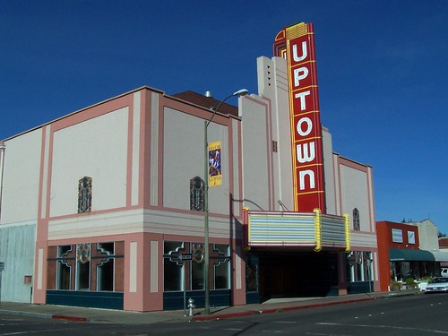
Uptown Theatre in Napa
Frustrated, I drove to Vacaville and used an ATM I knew of there, and then went to Foster's Freeze. Having now walked more than 10 miles and having gone all day without eating, I felt justified in eating a decadent burger.

The Big Boss from Foster's Freeze
Hike Summary:
Date: 20 January 2007
Approximate distance: 7 miles
Links: park website
1 comment:
Wow, your deer photo is definitely a money shot! We saw some deer and wild turkeys when we went hiking at Skyline Wilderness Park, but they never agreed to pose for us like that deer did for you. The sky was cloudy for our hike, but the hills faintly visible in the distance added a little mystery to my long distance landscape photos at Skyline Wilderness Park.
Post a Comment