Secluded Cove
My plan on this day was to hike from D.L. Bliss State Park along Rubicon Trail on the western edge of Lake Tahoe south to Emerald Bay, Vikingsholm, and Lower Eagle Falls. But even though it was a Thursday, D.L. Bliss State Park had already hit its limit for visitors for the day, and I was directed to Eagle Point Campground, on the southern side of Emerald Bay.
I parked at Eagle Point and headed off in the direction of the trail. I saw a small use trail leading from a picnic table that I thought was a shortcut to the main trail. I followed it, and soon found myself working my way through trees and undergrowth down the side of a slope. I struggled a ways through this before coming out on a clear trail.
I was starting at the point on the southern side of the mouth to Emerald Bay and was hiking west to the innermost part of the bay. I had glimpses of the emerald water and Fannette Island to the north as I hiked along, gradually dropping in elevation.
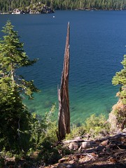
View of Emerald Bay and Fannette Island
As I got close to the innermost part of the bay, I started encountering people. I crossed a bridge over a creek and hit a junction with the short spur to Lower Eagle Falls, which I took. It's a steep (but brief) climb up to an overlook of the falls. There were lots of people here, and plenty of evidence of where people had left the trail for closer views of the falls. Then I dropped back down to the trail and continued to the north, having already reached the westernmost portion of trail.
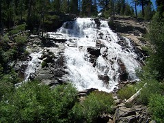
Lower Eagle Falls
There I ran into large crowds of people who were parked in a lot above off of CA 89 and had come down to use the beach and visit Vikingsholm. I certainly looked out of place with my hiking boots on and my backpack filled for an all-day hike around people in swimsuits and flip-flops. There were several boats at the pier.
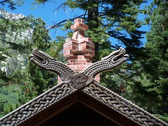
Vikingsholm
But it wasn't long before I was away from the crowds. Hiking east along the north shore of the bay I was much closer to the water, and my view of the bay was not obscured by trees as often as it had been on the south side. At one point I passed through a campground--a boat-in campground.
As I got close to Emerald Point, the trail veered north away from the water. My map showed the trail splitting two ways, with one continuing on along the water's edge around Emerald Point, and the other cutting across farther inland. I figured I would take the latter way out, since it was the only path I saw, and take the other way back for variety.
At one point the trail here passed through the middle of a boulder that was split in two with just enough room for a person to squeeze through.
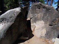
Narrow Passage
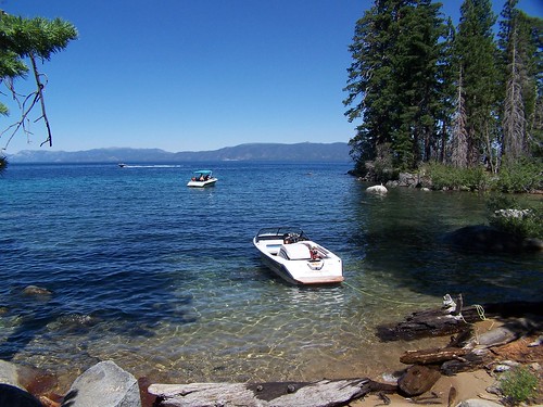
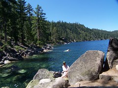
Finally I came out next to the water along the shore north of Emerald Bay. I passed one particularly gorgeous cove that had one boat anchored in it and a lovely beach. What a place to spend a vacation (picture at the beginning of this account).
When I reached a point with an expansive view of the lake and shore with some nice boulders, I stopped to eat my sandwich. As I was sitting there eating, several Steller's jays flew in and landed on rocks around me. I was able to get some good close-up shots.
Stopping Point
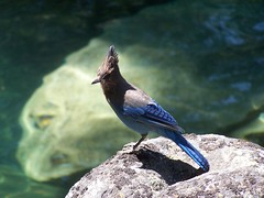
Steller's Jay
Then I returned. I tried to find a way out to the end of Emerald Point, but never did succeed. So I ended up just passing through everything I had seen earlier.
Hike Summary
Date: 27 July 2006
Trailhead: Eagle Point Campground
2 comments:
Great hiking stories! I have done a lot of the same trails (but much shorter) so I've enjoyed reading about some hikes I've thought about. waterfallswest is a great resource (have you been to Bassi Falls?).
And great pictures too!
cgbikes.blogspot.com
Love the waterfall. Love the bird. The people make me squeemish though. :D
Post a Comment