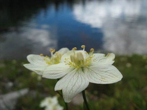
Grass-of-Parnassus Next to Emigrant Lake
My friend Erik and I decided to squeeze in one more hike before the crowds hit the trails for Labor Day Weekend. I gave Erik a choice of an easy hike to Emigrant Lake from Caples Lake, or a more difficult hike from Carson Pass to Fourth of July Lake via Round Top Lake. In finding information to answer his questions about the hikes, I read about an alternative: Carson Pass to Round Top Lake, and then off trail to Emigrant Lake. I suggested to Erik that we try that, writing "Why bother to drive all that way and not have a little fun?" He agreed.
Carson Pass is the high point on CA 88 when it passes through the Sierra Nevada, south of Lake Tahoe, and east of Sacramento. It is named after Kit Carson, who led John Fremont through the area, and performed the great feat of carving his name on a tree. A bronze replica of the carving stands at the edge of the parking lot for the trailhead, and indicates that the original is preserved at Sutter's Fort in Sacramento. The trailhead here has an information center, where permits for camping my be purchased. This is where the Pacific Crest Trail crosses CA 80, with another trailhead just west on the other side of the road heading north on the PCT. At both trailheads, parking is $3.
This trail quickly passes three mountain lakes, without much climbing, and we weren't slowed down by heat either, as it was a cool day with lots of interesting cloud cover. We quickly climbed a broad, winding path up to an unmarked junction. I glanced over and saw a lake to my left, which had to be Frog Lake, so we headed over. This late in a dry year, the lake had shrunk considerably from its usual perimeter, leaving that unappealing bathtub ring look. But there were nice granite boulders along the south shore of the lake, and a backdrop to the north of a volcanic ridge in the distance forming the northern wall of the valley.
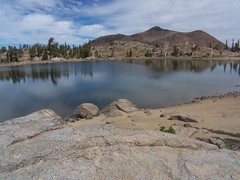
Frog Lake
Back on the trail, we soon encountered a signed junction, left to continue on the Pacific Crest Trail 22 miles to Ebbetts Pass, or right one mile to beautiful Winnemucca Lake, which was our direction. The gradual climb here was through a mostly treeless area covered with small shrubs, with distant views on the right (northern) side of the trail, and the looming hulk of dark, rounded, and barren Elephant's Back to the left. The hike to Winnemucca Lake from Woods Lake is also short and easy, and so the area is heavily used. In my brief hiking career, this would be my fourth visit to Winnemucca Lake. There weren't many people on the trail on a cool and cloudy Thursday before Labor Day Weekend, but there was plenty of evidence of the popularity of these trails, particularly in the "Stay on Trail" signs and the posts near Winnemucca Lake indicating an area that was off limits for plant rehabilitation.
Loving the clouds, Erik was stopping to take pictures while I walked ahead. I came up above Winnemucca Lake to the northeast of it, and left the official trail to follow a use trail above the eastern edge of the lake to get some shots with the best lighting, and with one of the granite islands in the southeast corner in the shot. By the time I got over there, I saw Erik had arrived at the lake and called out to him, so he wouldn't think I had continued on past Winnemucca Lake.
I walked back and we headed down along the northern shore of Winnemucca Lake as soon as we were past the restricted area. The sky above the mountain that rises directly from the lake's edge to the south was dramatic, but without direct sunshine on the lakes and rocks, I wasn't getting the sharp colors and contrasts I enjoy.
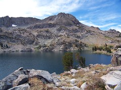
Winnemucca Lake
From the junction with the trail from Woods Lake at the northwest corner of the lake, we headed towards Round Top Lake, first crossing the outlet creek from Winnemucca Lake on a log. As we started up on the other side of the log, I started noticing more wildflowers. It was not the rich profusion you will find in July on the trail from Woods Lake to Winnemuca Lake, but any and all wildflowers are a welcome sight this late in the year.
As we climbed up with Round Top looming above us to the left and distant views of the valley to our right, we crossed a small stream flowing down from pockets of snow still clinging to Round Top's north face. Near this source of water the wildflowers were more abundant.
We climbed to a ridge, then started the gentle descent to Round Top Lake. I waited on a granite rock for Erik there, behind taking pictures again, and showed him the contour map while reading the directions from my book on how to get over to Emigrant Lake. I wanted us both to have an idea of where we were going.
From Round Top Lake, we followed the official trail, which goes on to Fourth of July Lake, south past posts marking where designated campsites were, and started descending gradually, with dramatic views of Caples Lake in the distance to the right, and directly below a view of lovely meadows, some of which I believe we explored when we got lost last year going to Emigrant Lake (I later made the hike to the lake from Caples Lake alone). A junction with a path that veered off to the right to the saddle between Two Sisters and Fourth of July Peak was clear, although unsigned. We took that, and passed where a sign of some substance once stood. On top of rocks, there were metal bars sticking out of a rock and mortar base, but no sign was attached to the metal bars. We descended to the saddle, then started up Fourth of July Peak slightly. We reached a fork in the trail, the more heavily used path heading right up towards the peak, while the more lightly used trail headed west, staying at the same elevation.
From the description I had read, I had the impression that our 1-mile jaunt west would be at about the same elevation most of the way, following the contours of the land, before making a short but steep descent to Emigrant Lake. The trail headed up seemed to me to have the top of this peak as its destination, whereas the other trail was following the sort of path I was expecting to find. I thought we should take the one that stayed at the same level, which ended up being my third worst decision of the day.
The path was clear at first, but as we hit talus, the trail disappeared. I just crossed as best I could, with Erik following, trying to avoid going up or down, except when necessary. Erik noticed there was a ledge up above, and thought the trail might be there, but I wasn't too concerned about the lack of a trail, since my book had described this as "cross country."
When we got to the other side of this talus, we climbed up to a saddle where there was clear trail, coming down from up above. We followed this some ways, and then it disappeared. I didn't stop to search for it, again, because I thought we were going off trail, and we just had to head west and stay at about the same elevation.
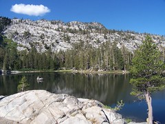
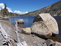
We continued on, just taking the route that looked best initially, and then we arrived at the top of the cirque around Emigrant Lake. I had told Erik that if he chose to take the easy trail from Caples Lake to Emigrant Lake, I would want to try to climb the rim above it for more interesting views. That is where we found ourselves, and it was dramatic. The mountain rises about 500 feet above Emigrant Lake with the exception of a small section to the north where the trail from Caples Lake arrives. Just to the east of that, and to the north of where we were, the rise of the mountain is not so shear as it is where we were, looking nearly directly down on a mixture of emerald and blue water, with Larger Caples Lake visible in the distance to the northwest.
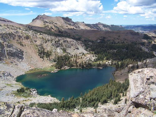
Above Emigrant Lake
The easiest way down appeared to be the more gradual course to the north, and I had climbed up part of that from the shore on my previous visit to Emigrant Lake. But it also appeared that we could get down more quickly following some slanting paths from where we were, directly east of the lake. So I made my second-worse decision of the day, and started down.
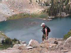
Me Starting Down
We both chose our own ways down, according to what looked best to us. My way was steep and required careful footing, and I had to walk through prickly bushes and hold on to tree branches. It took far longer than I expected. I kept looking down and then looking back up, and was always surprised that I still had so far to go, having put in so much work to descend already. But Erik was even higher up, and sometimes I couldn't see him. I would call out because I was worried. I thought he might choose to stay up top, rather than go down, which meant I would have to climb back up the same way, and I had decided I wanted to take the more gradual route up.
I made it down to the lake's edge and started to eat, but had little appetite. After taking some wildflower photos, I thought about the return route. It looked difficult to get around via the east shore to the area where I wanted to start up again, because the mountain rose up directly from the lake's edge. On the west shore a talus pile looked like a problem, so I started over to scout it out before Erik made it down.
The talus ended up being no problem, but there was a huge granite arm of the mountain sticking out before it that was trouble. I started climbing it to get over. By this time, Erik had made it down to the lake's edge. As I was trying to decide whether to proceed, we called out to each other. At first I suggested Erik come my way, but looking at how difficult it was, I suggest he go the other way, if he could find a reasonable route. I thought about heading back the same way, but then made my worst decision of the day. I chose to slide down a slope I knew I would not be able to return on, and then drop down to the edge of that talus.
But the drop down was much more than I was expecting, about 9 feet directly below me, with little for grips along the edge to allow me to lower myself down. I tried to go back up, but couldn't make it. I thought about just dropping down that distance, but decided it was unnecessarily risky. Instead I called out to Erik and told him, "I'm in trouble, and I need help. I can't get down and I can't go back up."
So Erik crawled to my rescue. Not only did he have to pick his way back from the way he was coming, but then he had to climb up above me to cross over this outcropping and get down safely to the other side. I'm not sure how he made it, as looking at it later, the whole thing seemed impassable. He didn't make it easily, and had to stop to rest above me before continuing down.
I dropped down my backpack, which had to fall a short ways before Erik caught it. We talked about our approach and studied the situation. I had Erik set up his camera on a rock pointed in my direction to record a video of the event. It's not like I was going to die, or even break a leg, but if I ended up with a sprained ankle, $100 from America's Funniest Home Videos would help ease the pain.
It looked to Erik like I could climb back up, but I had already tried that. The slope was too steep, and the crevices just didn't let me get a finger hold, but I tried again to show him I couldn't do it. It was less of a drop to my left and Erik's right (where you'll see him setting up in the video, making the drop look shorter than it was) and Erik suggested I try and get over there, and I did try, but it just wasn't possible. But soon I was fully committed committed to coming down. I was sliding down slowly, but inevitably, with no way to stop myself and get back up. It was slow and controlled because Erik supported some of my weight by holding up one foot, and I was holding the ledge as best I could as I slid down. We were both most worried about me being twisted to the side and not landing on my feet, but Erik backed off at the perfect moment, and I landed with little trouble, much to my surprise. It was more of a challenge than it looks like in the video.
Untitled from Elund and Vimeo.
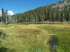
My legs were shaky for several minutes after that, but not from any exertion--I had mostly been resting comfortably, saving my strength. It was just from adrenaline. But I wanted to start across that talus immediately, as now my only thought was of getting home. On the other side of the talus, it was easy to pick up a use trail that took us through bushes and the sometimes swampy land around Emigrant Lake (not that day). We made one stop because Erik's boot had separated at the sole. I taped it up with medical tape, which is no match for duct tape, and we continued on.
We started up the use trail I had followed up the rim of the cirque on the northeast side of the lake the year before, and soon I realized it was more than a use trail. Not only was there the occasional cairn, there were orange paint marks on rocks leading the way, each one a line with a dot above it, like a small "i," the same mark used in blazes on trees. This simple fact changed my approach dramatically: no longer did I think I was going cross country, as best I saw fit, but instead I was following a diaphanous trail, and needed to carefully search for signs of it. Erik, being totally spent and not having the time to rest that I did, was moving slowly, so I took advantage of that time. Rather than plowing ahead as usual, I took the time to stop and study the area, and look for any sort of indicator of trail.
This worked pretty well. I would lose the trail at points, and just start up what seemed the most reasonable route, and then I would see another trail indicator. This meticulous approach really paid off at one point when I didn't see any trail indicators ahead, and would have just continued the direction I was going, but after long study, I saw one of the orange paint marks above. The trail jogs sharply up and to the right at this point, whereas it had been fairly linear. I had gotten a little too far ahead of Erik at this point, however, and he jogged down here, only to see me up above.
Shortly afterwards I lost the trail completely, but a route to the saddle we had crossed before was easy and obvious, and as I got close to it, I saw the trail we had followed briefly on the way out a couple of yards above us. When I lost that trail on the way out, I should have been looking all around for cairns and orange paint marks, and maybe I would have spotted one below the trail that would have saved us a lot of effort, although it also would have deprived us of a great view.
Back at the saddle and the trail, this time we headed up over the trail we had seen and joined from below on the way out. Again, it was not easy to follow. This is talus, "A scree slope, consisting of material which has fallen from the face of the cliff above" (SOED). With the heavy snows, run off, and freezing and thawing, there's a lot of erosion and rock slides each year on talus, and a well-laid cairn is likely to be knocked away. But we did as best we could. I'm pretty comfortable with crossing talus with trail or without, so when I seemed to lose the trail, I would head up or down and try and find it. If I succeeded, I would let Erik know where to go.
Once we got across that field, we were back on a well-defined, and nicely switchbacked trail, the one that I had thought on the way out climbed to the peak of Fourth of July. When we got back to the junction where I had erred before, I pointed out the mistake to Erik.
Everything was clear from then on out. Both Erik and I had run out of water long before and were looking forward to getting back to the car, but it would take awhile. Near the end of the return, we saw a backpacking couple just heading out with their two dogs, a small white one, and a large black one. The large dog had only three legs, but he was hopping forward on the trail with great enthusiasm. That dog looked as though he felt the same way I did in planning this trip, "Why bother to drive all that way and not have a little fun?" It was nice to pick up some of that vibe again as the hike ended.
Hike Summary
Date: 30 August 2007
Trailhead: Carson Pass
Approximate distance: 10 miles