The forecast for Sacramento was 102 degrees on this particular Sunday, so I was looking for a hike that would keep me and my friend Eric above the heat. I chose the Pacific Crest Trail from CA 88 to Showers Lake, all of which was above 8,000 feet.
It was just about 100 miles to the trailhead, which is almost due east of Sacramento. We took US 50 to Sly Park Road, took that down to the south end of the lake and turned onto Mormon Emigrant Trail, which took us to CA 88. On 88, we passed Tragedy Spring, Silver Lake, and Caples Lake, before reaching the parking lot just .2 miles short of Carson Pass.
A very brief history: a number of Mormons came out to California in the 1840s to work for John Sutter. When finished, they wished to return to Salt Lake City. They sent ahead some scouts to find a good route for their wagons, but they didn't come back. They sent out a search party, but found nothing. So they went ahead and started back. They found the remains of the advance scouts buried in a shallow grave near springs they names Tragedy Springs. For more information, go
here.
The parking lot was nearly full, despite the $3 fee. We started out on a signed and clear trail. Soon it was not so clear which way to go, and Erik told me he thought we were off trail. Two equestrians who were following us also questioned the direction I had chosen.
I went cross country to the west hoping to meet up with the trail again. The equestrians and Erik headed back the way we had come. Not finding anything, I headed south, and found the trail. Pretty soon the equestrians came along. Since Erik had been behind them returning the way we came, I figured he would be behind them on the trail. So I went back on the trail all the way until I could see the sign at the trailhead, but there was no sign of Erik. I was shouting to him occasionally.
So I figured he was ahead of me on the trail, and rushed on to catch up with him. I met some people coming the other way, and asked them if they had seen a hiker looking for someone. They told me they saw someone with a camera around his neck (which would be right) who was looking for a guy with fishing poles (which would be wrong). Later on I met some more people, and they mentioned an older, heavy set guy looking for a man with fishing poles. So that was someone entirely different.
I kept rushing ahead, but at this point I was thinking of how upset Erik's wife was going to be when I had to tell her I left her husband for dead in the national forest. But then I heard Erik calling to me from behind me. I stopped and he came rushing up, out of breath.
When I had gone back to the start of the trail, I saw where I went wrong. There's one point where the trail crosses rock, and it appears that there is a trail going straight north. Some sticks and rocks have been laid out to try and indicate to people this is not the way to go, and there are two cairns off to the west to indicate that is the way to go.
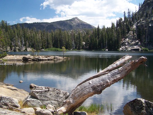
The first part of this trail is filled with boulders, deciduous trees (aspens, I think), and conifers. It goes up and down at a moderate grade. Then we got to a clear area where the trail starts to climb steadily, and has switchbacks. The climb starts at about 8560 feet and tops out at about 8800 feet. There was a pond at the end of the climb, then the trail continues level for a ways, before dropping down to about 8400 feet. Of course I knew that meant we would have some fun on the way back.
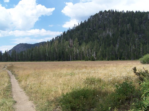
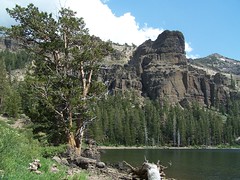
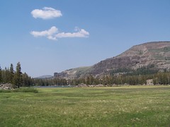
We dropped down to a lovely meadow, crossing the Upper Truckee River three times. It's just a creek up at this elevation, and since there wasn't much snow this winter, the creek didn't have much water in it. In the distance on either side of this meadow we could see dramatic volcanic cliffs.
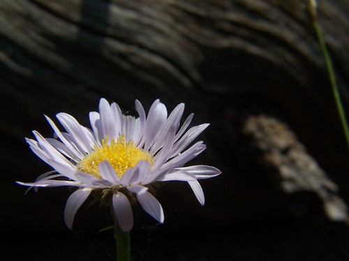
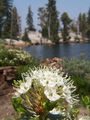
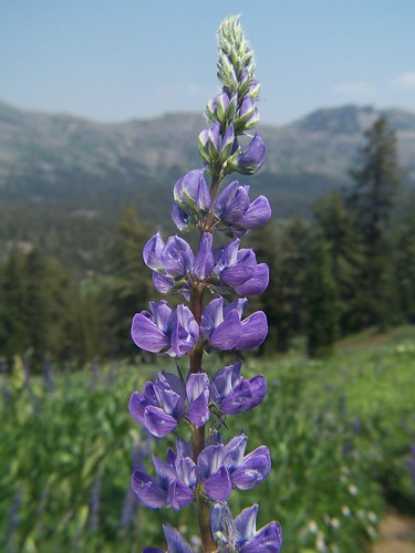
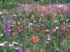
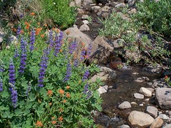
After the final Upper Truckee River crossing, we descended to a pond before beginning the final 350-foot climb to Showers Lake. There had been excellent wildflower displays for most of the hike, but on this climb to the lake we saw the most dramatic of all, a lush hillside filled with white, purple, and red wildflowers, and the occasional yellow ones. It was also popular with mosquitoes, and I applied some mosquito repellent at this point.
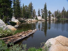
After a few switchbacks, we got to the lake. The sign at the trailhead indicated 4.5 miles to the lake, whereas
Tahoe Sierra listed it as 5.1 miles. I suspect it is 4.5 miles to the southeast corner of the lake, and another 1/2 mile plus around the lake to the nice spots on the west and southwest shore, where there is nice granite to sit on.
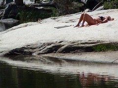
There was a couple swimming in the lake when we arrived. When I picked out a spot to sit and eat our lunches, I was going to take a picture in their direction. But the guy was standing nude on the shore, so I decided to wait until they cleared out to take any pictures.
For some reason, neither of us had much of an appetite. I forced myself to eat as much of my sandwich I could, but then went on to explore more photographic opportunities. Unfortunately, it was very hazy (from some forest fire I hadn't heard about), so that ruined lots of potentially good shots.
On the way up, we just hiked, not taking photos. That's the way I prefer to approach a trail I've never been on before--I want to find out just how long it takes to hike the trail before I start spending extra time taking photos. On the way back, we stopped for photos.
When we crossed the Upper Truckee River for the first time on the way back, there was a clear use trail (there is no official trail) heading off to the east to Meiss Lake, which we had seen in the distance on our hike out. I checked with Erik if he wanted to head over that way, and he was up for it. But it didn't work out. Eventually we ran into some water we couldn't find a way to cross. I had printed out a lovely topographic map for this hike, and could have used that to help us find the best route, but I had left it at home next to the printer.
So we just headed back to the Pacific Crest Trail to make our return. I asked Erik for some blueberries he had offered me earlier, as I was nearly out of water, and wanted the liquid. I didn't take that much water as it was only rated as difficulty level 2 of 5 by
California Hiking, but it was a warm day, and we were mostly in the sun.
On the second crossing of the Upper Truckee River on the way back, I stopped to splash some water on myself to cool off. Not long after I started the final major climb.
It wasn't that hard, but I had cotton mouth. On the descent in the treeless area, I had fantastic views of Round Top and Elephant's Back to the south, but didn't bother to take a picture because of the haze. Also on the descent, I could hear traffic on CA 88.
I was quite happy to get to the point that I could see CA 88, and then see the trailhead. My bottle of water had been left in the sun in the car, and was quite warm, but I quickly drank it all.
The haze detracted from what would have been a pretty spectacular hike, but on the positive side, it turned out to be more of a good workout than I expected. Erik disagreed with the difficulty rating of 2.
Hike Summary
Date:
8 July 2007Approximate distance:
10.2 miles