Some of my photos are now for sale at ImageKind.

Nature Index
(My hiking and camping adventures in Northern California.)

Culture Index
(NorCal cities, highways, restaurants, museums, architecture, historic attractions, vintage neon signs, roadside attractions, etc.)
Showing posts with label Route 50. Show all posts

Thursday, March 8, 2012

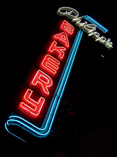
Lost Neon Sign: Sacramento's Philipp's Bakery

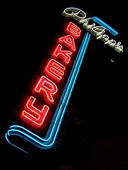
20070426 Philipp's Bakery

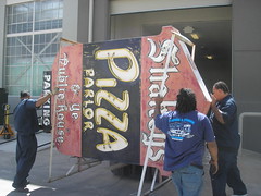
Not really lost. Just disappeared from public view, into the warehouse on the old McClellan Air Force Base where the Center for Sacramento History stores its large collection (more than 30) of vintage neon signs, including those from the original Shakey's Pizza on J Street in East Sacramento, and the Rosemount Grill, the bakery's former neighbor. I think they also have the Ark of the Covenant in there, but who really cares about that? THEY'VE GOT MORE THAN 30 VINTAGE NEON SIGNS!!! (I'm an enthusiast.)

New Off-Site Storage Facility #10
[This photo, from the Center for Sacramento History's Flickr account, shows them moving signs into the warehouse.]

According to an article by Lance Armstrong (presumably not the famed cyclist enjoying an encore career as a local interest writer), German immigrants Julius Herman and Angelina Philipp first opened their bakery in Calistoga, then moved to East Sacramento in 1925.

Besides the fact that the bakery was a longstanding institution in East Sacramento, the sign for it was a notable landmark on the old alignment of U.S. Route 50, pre-freeway. You can read more about the vintage remainders of this section of the old highway in my blog entry on Sacramento's Folsom Boulevard.

In 2007, I met the a man who claimed to be the owner of the building while taking the photo below. He was a broker who had returned to Sacramento and told me he had been very excited to be able to purchase his father's bakery and that his wife was running it now. He gave me his and his wife's cards and asked me to e-mail him a photo from that night. I did, but never got a response.

20070426 Philipp's Bakery

He told me that he had the sign restored (by Pacific Neon) in place, as he was afraid if it were taken down the city would not let him put it back up again. During the restoration process, it was discovered that the sign was a flasher, which he did not recall as a kid. He found out why. It was restored as a flasher, and a part kept burning out that had to be replaced for a couple of hundred dollars regularly. He figured his father had simply wired it to stay lit continually so as to avoid the expense.

Shortly after this conversation, I was surprised to learn that the bakery had closed, and a blog on the Sacramento Bee's website indicated that the brothers who owned the building had refused to renegotiate the lease of the baker and instead evicted her. Strange situation if said baker was the wife of one of the brothers.

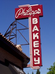
20040824 Philipp's Bakery

Sorry to see the lovely old sign leave the neighborhood, particularly since I haven't photographed it since I upgraded from a compact digital camera to an SLR in 2008. I have been meaning in recent months to reshoot it, but once again I failed to act in time. Hopefully the Center for Sacramento History will let the people get another glimpse of it. Preferably sometime before their big Ark of the Covenant of show.

Monday, June 22, 2009

US Route 50: Sacramento's Folsom Boulevard

U.S Route 50 runs 3073 miles from Ocean City, Maryland to West Sacramento (up until 1964 it turned south from Sacramento to Stockton, then went west to the Bay Area via Tracy). It is the last of the designated federal highways (from before the Interstate system) to run from coast to coast (or at least to a reasonable drive from the coast in West Sacramento).

In California US 50 follows a route historically important both for 19th century immigration and for the development of automobile travel and the highway system. From South Lake Tahoe to Folsom, the current U.S. Route 50 roughly follows the immigrant wagon train path. In the early 20th century, this became the southern branch of the Lincoln Highway (the northern branch went from Truckee to Sacramento roughly along the old U.S. Route 40 and current Interstate 80 path). From its origin in 1926 until the completion of the El Dorado Freeway (current U.S. 50) in 1973, U.S. 50 ran from Folsom to East Sacramento and Midtown via Folsom Boulevard.

Unlike many stretches of old U.S. 40 in the greater Sacramento area, business has continued to flourish along most of the old U.S. 50 route on Folsom Blvd., despite being bypassed by the freeway. It remains an important east-west artery through East Sacramento, and is the main business thoroughfare in Rancho Cordova.

As a result, Folsom Blvd. is lined with a hodgepodge of new and old. I'm going to highlight those old portions that can still be seen, or could be seen in the last few years, while taking you on a trip down Folsom Blvd. from its west end at Alhambra Blvd. in East Sacramento to Rancho Cordova, leaving the historic mining town of Folsom for another blog entry.


3145 Folsom Blvd.
Rosemount Grill


[Historic photo of the Rosemount Grill.]

This long-time Sacramento institution was originally located downtown, but moved to Folsom Blvd. around 1940. When the owners retired and sold the place, the new owners wanted to maintain the tradition, but the family didn't want somebody else running the business under the same name, so the old neon sign was carted off to the Sacramento Archives, where it is still preserved, and the restaurant became Andiamo's. I had an Easter Buffet there once long before learning anything of the restaurant's history.

20051031 Andiamo!

3201 Folsom Blvd.
Regal Station


20071209 Former Regal Petroleum

This was the sign for a gas station from the Regal Petroleum Corporation. In the early 1970s, the lot was used for a car dealership, and the owner made good use of the sign, naming the business Crown Auto Sales. Really, Finish Master? Why not be the Finish King, rather than just a master? Restore the crown!


3300 Folsom Blvd.
Philipp's Bakery


20070426 Philipp's Bakery

This place I was able to get a little insider information on as I was photographing it one night and ran into the owner (as he told me, co-owner with his brother as I found out later). His last name was Philipp and this had been his father's bakery, but it had passed out of the family hands. He (and his brother) did well in business and and bought the bakery, and his wife was running the bakery. He gave me his business card and hers. But then shortly after, the bakery closed, and an article indicated the two brothers had evicted the baker tenant. Odd.

Anyhow, he had the sign restored by Pacific Neon. Just in case there would be some objections to putting it back up, he had the work done on the sign in place. They discovered that, while it had not been used that way for years, the sign was designed to be a flasher, so it was restored that way. But he soon found out why it had been altered, as a part costing a couple of hundred dollars needed to be replaced every few months.

4300 Folsom Blvd.
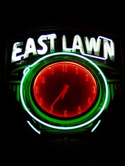
East Lawn Memorial Park


20051101 East Lawn Memorial Park

4757 Folsom Blvd.
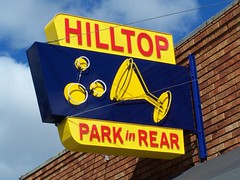
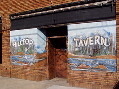
Hilltop Tavern


20070301 Hilltop

Formerly a small grocery store, the Hilltop opened in the late 1950s or 1960, and when I first saw it, had lovely murals out front, which are now gone.

20051031 Hilltop Tavern


4800 Folsom Blvd.
East Sacramento Hardware


From at least 1953 to 1982 this was Sacramento Building Specialties, and it has been East Sacramento Hardware since at least 1990.

4920 Folsom Blvd.
Burr's Fountain


I'm curious about this place. It has only been an ice cream shop since the late 1970s or early 1980s (first Vicki Marie's Ice Cream before becoming Burr's Fountain). Before that it was Zarett's Pharmacy, dating back to the 1950s, which looks like the right age for the building. It's possible that it had a soda fountain in it as a pharmacy, which would make it one of the oldest in Sacramento. The counter inside is certainly much newer than that, but whether it replaced one from the 1950s, I don't know.

Owned by the same people as venerable Vic's Ice Cream across town (according to a friend), the menu is much the same--you can still get your sandwiches, which come with potato chips and pickles, on dark rye, and you can get a braunchweiger sandwich to go with your phosphate.

5200 Folsom Blvd.
Socals


20081128 Socal's Tavern

While this has long been a tavern, it has only operated under the names Socals since the early 1970s. In the '50s and '60s it was the Clover Club.

5201 Folsom Blvd.
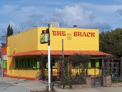
The (Sub) Shack


20001118 The Sub Shack

Born in the early 1970s as The Sub Shack, it has gone upscale under new owners and dropped the "sub" part, and is now a small eatery with a lovely outdoor area known as The Shack.

20070211 The Shack

5723 Folsom Blvd.
Square Deal Cafe/Espanol Italian Restaurant


20071120 Italian Dinners

The Espanol Italian restaurant started as the restaurant in a Basque boarding house for sheepherders, the Espanol Hotel, at 114 J Street in 1923. Ancil Hoffman bought it during the depression and turned it into a celebrity hangout. Ann Sothern and Max Baer frequented the place. In 1952, it moved into the Commercial Hotel at Third and I. In 1959 the Luigi brothers bought it and gradually changed the food served from Basque to Italian. In 1965 it moved to its present location because of the construction of I-5 where the Commercial Hotel once stood. The building formerly housed the Square Deal Cafe.

5810 Folsom Blvd.
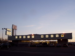
Corti Bros.


20051030 Corti Brothers

This was the Grand View Market in the 1950s, and Giant Foods in the 1960s, but as the sign tells you, Corti Bros. has been around since 1947. They started downtown, at what was presumably a much smaller location, then moved to 3195 Folsom Blvd. before moving even farther out to this spot around 1969-1970, presumably following their customers in the flight from downtown.

They usually win any local vote for best deli, and have a fine selection of specialty import groceries. It's where I go every year to get lefse, and the only place I can find in the area that it is available.

5901 Folsom Blvd.
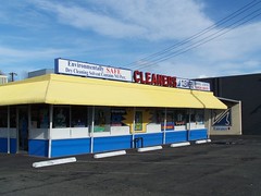
Camellia Cleaners


20070211 Camellia Cleaners

Camellia Cleaners has been here since at least 1970. Before that Bossy's Drive-In had this address, but I'm not sure if it's the same building or not.

6200 Folsom Blvd.
Giovanni's Pizzeria


This was a tractor supply business for most of its early life, which gives you an idea of the changing character of the area, as this used to be the edge of town. This is my favorite place for New York style pizza.

6300 Folsom Blvd.
Hoppy Brewing Co.


And this placed housed a feed & farm supply company.

6601 Folsom Blvd.
Sambo's Pancakes


20070424 Sambo's Pancakes

It was built as a Sambo's in the mid 1960s, and remained one until at least 1982, and has been a series of restaurants since then.

6727 Folsom Blvd.
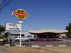
Dairy Queen Drive-In No. 52


20050919 Burger Chief

It started out as a Dairy Queen in the mid 1960s and remained one until the early 1990s, then became, successively, Burger Chief, Will's Burger, and now Dino's Dogs & Gyros.

6800 Folsom Blvd.
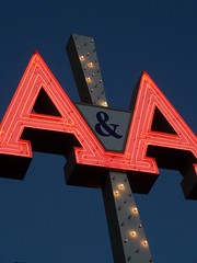
A&A Appliance


20070424 A&A Appliance

8294 Folsom Blvd.
Sac City Ink


Housed in an old brick building.

Junction with CA-16

Folsom Boulevard swings around a bit here, and then closely parallels the railroad tracks for several miles into Folsom. This grade was originally selected for the Sacramento Valley Railroad, which started construction in Sacramento in 1852, and reached Folsom in 1856. Now the Sacramento Regional Transit lightrail runs this route. See this history of the Placerville and Sacramento Valley Railroad.

8329 Folsom Blvd.
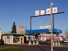
Park N Gas


20060207 Park N Gas

An old Texaco station.

8475 Folsom Blvd.
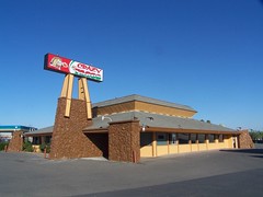
Crazy Tacos


20070317 Crazy Tacos

It was Brawley's Coffee Shop from at least 1970-1990, although I don't know if it was originally that.

8545 Folsom Blvd.
Bamboo Tree Mobile Park


20060207 Bamboo Tree Mobile Home Park

8581 Folsom Blvd.
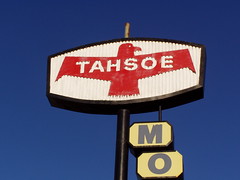
Tahsoe Motel & Coffee Shop


20060207 Tahsoe Motel

It has been a while since the coffee shop was open, but the motel was still around in 2007, and was demolished late that year. I don't know what the name is in reference to.

8637 Folsom Blvd.
Stardust Motel


20071117 Stardust Motel

It's harder for me to research businesses farther out than this, as we are now moving out of range of the earlier city limits

9509 Folsom Blvd.
Casa Linda Motel


9515 Folsom Blvd.
Vince's Motel


Welcome to Rancho Cordova

20090626_10513

There are some interesting historic artifacts in Rancho Cordova, like the Kilgore Cemetery, but the vast majority of this city is of very recent origin. A post office didn't open up here until 1955, and the city was not incorporated until 2003. It consists largely of corporate campuses, strip malls, and suburban housing. The city has massive plans for growth, so I'm sure it will get even uglier than it already is.

9878 Folsom Blvd.
Routier Station


20090705 Routier Station, 1860
Long Exposure at Night of the Front

This is the historic railroad station on the Sacramento Valley Railroad line known as Routier Station. It dates from 1860, and of late has been uses as an office for Pfingst Realty Company. It's a neglected relic--despite the fact that I used to drive by it on the way to work and meant to photograph it, it took me 4 years to get around to doing so, and I can't find any other photos of it on Flickr.

20090705 Routier Station, 1860
Long Exposure at Night of the Back

10115 Folsom Blvd.
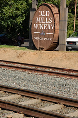
Old Mills Winery Office Park


20090626 Old Mills Winery

Being the clever sleuth that I am, I have deduced from the name of this business park and the part of a wine cask used for its sign that a winery once operated at this location, but I haven't found any information on it yet.

10121 Folsom Blvd.
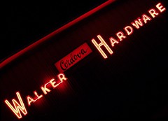
Walker Cordova Hardware


20051122 Walker Hardware

10153 Folsom Blvd.
Wienerschnitzel


20070625 Old Wienerschnitzel

In the classic A-frame building, now demolished.

10271 Folsom Blvd.
1st Value Inn


Formerly a Motel 6.

10273 Folsom Blvd.
Rosie's Country Kitchen


Formerly a Denny's.

10701 Folsom Blvd.
Cordova Lodge/Inn


20080304 Cordova Lodge Restaurant

Cordova Lodge, is what it originally was. After a series of other names, it now has one that is simliar, the Cordova Inn. I would guess that it was built around the time that the post office opened (1955). The "Restaurant" sign on the side had been painted the same color as the building to blend in for years, since there is no longer an operating restaurant, but when I drove by recently I noticed it has been removed all together.

I hope to flesh this out some more in the future with more information and photos, and perhaps more entries, but for now, this is it.

Monday, September 24, 2007

U.S. Route 40: West Sacramento's Motel Row

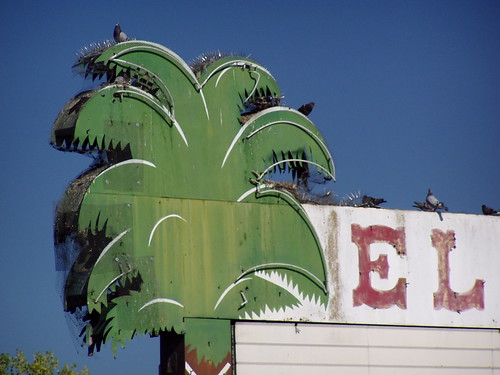
20050727 El Rancho
R.I.P. El Rancho Neon

[If you're interested in Highway 40 history in Sacramento, see also my blog entries on Del Paso Boulevard and on Auburn Boulevard.]

While most Americans on roadtrips today are content to speed along controlled-access freeways sealed inside climate-controlled cars and SUVs, only pulling off for the safe and familiar comforts of chain restaurants and gas stations, they are also nostalgic for a bygone era when the traffic on the highway slowed to go through the heart of business districts of both small towns and large cities, and drivers could impulsively pull over to unique roadside diners, motels, service stations, and tourist traps.

While U.S. Route 66 from Chicago to L.A. (omitting the eastern seaboard, the most populous area in the country) has become a focal point for this nostalgia, Sacramento has been home to old highways of arguably greater importance and interest, U.S. Routes 40 and 50. U.S. Route 50's distinction is that it is the only surviving transcontinental highway that is not all Interstate freeway. U.S. 40, now supplanted by Interstate 80 in the West, ran from Atlantic City to San Francisco, and in California is notable for the fact that it mostly followed the route of the old Lincoln Highway, the first transcontinental highway. (U.S. 50 also followed, and in some portions still follows, part of the Lincoln Highway route, the "Pioneer Branch" from Sacramento through Folsom, Placerville, and South Lake Tahoe before rejoining the northern route.)

One of the quickly disappearing local legacies of the pre-freeway routing of both historic highways is the motel row in West Sacramento. This was the major approach to Sacramento from the Bay Area on U.S. 40 for many years, and was part of the original routing of 50, when it originated in West Sacramento, as it does today. (In intervening years, 50 was routed down Stockton Blvd. and then Cherokee Lane through Lodi and into Stockton before heading over to Oakland via the Altamont Pass.) In the then unincorporated area of Yolo County, motels, restaurants, and a drive-in movie theater lured tourists off the road with boldy designed buildings and bright neon lights before they reached Tower Bridge, constructed in 1935, to enter the city proper. The main artery carrying traffic across the Sacramento River now, the Pioneer Bridge, was not opened until 1966.

When the freeway bypassed West Sacramento in 1954, the inevitable decline began. The El Rancho Hotel had once accommodated stars and high-ranking politicians, but when the Cleveland Cavaliers were booked there in 1985, several players refused to stay and paid for their own rooms on the other side of the river. The El Rancho Drive-In Theater became the El Rancho Mobile Park. Being in an unincorporated area without a local police force, the old motel strip became a place to escape strict law enforcement and harassment in the city, making it a popular gay cruising ground, but also an area blighted by prostitution, drug dealing, and fights. Adapting to the times, some of the motels became adult-oriented, like the Experience Motel, which became the Adult Experience.

In that area that now lies within the city of West Sacramento (incorporated only in 1987), there are still a few interesting remnants of the Route 40 heydays, including many surprisingly well-maintained motels, although they are fast disappearing. I started taking an interest in roadside relics in 2000 and photographed many with my old APS camera. Later I got a digital camera and with extensive practice improved my crude skills, and I went back to get better photos of the area, but some I would find were no longer there. And they keep vanishing on me.
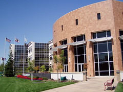
20060827 West Sacramento City Hall
West Sacramento City Hall

Newly incorporated West Sacramento worked to turn around the area's image in the typically American fashion: by destroying the past. The Capitol Inn where Clark Gable once stayed was razed, rather than rehabilitated or reinvented, and became the site of West Sacramento's City Hall. In 1993, only 6 years after incorporation, West Sacramento instituted a comprehensive sign ordinance, strictly limiting the size of free-standing signs. Businesses were given a generous 15-year period in which to bring their signage into compliance with the ordinance, but no exceptions were allowed for. When I first started taking pictures of the signs along this route, I thought all the small, plastic, back-lit signs were there because the motels had changed names when they changed ownership over the years, but my research shows that most of them have been under the same name for 50 years. Those with plastic signs were ones to quickly adhere to the new city ordinance. While the city of Sacramento has sought to protect its identity by protecting its historic signage, like the Joe Marty's sign, the city of West Sacramento is mandating the removal of this important part of its history by May 1, 2008.
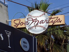
20050728 Joe Marty's
Sacramento's Historic Joe Marty's Sign

Meanwhile, the proximity of West Sacramento to downtown is finally attracting the interest of major developers after the development of Raley Field, the Ziggurat Building, and the associated waterfront park area. Big changes are in store for the city in the near future, but for the moment let's look to the past.
Much of that past is nothing more than tantalizing hints I find in the library, like the names of the Pink Cucumber, or the Hawaiian Hut, old restaurants, or the old motel post cards in the Sacramento Room of the Sacramento Central Library. But I did get to see, and photograph, some of the remaining vestiges of this rich history, and have seen others' photos. Here's a review from west to east:

Ortega's West
4205 West Capitol

In the 1960s, this was the Road House. All that remains from those days, at least outside, are the two arrows indicating where to turn off the road.

20071008 The Road House

Walnut Trailer Villa
2355 West Capitol
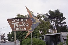
20001020 Walnut Trailer Villa

The sign must have disappeared not longer after I photographed it, as I was never able to find it again. Here's a better photograph of it.

Red's Drive-In
2328 West Capitol
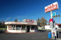
20080309 Old Drive-In

At least since 1961, this has been a liquor store: Henri's Drive-In Liquors, then Springer Bottle Shop, and currently A&B Liquors. But its shape betrays its origin as a drive-in restaurant, and the old city directory confirms this, indicating that in 1957 it was Red's Drive-In. When photographing it recently, a man bicycled by and told me that it used to have a giant top hat on top.

Yolo Club
2216 West Capitol
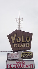
200010 Yolo Club

The Yolo Club probably opened in the 1930s. The vintage sign remained until at least 2000, although a Sacramento Bee restaurant review in 1986 of The Western Rib House at the Yolo Club mentions "the site of the old Yolo Club." Now it is operated as Puerto Azul, and the sign has been altered. Here's an advertisement for the Yolo Club from 1978:

"Mention the word 'barbecue' and Yolo Club immediately pops into mind. Long famous for its barbecued pork spare ribs and chicken, the specially-blended, tangy Yolo barbecue sauce is the same recipe developed by the original owners more than 40 years ago. Or try the special Yolo steak, hand cut right on the premises from the finest of choice meats. Yolo Club has a real western atmosphere, with a completely circular bar right in the middle of the dining room! Take the entire family!"
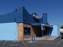
20060828 Puerto Azul
Puerto Azul

Plaza Motel
2007 West Capitol

In the last couple of years all of the neon tubing has been broken off of this large sign, and both arrows are now gone.
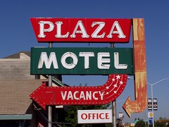
20050726 Plaza Motel

El Rancho Drive-In Theater
2000 West Capitol
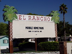
20050727 El Rancho Mobile Home Park

The El Rancho Mobile Park was once the El Rancho Drive-In Theater, which seems more fitting for the glorious sign that once welcomed people to its entrance. A year or two ago I had a call from the owner, from Sonoma. She inquired if I was "Tom Spaulding the photographer," to which I hesitantly answered "yes" (I take a lot of photos, but have never made any money from it). She was looking for a photo of the old sign lit at night, but I was never fortunate enough to see it that way. The sign was taken down early in the summer of 2007.

Part of the El Rancho in 1946.

El Tejon Motel
1821 West Capitol

20080309 El Tejon Motel

It has been there since 1946, and likely a decade longer than that, yet it looks beautifully maintained. But there has been one change. Their motto used to be "Watch for the motel with the blue glass windows," but I've never found any blue glass windows there.

Denny's
1638 West Capitol
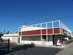
20070926 Denny's in Disguise

The building has now been divided to house two different businesses, and much of the distinctive roofline has been covered over, but from the side you can still spot the old Denny's underneath. Later it had a long run as Torrey's Coffee Shop.

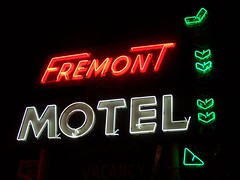
Fremont Motel
1550 West Capitol

20080216 Fremont Motel

20061122 Fremont Motel

This motel is a particular favorite of mine, as I love the design of the building as much as its wonderful neon sign. I got to talk to the manager (and possibly the owner) when first photographing the sign at night and he seemed as fond of it as me. It is from him that I first learned of the city ordinance and the impending destruction. I don't see how this could possibly be considered a blight on the city that would hold it back from prosperity. To me it’s a treasure.

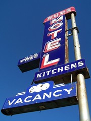
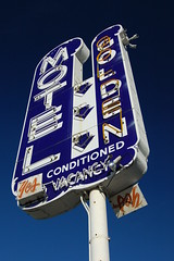
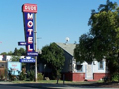
The Dude Motel and the Golden Motel
1501 & 1917 West Capitol
20070926 Dude Motel

20070926 Dude Motel

20080309 Bye-Bye Golden Motel Neon

Just two old motels that managed to keep the same name and the same sign in good repair for all these years until the city intervened.

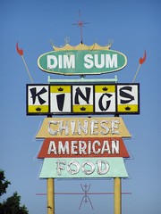
King's Chinese Restaurant
1500 West Capitol
20050727 King's

What a beauty! Yet it didn't inspire me to eat there until after the sign was gone, I'm ashamed to admit. This was a massive sign that towered above everything, a true West Sacramento landmark.. Perhaps it was out of spite (a waiter there told me the owner was very upset to have to remove the sign) that it was replaced in 2005 with the most lowly and unobjectionable sign you can imagine, a small, back-lit, plastic thing hugging the ground. Now that's a "low-rent" sign, a term city officials have used repeatedly over the years in interviews when talking about redevelopment efforts (although I now see that the sign has been placed on a pedestal, making it look more typical). The old sign was first class. See it at dusk.

Budget Motel
964 West Capitol

20080216 St. Francis Motel

This was built in the early 1950s as the St. Francis Motel, advertised as "THE HOUSE OF DISTINCTION." It was still the St. Francis as late as 1980, but was the Budget Motel, with another boring new sign, by 1990. The office building is original though.

The Flamingo Motel
920 West Capitol

This motel never captured my eye, until I saw a postcard in the Sacramento Room of what the sign for it used to look like. One of my contacts on Flickr has posted his photo of that sign here.

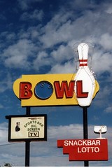
Capitol Bowl
900 West Capitol
200010 Capitol Bowl

20051210 Capitol Bowl

Formerly the El Rancho Bowl, the neon signs on the building should be allowed to stay under the ordinance, as long as they are in good repair, but the free standing sign with a bowling ball for the letter "o" is likely doomed. People have told me that the owners always kept it in good repair, but part of it was flickering weakly when I photographed it at night, and there's no point in spending money to repair a doomed sign.

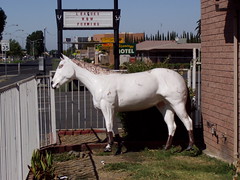
Old Town Inn
826 West Capitol
20060827 Old Town Inn

The horse statue standing outside this motel always struck me as peculiar, but it might have been part of the original decorative scheme, as before this was the Old Town Inn, it was the Pony Express Inn.

The Experience Lodge
824 West Capitol
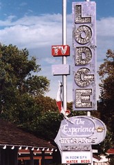
2001 The Experience Lodge

This sign featured a diving beauty and a mixture of neon tubing and incandescent bulbs, a style that is a particular favorite of mine (see Plaza Hof Brau at the corner of Watt and El Camino for a fine working example). It has been gone for a few years now, although the motel is still in business, again with a plain and unobtrusive plastic, back-lit sign.

Welcome Grove Motel
600 West Capitol
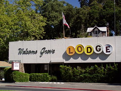
20060827 Welcome Grove

Motel and trailer park, actually. Plus, there's a small house sitting on top of the motel. The approach to the Tower Bridge in this area is being reworked, and I don't know how that will effect the Welcome Grove.

Tower Bridge
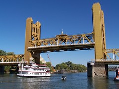
20061022 Spirit of Sacramento

20080312 Some Bridge

The bridge has marked the transition from West Sacramento to Sacramento since it opened on 15 December 1935 is closed right now, but just temporarily, as the sidewalks are widened. The future of this structure is secure as only the Capitol Building rivals it for status as the representative landmark of the city of Sacramento.

For 25 years this was the main portal for traffic entering Sacramento from the west, as Mayor Arthur Ferguson envisioned it in his comments during the opening ceremony: "These towers shall stand through the years indicating the true friendliness and welcome of the City of Sacramento" (qtd. in Sacramento Bee 12/16/1935).

Once the freeway was opened on June 15, 1954 bypassing West Sacramento, the bridge became a real bottleneck for traffic, especially since the train tracks crossed the approach to it. This was not alleviated until the Pioneer Bridge was finished sometime in late 1966, carrying the freeway across the Sacramento River.
-----
Highway 40 continued:

North Sacramento's Del Paso Boulevard
Auburn Boulevard