Desolation Valley
From what I understand (and that's no guarantee of accuracy), the most popular entry into the Desolation Wilderness for backpackers is from the southern end of Lower Echo Lake. There are two advantages to this entry point: the car does most of the climbing, as it is less than 700 feet of elevation gain up to popular Lake Aloha, and one can take a boat taxi across the Echo Lakes and cut 5 miles off of the hike, round trip.
Despite the popularity of this area, it is one of the few approaches to the Desolation Wilderness I had not taken before this hikee. I've been meaning to do it for a long time, but after not going earlier in the season, I was going to put it off until next year, as Lake Aloha is partially drained late in summer to supply water to the downstream population. Unlike the many other natural lakes in the area with small dams built to increase holding capacity and control the outflow of water, Lake Aloha did not exist before a dam was built--this was the Medley Lakes area of Desolation Valley. A dam was built in 1875 and raised in 1914, creating Lake Aloha for part of the year. But late in the season it is drained, and isolated pockets of water--formerly the Medley Lakes--remain.
I changed my mind about putting off this trip another year after the hike I took with my friend Erik the previous week to Ralston Peak. From there we could see that many of the other lakes in the area were full and quite beautiful. So I suggested this for the next weekend, and Erik agreed.
The Echo Lakes lie north of U.S. Route 50, just short of the high point of the pass on the way to South Lake Tahoe. Right after the Tahoe at Sierra ski resort, we turned left onto Johnson Pass Road, which heads right down to join U.S. 50 again on its descent to South Lake Tahoe, as we found out because I went right past Echo Lake Road, and had to turn around. I suspect this road might have been one of the routes immigrants took during the Gold Rush.
Back on Echo Lakes Road, we drove to the parking lot just above Echo Chalet and the dam for Lower Echo Lake. The hike took us down past the pit toilets maintained by the U.S. Forest Service next to Echo Chalet, and they were especially fragrant that morning. Before heading up on the dam, there is the sign with Desolation Wilderness permits. Then we crossed the dam, and the bridge across its outflow, and started up the trail. I'm not sure if the boat taxi operates after Labor Day, but even if it does, there was no question that we would hike the 5 extra miles to save the money.
After crossing the dam, the trail climbs up some short switchbacks, and stays above the Echo Lakes the rest of the way, with some minor ups and downs. To the right rise large, rounded swells of granite, stained orange and black from minerals that leach out during the spring snow melt. To the left between the lakes and trail lie private cabins, many with small docks and roofs on posts to cover boats. Quite a few looked as though a lot of money had been put into them recently. Where there was enough soil to provide a foothold, conifers sprouted up.
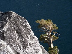
Along Lower Echo Lake
The trail was clear and wide, and had interesting artifacts. There was a point at which it looked like a large, rounded granite outcropping that would have been impossible to cross had been blasted to clear out a trail, and then there was concrete filling in part of the path. A couple of places had short metal rods sticking out of the rock. Erik speculated that there may have been railing at these points at one time.
Once past Lower Echo Lake, the lake views ended, as the trail along Upper Echo Lake is not as close to the water. We hiked through forest on dirt, with the cabins now much closer to the trail. The end of Upper Echo Lake is marked by a sign for the boat taxi.
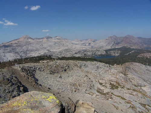
After that, we climbed out of the forest onto granite scree. Below us to the left we had nice views of Tamarack Lake appearing temptingly close, with Ralston Peak, the destination of our hike the week before, rising up behind it. Turning around we had our best views of both Echo Lakes. We continued on past the spurs to Triangle and Tamarack Lakes, up into forest again, where we found our spur to Lake of the Woods.
We crossed Haypress Meadow and then started climbing steeply to the top of a ridge, and then it was steeply down (quite a bit more than we has climbed on the spur) to Lake of the Woods, with dramatic views of it through the trees backed by a granite dome and the peaks of the Crystal Range, most prominently Pyramid Peak.
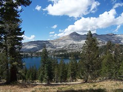
Lake of the Woods from Above on the Trail
Down at the lake we found some signed campsites, and a small concrete foundation. I'm not sure why that was there, but a book on the Desolation Wilderness from the late '60s mentions that the forest service put in pit toilets and picnic tables in parts of the Desolation Valley Primitive Area (its original designation) when few people were visiting, only to take them out when the number of visitors increased dramatically.
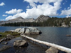
Lake of the Woods
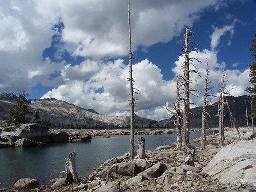
Behind the campsites a piece of glacier-worn granite juts out into the lake, and we went out on that to eat lunch on a sloping shelf into the water. It's exactly the kind of spot where I like to go swimming, and then lie back and dry out on the warm granite afterwards. The only problem was that it was in 60s and windy, and the water was too cold. The season for swimming in the mountains had already passed for 2007.
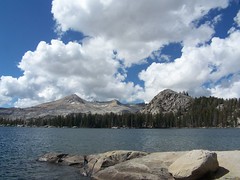
Granite Rest Stop
I had planned on Lake of the Woods being the final destination of the hike, but Erik had never been to Lake Aloha before. Since it was so close, I suggested that we proceed, even though I knew the water level would be low.
We followed the trail around the north edge of the lake, then started up just next to a high granite dome. Along the trail it was surprisingly lush for a hike into the heart of the Desolation Valley, but the satellite images show that this was just a narrow band of trees between Lake of the Woods and Lake Aloha, with plenty of open granite beyond them on either side.
We reached the junction with the main trail from Echo Lakes. I had expected to be able to see Lake Aloha from there, as the map shows it lying quite close to the lake, but we were still in the trees. A little bit farther along there was a junction with a post indicating only that behind us were the Echo Lakes. But another hiker there told us that the trail to the left went along the south side of Lake Aloha and quickly ended, while the trail to the right went along the north shore of the lake.
We headed towards the north side of the lake, and quickly came across the dam, with a depression of dried mud in front of. We explored several of these depressions where water had formerly been before finally coming upon a large body of water that had not been drained and had not yet evaporated.
We had started the hike under clear skies, but as the day went along it kept getting cloudier. At this point I noticed that the clouds coming over the granite peaks of the Crystal Range that rise up directly from the west shore of Lake Aloha were ominously dark, so I suggested to Erik that it was time to start back. I had told him earlier that the junction with the trail we would return on had to be at the north end of the band of trees along the northeastern edge of the lake. I returned to the the trail and started in that direction, while Erik was taking pictures behind me.
After a while I stopped and waited for Erik. Then I shouted to Erik. Then I started walking back on the trail while shouting to Erik. Then I started running back on the trail shouting to Erik. I stopped and wondered if maybe he had gotten ahead of me off trail, but that didn't seem likely, as I should have been able to see him between the trail and the lake. I considered just continuing on, counting on him to follow the trail signs back to the car when he realized we had gone different ways. But instead I kept heading back until I found him and a man with two llamas. He had headed back on the trail the way we had come, until he encountered the alpaca-loving man who told him he had not seen me coming that way before him. I told him we should hurry back in case it rained, since we didn't bring jackets, and promptly headed off. Later he told me he had two trash bags we could use as ponchos.
We marched back through forest and cross some areas that must get swampy when the snow is melting, as there was a sort of boardwalk along one stretch, and then a raised area of dirt held between logs on another stretch. We passed by and above small Lake Margery before reaching the spur we had taken earlier to Lake of the Woods. From that point we retraced our steps back to the spur for Tamarack Lake.
We were heading southeast, while the ominous clouds were slightly to the north, and it appeared we would avoid any rain, so when we reached that junction, we headed off to Tamarack Lake as I had originally planned. I told Erik that taking this spur, which actually heads off to three lakes very close to one another, would put us back at the car by 4:30. It was 2:45 then so I was estimating the remainder of the hike would take us 1 hour and 45 minutes. I ended up being off by by a full hour.
Tamarack Lake certainly looked close, and it was. We headed across an open area filled with bits of broken up and breaking up granite everywhere, following cairns to find the trail. Once to Tamarack Lake, I headed south, with Erik following my lead, towards where I thought the other two lakes were. But we came to a steep drop off, and I couldn't see any lake at the bottom of it, so we headed back towards the southern end of Tamarack Lake. At some point we hit something that looked like a trail, and two people hiking back the other direction reassured me.
I believe this is just an unofficial use trail. It shows up on my map, but so do other unofficial, unmaintained use trails. Once on the other side of the seasonal outlet creek for Tamarack Lake, bone dry when we were there, it was easy enough to follow.
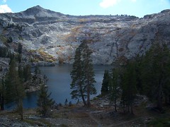
Ralston Lake & Ralston Peak
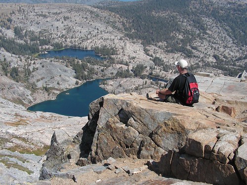
We climbed up and then had the dramatic view of Ralston Lake backed by Ralston Peak, and we could see where we had been the week before looking down on the spot we were at then. Unfortunately, we were looking into the sun, which meant that the camera could not capture the beauty that our more sophisticated eyes were taking in.
There were two paths down to Ralston Lake, one to the east to the north shore, and the other to the south to the dam at its outlet creek. We took the latter, which was more steep. The dam, dedicated to Ross E. Pierce by the Mt. Ralston Fish Planting Club in 1960, had a center section that was broken off.
We crossed the dam and climbed up the granite on the southeast side of the shore a ways for the views. The sun was mostly covered with clouds then, but occasionally the wind would blow them away, and the lake would be hit with a greater intensity of light, revealing a beautiful emerald color in shallow portions of the water.
From there we set off to find Cagwin Lake. My map showed the trail going along the north side of the then-dry outlet creek for Ralston Lake, but I knew enough by then to trust the physical evidence of the land before me over the map, and the trail to Cagwin Lake clearly lied on the south side of the outlet creek. We followed it, and found a sure sign that we had gone the right direction--an El Dorado National Forest sign naming Cagwin Lake and indicating it was at 7680 feet. We hadn't seen signs for any of the other lakes.
We went back the way we had come, and got off trail after crossing the dry outlet creek from Tamarack Lake. There were cairns we sometimes spotted, and eventually following those we got back to our spur trail, just before it joined the main trail back to Echo Lakes. The views we had of the Echo Lakes were marred by the shadows cast by clouds. I hadn't taken a photo earlier on the way out, thinking the view would be better in the late afternoon sun.
Back on the main trail, I revised my estimate of when we would make it back to the car. I checked it by the time it took us to make it back to the sign for the boat taxi, and we were not doing well. Unless the distance on my map was off, which is always a possibility, we were going really slowly. So I cranked it up from there, setting the pace for Erik, as always. Some people pay personal trainers as much as $75 an hour for such a workouts.
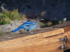
Steller's Jay on the Dam
For some reason, 5:30 became the magic time for me. I made it back to the car just before it, and felt a sense of accomplishment for achieving this arbitrary goal. Erik came along a few minutes later after calling his wife at Echo Chalet, and we headed home.
Hike Summary
Date: 16 September 2007
Trailhead: Echo Lakes
Approximate distance: 13.7 miles