Some of my photos are now for sale at ImageKind.

Nature Index
(My hiking and camping adventures in Northern California.)

Culture Index
(NorCal cities, highways, restaurants, museums, architecture, historic attractions, vintage neon signs, roadside attractions, etc.)
Showing posts with label fallow deer. Show all posts

Friday, June 8, 2007

Point Reyes: Bear Valley & Arch Rock

20070130 Boys Will Be Boys
Fallow Deer

Probably the most popular hiking trail at Point Reyes National Seashore is Bear Valley Trail down to Arch Rock. It's an easy 5.7-mile hike (according to the South District Trail Map, my hiking book says it is shorter), and the first 4.8 miles you can take via bicycle. To make it a little more interesting, I planned on a small loop at the end with a diversion on Glen Trail and Coastal Trail. My friend Erik joined me on this hike.

Bear Valley Trail climbs modestly to Divide Meadow (where there are pit toilets), then descends modestly down to the coast. At Big Meadow another hiker reported having seen a bobcat to us, but we weren't fortunate enough to spot him. We did, however, see many black-tailed deer from Big Meadow on.

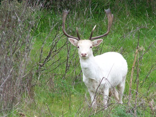
Rather than go to the end of the trail, we took a left onto Glen Trail, which gave us some climbing to do. It turned out to be well worth it, because as we descended on to the Coast Trail, we saw the stags in the photo at the top of this entry. Both are the same species of nonnative fallow deer.

Then we reached Arch Rock, meeting up with the end of Bear Valley Trail. Officially, the park service says there is no beach access at Arch Rock. I found that out from the website after I got home. Erik and I went ahead and climbed down to the beach here.

First that meant crossing a creek. Erik chose to rock hop it, and, as always on our hikes, I chose to photograph him in the process. It's one of my favorite photography subjects.

20070130 Erik Rock Hopping

I chose another spot and leapt across the creek. But that wasn't the end of it. Then we had to carefully crawl down a rock formation. Erik got a nice shot of Arch Rock from the top of that outcropping.

On the south side of Arch Rock we found some tidal pools. After photographing their inhabitants, we headed north along Kellham Beach.
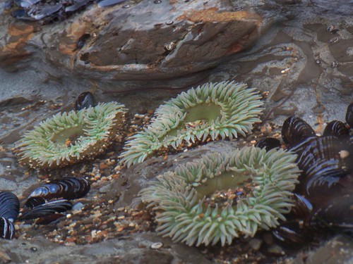
20070130 Giant Green Anemones

We ran into another hiker there who told us about an elephant seal up ahead. He was afraid that it was ill or injured. As he did, we kept our distance so as not to put stress on the magnificent creature. Luckily my camera has 10X zoom.
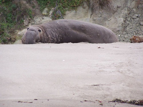
20070130 Elephant Seal

Rather than return on the beach to Arch Rock, we found a small use trail at the north end of Kellham Beach that led up to an old ranch site on Coastal Trail. You can tell it by the eucalyptus tree (so popular at ranches in the area) and the debris. We took Coastal Trail south back to Bear Valley Trail, and then Bear Valley Trail all the way back to the car. On the way back, we had the odd experience of being passed by an ambulance.

Hike Report

Date: 30 January 2007
Trail head: Bear Valley
Approximate Distance: 14.2 miles
Map: South District Trail Map

Point Reyes: Mt. Wittenberg & Woodward Valley

20070201 Fallow Deer
Fallow Deer

When I started hiking it was for two objectives: exercise, and photo opportunities. I did not value the experience of hiking for its own sake. But the more I hike, the more important that experience becomes, and the less I worry about those other objectives.

I planned this hike in order to get a good workout. The winter hikes in the area do not require nearly as much climbing as the Sierra trails allow in summer, and I had done very little hiking from October through December. So I wanted a long hike with as much climbing as I could get in at Point Reyes National Seashore.

At 13.5 miles with 1407 feet of variation in elevation, this hike gave me the workout I wanted, but it also proved to be an absolute delight, and a great overview of the variety of wonders Point Reyes has to offer.

I started from the staging area at the Bear Valley Visitor Center, and took off on Bear Valley Trail for 1.9 miles before hitting the junction with Mt. Wittenberg Trail. Then came the steepest portion of my hike. The trail doesn't go to the peak, but there is a small spur trail that does, so I took it. The "peak" was disappointing--it's just a clearing in the woods. The only view you have is of the trees around you. But I still, I guess I bagged that peak.

So I continued on to the Sky Trail, and then onto the Woodward Valley Trail. The Sky Trail was in a lovely forest, but the Woodward Valley Trail is where I started to get excited. It goes through an area that was hit hard by the 1995 Vision Fire. There are some areas that were not touched, others that are growing back nicely, and others that are still dominated by charred trees.

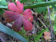
20070201 Leaf

At one point on the trail, not too far from the above leaf, I encountered an area with lots of wild mint. The smell was nearly overpowering, and quite an unusual experience for me. Later as I started descending the coast, I was treated to views of the Limantour Spit, Drakes Head, and miles of beaches.

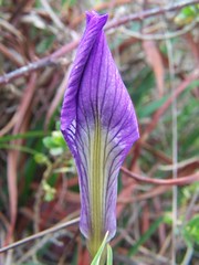
20070201 Douglas Iris

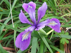
20070201 Douglas Iris

At the end of the Woodward Valley Trail I turned south on the Coastal Trail. I encountered the fallow deer (up top) somewhere along the Coast Trail. The trail also took me by a little spur trail to Sculptured Beach. My friend Erik and I had recently hiked there to see the tidal pools at low tide, but I made a quick jaunt out to take another look.

20070201 Giant Green Anemone
Giant Green Anemone at Sculptured Beach

Then it was back to Bear Valley Trail and the easy return to the car alongside the creek.

Before returning home, I drove around and shot some Marin County neon.

20070201 Fairfax Theater

20070201 Lark Theatre

Hike Summary

Trailhead: Bear Valley
Approximate Distance: 13.5 miles
Map: South District Trail Map