I moved to Northern California in 1996, but didn't visit Point Reyes National Seashore until June of 2006. I tried to make up for that at the start of 2007, by making 10 visits to this diverse and scenic national park from January through April. But this year, high gas prices and increasing concern about putting too many miles on my aging car have forced me to curb my adventures at Point Reyes, and go only when my friend Erik can accompany me, to split the fuel costs.
Not being able visit one of my two favorite places on Earth (the other being the Desolation Wilderness in the Sierra Nevada) as often as I would like has led me to feel much greater anticipation before the few trips I am able to make, and I was particularly excited about the prospects of this hike. It's rare that I can find a day that both Erik and I have off from work, that has a low tide at the right time for us to visit the beach, and that the forecast doesn't call for overcast skies. But it all worked out this time.
Leaving on a Sunday morning, instead of Friday like last time, we didn't have to deal with slow traffic, and were able to speed to Sky Trailhead in exactly two hours--45 minutes less than it took us to get to Palomarin Trailhead on our most recent hike to Alamere Falls. It was crisp when we set out on the trail, but the skies were blue, promising warm sunshine by afternoon.
Last year when we visited Sculptured Beach, we did a short and easy loop. This year I also planned on a loop that covered some of the same territory, but overall would be longer and involve more climbing, which I consider an advantage. Two additional advantages are that this route would take us along the Woodward Valley Trail, which I enjoyed tremendously last year on a solo hike, and that it would take me across stretches of trail I had yet to hike--furthering my quest to hike every mile of official trail in the park.
We headed up Sky Trail, which near the trailhead off of Limantour Road, is wide enough to drive on. Soon we passed a sign indicating that we were entering the Philip Burton Wilderness. We must have just been crossing a small section of it, because we didn't have to climb far (1.3 miles according to the trail map) before reaching Sky Camp--a fully developed, hike-in campground with a pit toilet, drinking water supply, picnic tables, barbecues, and even a large water trough for horses.
Sky Trail travels all the way from Limantour Road to the Coast Trail, just above the shore--a total of 6.4 miles. But there are numerous intersections with other trails, making a great variety of loop hikes possible. After this trip, I have tread upon all of it but a .3 mile portion between the junction with Woodward Valley Trail and the junction with Old Pine Trail. When we reached the former junction, I jokingly suggested to Erik that I should quickly hike that .3 mile portion and then double back, just to check it off my list. As it turns out, I might as well have done that, as we had more than enough time.
If I've sped through the description of this first 3.3 miles of the journey, it's because that's what we did hiking. We had the time to stop and take photographs, unlike most times we have tried to hit a beach just before low tide. But, while it was beautiful, nothing in particular jumped out at us. In the woods, there were few wildflowers, and certainly not any kind we hadn't photographed previously. We didn't see any deer, and didn't lay eyes on any later that day either, which is unusual. So we just kept plowing ahead.
I particularly enjoy Woodward Valley Trail, although I could not explain the name to Erik, since it travels along a ridge before descending to Coast Trail, and not through a valley. It passes through some aromatic vegetation, and through dead trees covered with pale green moss, which I find strangely beautiful, while giving splendid views of Limantour Beach, Drakes Head, and Chimney Rock as it approaches Coast Trail. The dead trees are a remnant of the Vision Fire that scorched the area in October of 1995.
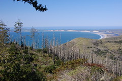
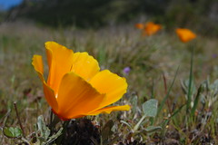
As soon as we hit the Coast Trail, we ran into other hikers. After checking the map, we started south to the spur trail for Sculptured Beach. Along the Coast Trail grew many wildflowers, including California poppies and Douglas irises. At the spur we made the short trip to the stairs down to Sculptured Beach. We were much too early for low tide, but headed off to our favorite area.
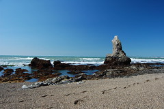
At low tide, one can easily walk along the sand from Sculptured Beach for a few miles onto Limantour spit, past crowded Limantour Beach (crowded because you can drive to it, rather than hike to it). But going south from Sculptured Beach is more difficult, because of rocky outcroppings that jut into the sea. The first one, right near where the trail reaches Sculptured Beach, is easy to clamber up. Getting down to the beach on the other side of it, and getting back up on the return, are a little more difficult. Despite having managed it on last year's hike, we still had to search around to find a manageable point to get down.
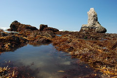
From there I told Erik that I would head down to the south end of the beach, by which I meant to the barrier that had stopped us from going any farther south last year, to eat lunch and wait for the tide to go out. He soon joined me.
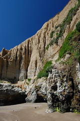
This barrier is a large outcropping with a hole in it, though which one could easily scramble over to the next section of beach. But in doing so, one would have to climb across dozens of California mussels, and we don't like to disturb the marine life. Erik was really anxious to get to that next section of beach, however, so after lunch he tried to find a way to climb over without disturbing the mussels.
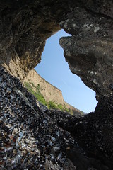
Looking South
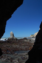
Looking North
By the time I joined him, he was already up on a spot that I could not determine how he could contort himself to reach. But that was the end of the road for him--he couldn't find the next spot to step forward, and decided to come back. He bumped his camera, and the lens cap fell off into a pool of water, but he said he thought he could retrieve it. I vacated the area below him and made my way back to the beach. When Erik finally joined me, he reported that he had slipped, and fallen into the pool, which was quite a bit more deep than he had imagined--his leg went in above the knee. He was unable to retrieve the errant lens cap.
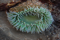
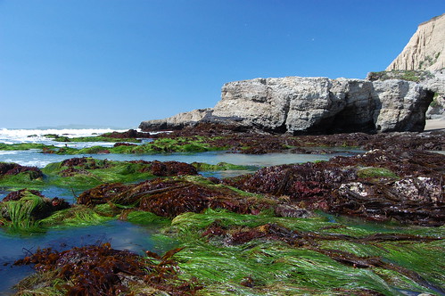
There was still plenty of time before low tide, but we started exploring the tide pools anyhow. There were abundant anemones, but we weren't finding any star fish. I remembered numerous star fish in this particular section when we were there last year, and Erik recalled the same abundance. This time we could only find three, and one was inaccessible. But we still had fun exploring the caves along the coast and the holes carved in large rock outcroppings, and carefully hopping along the rocks in the ocean, which were covered with strange plants and tiny anemones.
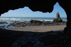
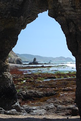
As it started getting close to low tide, I was ready to abandon this area, and try my luck farther north, so I climbed back up that first barrier. It was a little tricky for me, so I put my camera up top, so that if I fell and hurt myself, at least nothing important would be damaged. Then I pointed out to Erik where I thought it was easiest to get up, and he made it right up without any problem.
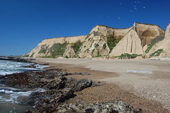
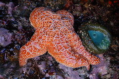
In all the time we spent on the south side of that barrier, we never saw anyone. But on the north side of it, there were now several people, exploring the tide pools, or just walking barefoot on the sand. We started working our way along the rocks in the ocean looking for tidal pool life, while gradually making our way towards Coast Camp. We encountered more success here--quite a few sea stars, as well as massive collections of California mussels, and a few goose barnacles. Erik found a sea star upside down and a ways up the beach, but apparently still alive, so he dropped it in a tide pool occupied by two other sea stars.
His boot that had been filled with water was filled again, as a wave came in while he was taking a photograph. I too got a foot soaked, as I finally slipped on one of those rocks and my left boot landed in about 16 inches of water. I took off my boot and wrung out my sock, only to get soaked again when I was kneeling for a shot and a wave came in.
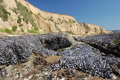
When we reached the end of the rocky area--now some time past low tide--we just turned to march straight up the beach to Coast Camp. This proved difficult though, as the wind was whipping and occasionally gusts were hurling sand into our faces. We alternated between walking forwards and backwards.
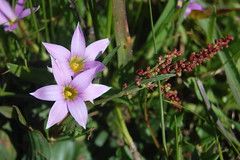
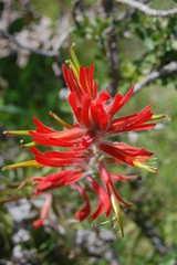
From Coast Camp we took Fire Lane Trail, and encountered masses of vivid wildflowers along the way, including tiny pink ones that were growing right on, and by the edge of, the trail. At the next junction, we took Laguna Trail. It took us to just short of where we had parked for last year's hike to Sculptured Beach, then veered off to the right past an environmental education center.
This meadow area was the only part that seemed remotely laguna like. At the end of it, the trail started climbing. Except for one brief downhill stretch (on which I just missed the opportunity to photograph a turkey vulture up close and in flight as it swept up in a clearing in the trees near me), the climb was persistent until the junction with Bay View Trail. This little portion of Bay View Trail just took us right alongside Limantour Road and back to the parking area for Sky Trail and my car.
All told it was a hike of a little over 10 miles through forest and meadows, along the beach and amongst the tide pools, all in bright sunshine under blue skies. Everything worked out so well, that I wasn't even bothered when I got home to find that I didn't any very good photos from the trip. It just gives me another reason to hike to Sculptured Beach again next year--as though I needed one.