Some of my photos are now for sale at ImageKind.

Nature Index
(My hiking and camping adventures in Northern California.)

Culture Index
(NorCal cities, highways, restaurants, museums, architecture, historic attractions, vintage neon signs, roadside attractions, etc.)

Sunday, August 13, 2023

Cave Springs Resort

20230809_0318

(If you wish to enlarge details of any of the photos, click on them to be taken to their pages on Flickr.)

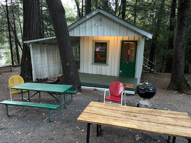
I recently had the pleasure of staying in a charming, 100-year-old cabin on historic U.S. Route 99 (decommissioned in the 1960s) in Dunsmuir, California.  The cabin is part of the Cave Springs Resort on a cliff above the Sacramento River—which in those parts is a small, rapidly flowing river with plenty of whitewater.


20230808_0309
My cabin, #5.


20230808_0307
I found the key a bit challenging at first.

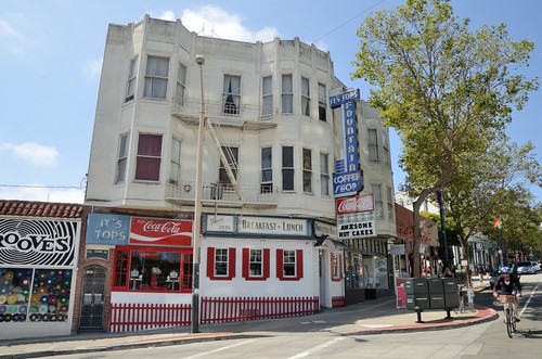
In the 1920s and ‘30s, Dunsmuir was a railroad town.  Having pored over the 1930 census records for the area, it appears that more than half of the people employed were working in the railroad industry.  Following that were hotel and restaurant workers—presumably serving the railroad travelers.


20230808_0305
Dunsmuir, Railroad Town

But foreseeing the future of travel, Dewitt Clinton “Clint” Brown and his wife, Ida May, started the resort as an auto camp in 1923, soon to be named Brown’s Motor Lodge.  Each of the 15 historic cabins has a car port built into it, although none of the guests were parked under the narrow ports when I was there.
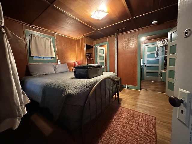

20230808_0311
Interior, Cabin 5

Besides being familiarly called Clint, Mr. Brown was also known as the “The Trout Fish King.”  He no doubt enjoyed plenty of fishing given the lodge’s location on the river before he passed away at the age of 58 in 1933.  After that, Ida May Brown carried on running the lodge with the help of her sister, Maude Young.  After Ida May died in 1944 (California Death Index) or 1945 (her gravestone), the establishment was sold (in 1946) to two couples from Walnut Creek: Bob and Lois Dewey, and John and Joalice Richards, with the Deweys buying out the Richards a few years later.


20230808_0314
Kitchen, Cabin 5

The new owners changed the name to Cave Springs Resort.  Where are the cave and the springs?  Just down below the cliff at the edge of the Sacramento River.  Unfortunately, I didn’t go down there when I stayed—but you can see a video shot by another guest of what they are like.

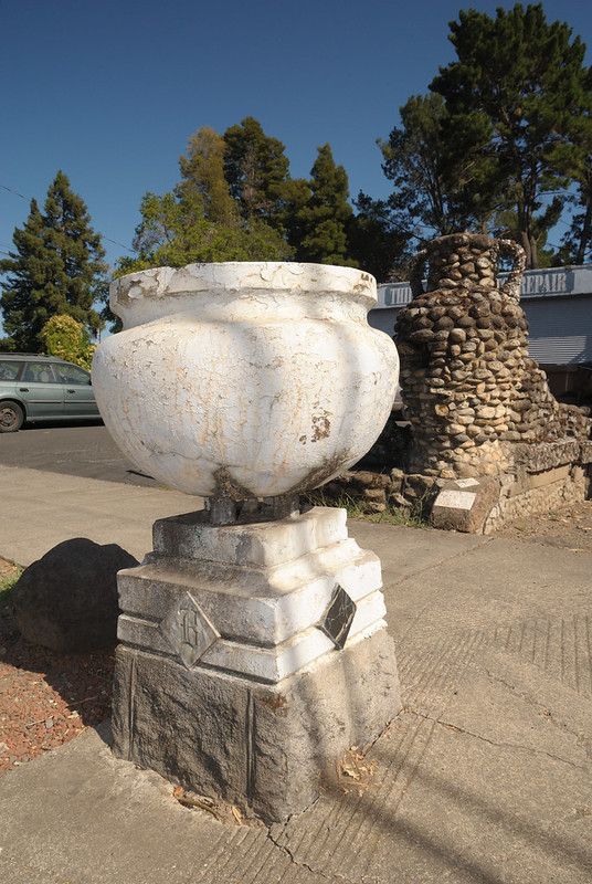
The springs pump out naturally carbonated mineral water, and that water used to be pumped up to a fountain in front of a 14-seat restaurant on the property.  I imagine the fountain was constructed in much the same fashion as the remnants of a small bench and planter that stand next to the old highway today.


20230809_0327
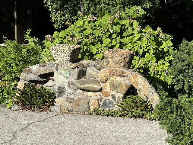
Small bench/planter out front.

Cave Springs Resort remained in the Dewey family until just last year, when Bob and Lois’s son Louie Dewey sold the property to a real estate investor with big plans to modernize the property.  That means this is the last summer you can rent any of the 100-year-old cabins. I wanted to stay in the already refurbished motel portion of the property to take advantage of the air conditioning and television.  But when I found out this was the last chance to stay in the historic cabins, I knew that is what I had to do.
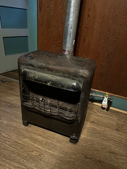

20230809_0480
Heater

It was worth it.  They are quite charming, and fortunately, it wasn’t too hot while I was there.  But I can see why they will be going away.  Still, it would be nice if the new owner kept one of the fifteen just to preserve a bit of history.  And I’m disappointed to see that the old neon sign is gone.  I happened to photograph it at night 15 years ago.


20080927 Cave Springs Motel

Despite the lack of amenities, and the rather troubling electrical wiring, I enjoyed my stay in cabin #5 at the Cave Springs Resort.  And I didn’t even use the swimming pool, bocce ball court, fire pit, or charcoal grill (one for each cabin).  It is wonderfully situated for what I was there for—visiting many waterfalls.  In fact, people going to Mossbrae Falls (trespassing on Union Pacific property on their way) park right in front of Cave Springs.


20230809_0481
Bathroom Light Switch
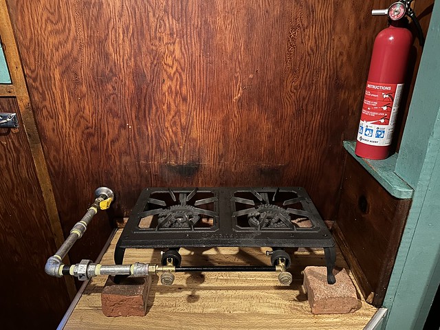
 

20230809_0479
Stovetop

20230808_0315
Refrigerator on Back Porch

20230809_0482
Dubious Wiring for Outdoor Refrigerator


Sources:

Interview with original owner on YouTube.
Well worth checking out for the recollections of growing up at the resort.

Article in Record Searchlight.
Includes a photograph of Bob and Lois Dewey.

FamilySearch
Free genealogical research site.

California Digital Newspaper Collection
Dunsmuir News articles won't be available in full until 2024, but I was able to pick up enough information from snippets available now to fill in the gaps in the story.

Clint Brown's Find a Grave memorial.

Ida May Brown's Find a Grave memorial.


Tuesday, November 5, 2019

Napa History: The A-1 Cafe

20191104_31792
Neon sign from the A-1 Cafe in the Napa Opera House Building

Napa History: The A-1 Cafe


Chinese immigrants Chin Yan Ing Low and Yuen Low opened Napa’s A-1 Café on Saturday, June 23, 1934 at 1018 Main St. in the Napa Hotel building on the northeast corner of Main and First. In 1947 the Napa Hotel building, which was considered a firetrap, was razed. The A-1 Café moved to the building next door, the opera house, and continued operation at 1028 Main St. It may be at this time that the A-1 Chop Suey neon sign was installed.

A 1937 advertisement for the restaurant in the Napa Daily Register gives the most detailed description of it I have seen: “Our specialty is Chop Suey and Chow Mein. Also other Chinese and American dishes. Chinese candles of all kinds. Lichee nuts. Beers of all kinds on ice.” I’m assuming that means bottles of beer chilled in ice, rather than beer poured over ice in glasses.

Yuen Low died some time between 1940 and 1948, but his wife Chin, also known as Mamma, continued running the restaurant until her retirement in December of 1967. At that time Yuen Low’s younger brother, Henry Wong Owyeong, and his wife, Mary Ng Owyeong, took over operations. They had been helping out at the restaurant since 1959. The Wongs, as they were generally known in Napa, expanded the business by opening two other Chinese restaurants in Napa. Despite much speculation over the fate of the opera house and several different plans for the property, the A-1 Café continued to operate through the 1970s, finally closing in 1982.

Where has the sign been since then and how did I come to photograph it? I’m not willing to share that information until the sign is in possession of the new caretaker who has been found for it.

Friday, September 13, 2019

Napa History: The Art of Edward Brown


20190905_i1572e

The Art of Edward Brown

Dedicated to Nancy Brennan, the historian of Tulocay Cemetery, where many of Edward Brown’s works of art are to be found.

Along the edge of the property of Third Street Auto Repair, often partially obscured by customers’ cars along the street, stands the remains of a cobblestone wall, graced with a massive cobblestone urn on the west end. Across the sidewalk (towards the street), two fine planters with the letter B ornately inscribed on their base, but never filled with vegetation, complete the incongruous scene. The inscription at the base of the urn offers some clues to the meaning of it all” 19 DEEP SPRING 12” and “PUBLIC REST STATION EDW. BROWN DESIGNER” with the “ROW” in Brown completely effaced and illegible.

20190630_21741

20190630_21734

The property at 441 Third Street, right next to the north entrance to the Napa Valley Expo, has long been the site of an auto repair shop. Vito J. Grossi established Grossi’s Garage at the site after buying the property from the Brown family in 1945. But when the Browns owned it, it was obviously something different.

Edward P. Brown was born in Benicia in 1875. His parents Lawrence and Mary (Cotter) Brown had immigrated from Ireland in 1869, and his oldest sister was born on the journey at sea. Soon after the family moved north. Tom Gregory’s 1912 History of Solano and Napa Counties California says that they initially farmed in Browns Valley, but the 1880 census shows the family living on Third Street, and Lawrence is listed as a laborer. Edward’s brother John would later establish a farm in Browns Valley, which perhaps explains the confusion.

It was there on Third Street between Soscol and the Silverado Trail that Edward Brown would establish his business in stone and concrete. This included rather pedestrian work, like laying cement sidewalks. But it also included artistic work that required exacting precision, such as memorial monuments. In fact, according to Gregory, “Some of his work in the line of architectural sculpture may be seen on the Spreckles Music Stand in Golden Gate Park, San Francisco, and the Herman W. Hellman Building, Los Angeles” (p. 478).

But one need not leave Napa to see the best of his work. That is featured at Tulocay Cemetery in a monument he designed and built for Manuel A. Almada (1842-1905), which Gregory wrote “is universally accepted as one of the most beautiful specimens of monumental sculpture in the west” (p. 478) and was “the finest monument in the cemetery” (p. 794). Apparently, he entered the design in a competition and beat out 17 other entrants. Afterwards his newspaper advertisements would describe him as “BUILDER OF THE M.A. Almada Monument. One of the finest monuments of the same size and dimensions in the world.”

20190714_0536
Manuel A. Almada Monument at Tulocay Cemetery

There are undoubtedly many of Edward Brown’s vaults, monuments, and tablets in Tulocay Cemetery that demonstrate his craftmanship. But without a surviving ledger from his business to consult, most of them would be impossible to identify. One exception is the Grand Army of the Republic Monument, as the dedication of that monument merited a frontpage write-up in the Napa Daily Journal that names Brown as its builder.

20170816_12395
G.A.R. Monument at Tulocay Cemetery

As for the rest station on Third Street . . . as the inscription indicates, construction on it began in 1912—November of 1912, according to the only newspaper article from the time that I have discovered yet. It was planned to have a fountain and a stone bench. The cobblestone wall was to extend for 120 feet.

20190905_i1574e

Obviously, the construction would serve as an advertisement for Brown’s business, giving examples of what he could do right along the route most Napans took to reach Tulocay Cemetery. It would also serve as a rest stop for those making that journey on foot.

For more than 70 years now, it has been an easy-to-overlook relic that is slowly disintegrating. I don’t know how many times I drove past it without taking notice of it. It wasn’t until I scored a great parking spot on the street for the Town and Country Fair and walked right past it with my daughter that I finally took note of it.

With a succession of auto repair shops occupying the spot since 1945, it has hardly been the refreshing rest station that Edward Brown originally created. The fountain and the stone bench are gone, and parts of the wall are crumbling. It’s still there, though, after 107 years. But it might not be there much longer.

While many Napans have been concerned about the efforts of the Napa Valley Expo to evict the Napa Valley Model Railroad Historical Society after 49 years of delighting the public at their current location, Phase 4B of the Napa Valley Expo Master Plan would also entail eliminating Third Street Auto and the remnants of Edward Brown’s public rest station. According to that plan, both would be replaced by parking—although the Register has been reporting that it is a new livestock area that will be replacing the Quonsets of the railroad society (which lies immediately behind the auto repair shop). But you can see the plans for yourself here.

Edward Brown never married and never had any children. But he left more permanent reminders of himself in Napa after his death in 1941. They are easy to miss, but they are also easy to notice and dismiss. I hope this history will help some people to appreciate them more.

Tuesday, July 23, 2019

Napa History: Napa Savings and Loan Association Building


20190718_29586

In my opinion, the finest expression of Mid-Century Modern architecture in downtown Napa stands at 1301 2nd Street, the northwest corner of Second and Randolph streets. Presently, it is the home of Quintessential Wines LLC. Although it is only 74 years old, much younger than many of the noteworthy buildings in the historic core of the City of Napa, the building was recommended for official designation as a local landmark property by Page & Turnbull in a survey conducted for the Napa Redevelopment Agency in 2011.

Ironically, the construction of this landmark building was only made possible by the destruction of another, older, landmark.  This Modernist building was originally constructed to house a savings and loan that was looking for new home. In 1954, the Napa Savings and Loan Association, located on Brown Street, bought the old Cotterill/Boke house at the northwest corner of Randolph and Second streets, which dated back to the late 1860s and had only been owned by two families. The old house was recognized as a landmark in a top-of-the-title headline in the Napa Register reporting on the Napa Board of Condemnation’s recommendation to the city council to condemn the house: “Board Acts to Condemn Boke Landmark” was the headline on 10 November 1953. The eventual condemnation order gave Henry J. Boke the option of razing the structure himself, repairing it, or selling the property. Selling the property was the easiest option, and that’s where the Napa Savings and Loan Association stepped in.

In 1955 construction on the historic home site began on a building designed by the Cunneen Company of Philadelphia, a national company that specialized in bank design with divisions in New York, Chicago, and Los Angeles. The design was typical of the trend in bank buildings in the mid-to-late-1950s: “The vernacular Modern bank had become a compact, asymmetrical composition of masonry volumes and glass curtain walls, locked together by a flat planar roof edged with aluminum” (Carol J. Dyson and Anthony Rubano, “Banking on the Future: Modernism in the Local Bank” in the journal Preserving the Recent Past 2, 2000). While not 100% finished, the building was opened to the public for a “special preview showing” on July 6 and 7, 1956. An article on the front page of the Napa Register the day before the preview describes many of the exciting modern features of the $130,000 building: porcelain enamel panels, Basalite brick, Solex glass, and “concrete stairways with invisible steel supports.”

Recent history has not been kind to Mid-Century Modern buildings, but remarkably the old Napa Savings and Loan Building looks, from the outside, very much as its designers intended. You can see a comparison by looking at this old photo from the Napa County Historical Society. In 2019, there are even plants in the planters!!! (I’ve seen so many Mid-Century Modern buildings with their planters filled with cement, or dirt, rocks, and garbage.) The only important element missing is the signage, particularly the three-dimensional projecting letters on that otherwise large blank space (the porcelain enamel panels?) on the 2nd Street side.

So if you happen to be passing by, make sure get a good look at this building and appreciate the artistry that went into its design (especially those floating concrete stairs!). Imagine the people in 1956 attending the open house, lining up to see this modern beauty. It is a particularly fine example of the architecture of the era in which it was built, and worthy of being considered a landmark.

Wednesday, July 10, 2019

Napa History: A Threatened Mid-Century Modern Gem

20190317_25647

After years of neglect and disparagement, Mid-Century Modern design has been become highly fashionable in recent years. While all sorts of newly created products inspired by Mid-Century Modern design are churned out to capitalize on this revived interest, the more important thing is that people are now actively working to preserve examples of Mid-Century Modern architecture.

So it comes as a bit of a surprise that the City of Napa would choose this time to plan on demolishing its lovely Mid-Century Modern city hall building. I could understand them wanting to get rid of it in, say, 1990. But now? Just when so many people have come around to appreciating the appeal of the design?

Napa’s City Hall is located on School Street, and someone asked me today if it was originally built as a school. No, the school that School Street was named after was far older than that, having been built in 1868-69. Later it became known as Central School. The old Victorian 2-story school building was demolished in 1923. After some discussion about building a civic auditorium, the city built a fire station on the property, and later added a flower garden.

California, and Napa with it, was rapidly growing in population throughout the 1930s and 1940s. The war effort took many resources, and temporarily stunted some of the civic growth that would have been expected to occur otherwise. But with the conclusion of World War II, California development took off.

Growing Napa was overdue for a larger City Hall at that time. The old city hall building on Brown Street had been condemned after the 1906 earthquake, but “No one, in later years, at least, has been able to trace the fate of the condemnation order. Suffice to say, it was never carried out” (25 July 1952 Napa Register p. 7). City officials temporarily relocated to the Goodman Library, but since that was not the use for the building specified in George Goodman’s gift to the city, they eventually moved backed into the old wreck of a building on Brown Street (the remains of that building weren’t torn down until after it was badly damaged again in the 2014 earthquake).

20190326_25953

In June of 1951 construction began on a new city hall building on the site of city’s flower garden on School Street. The new City Hall was a key item in the city’s 5-year capital improvement plan. The design was provided by Architect Silvio “Slim” Barovetto (1908-1996) of Davis. The building was to be large enough to accommodate many different city functions, but also fully modern in appearance and design. The building was officially opened in July of 1952, complete with ceremonies and visiting officials. The new City Hall was all over the Napa Register, making the front page and 4 full pages inside.

Of course, Napa’s City Hall is modest in scale, as befitting a city that had a population of only 13,579 in 1950. Large developments in recent years along First Street have made that School Street property very valuable. The city leaders are being fiscally responsible in thinking they could sell that property for a premium and use the money to build a larger municipal building that could reunite functions that have been dispersed across multiple sites because of lack of space.

But the 1950s are never coming back again, and Napa has only a handful of examples of high-end Mid-Century Modern architecture. The people of Napa should know and appreciate just what it is they would be losing before they approve the demolition of this little gem of a building.


See the following for more about architect Silvio Barovetto:


Monday, December 1, 2014

Interesting Eateries of Humboldt County: Bristol Rose Cafe

20141126_3157

In 2011 my family spent an unplanned night in Eureka on the start home from a lovely north coast/redwood vacation, and ended up choosing the Eureka Inn after some quick checking on the smart phone for nearby lodging that was both interesting and affordable. The Eureka Inn really delivered. The room wasn't much, but it was clean and comfortable and fine for the price. It was the public areas of the old hotel, which is listed on the National Register of Historic Places, that made our stay special.

20110806 A lucky find when we needed a room
Lobby of the Eureka Inn

But one of those we could only peep in at, the elegant dining room of the Bristol Rose Cafe. We asked and were told that they were still working on it, but were planning on reopening it. So when we passed through town going the opposite direction last week and we needed to eat, it's the first place I thought of.

This time, checking on the phone nearly led us astray. Yelp reported that the restaurant was permanently closed (choosing to hide, as it turns out, a review that stated otherwise from 9 months earlier). But my wife decided to call the hotel and ask, and was told they were open for business.

20141126_3244

We were the only diners (although it was early, and the evening before Thanksgiving), and they are open limited hours (5-9 Monday-Saturday). Which means they don't do a high volume of business, and so can't possibly offer all fresh and made-from-scratch food. My wife complained that the blue cheese dressing tasted like it was from a jar.

But I thoroughly enjoyed my rib eye steak and twice-baked potato, the elegant dining room, and the musical accompaniment of 1940s crooners. If the lights had been a bit dimmer and there had been 30 other people dining there, it would have been perfect.

20141126_3234

Thursday, July 31, 2014

Interesting Eateries of San Francisco: Whiz Burgers Drive-In

20140730_4080

If it were located on old U.S. Route 99 in the Central Valley, or even on a busy thoroughfare in the suburbs, Whiz Burgers would be perfectly ordinary. But it's surprising to find it in San Francisco.

It's an old drive-in burger joint, originating from 1955. No indoor seating is available. There is a counter that goes around 3 sides of the building, at which there are a grand total of two stools--presumably there used to be many more. Four picnic tables provide the main seating for those who choose to stay there to eat, which doesn't seem like the best option, given all the trash strewn about the neighborhood. It's got its own parking, though, which is a major plus in the city.

20140730_4050

You can get your usual burger companions there: hot dogs, French fries, and shakes. And they offer a few Asian basics featured in pictures in the window--shown both on paper plates and on fine China.

20140730_4057

I got the Whiz Burger, and said yes when asked about cheese on it. I was not disappointed, although admittedly I didn't have highest of expectations from the place. My expectations were exceeded, however, by the fact that there were avocado slices on my burger. Nice!

Monday, June 16, 2014

Interesting Eateries of San Francisco: It's Tops Coffee Shop

20140615_1281

Oh, It’s Tops Coffee Shop! You are absolutely perfect, with your wooden booths and ceiling, lunch counter and stools, and vintage neon sign! Where have you been all my life?

Oh . . . right there on Market Street. All my life. And a few decades before my existence to boot. Well . . . why doesn’t anybody inform me of these things?!?!?! Maybe my friends just don’t want me to be happy.

20140615_1073

Luckily there’s San Francisco Heritage, and their Legacy Bars & Restaurants program, which is how I belatedly discovered this totally classic and completely charming eatery in the Hayes Valley neighborhood of San Francisco. I heard of the program when contacted by San Francisco Heritage for permission to use some of my photos--7 of which now appear in the handy little map/pamphlet they have published with 100 legacy eating and drinking establishments in it. You can see my growing collection of photos from those businesses here.

20140615_1042

But back to my new love--It’s Tops opened in 1935 when, unbelievably, it was much smaller than it is now. There was no separate kitchen and dining area then, according to the restaurant’s website. The luxury of such separation had to wait until an expansion into an adjoining business space “about a decade’ later. And the lovely neon sign dates from then as well.

The menu offers your basic diner fare, but has some fun twists--like the various combinations you can get for your pancakes involving chocolate chips, peanut butter, bananas, and whipped cream. And they take the “coffee shop” thing seriously, serving up espresso drinks and an espresso milkshake, which I can’t wait to get back and try sometime.

20140615_1122

My cheeseburger, Dick’s Double, and onion rings were quite tasty, as were my daughter’s chocolate chip pancakes. And I had no problem finding parking right nearby--although I think next time we go, we will ride the trolley to get there, since it runs down Market Street right in front of the place.

And hopefully there will be many, many next times. I’m not sure how I managed to go so long without being aware of the existence of this place, but now that I do know of it, I am going to try to make up for all those years of neglect.

Wednesday, January 29, 2014

Coachella Valley's Shields Date Garden

20130515_2988

Palm Springs: a luxurious resort community with ideal weather, or a scorching hot desert unfit for humanity? From what little I had gleaned from passing references in pop culture, I wasn't sure exactly what to expect when I had the opportunity to visit the town and the surrounding communities of the Coachella Valley in Southern California last May.


It turns out it's a bit of both. The warm weather makes it a popular vacation resort in the winter, but in the summer temperatures can reach a withering 120 degrees. The natural desert landscape is barren, but a large aquifer, fed by the snow melt from nearby mountain ranges, allows for irrigation and such extravagances as the man-made lake and indoor/outdoor boat taxi at the JW Marriott Desert Springs Resort in Palm Desert, where we were staying.

20130519_3618
JW Marritott

This combination of intense sunshine, hot weather, and abundant water makes the Coachella Valley ideally suited for date palms. Which are different, in case you didn't know, from coconut-bearing palm trees. Don't feel bad—I didn't know before my trip either.

Why did I become interested in date palms? It was the giant knight with “Since 1924” on his shield, beckoning to the 1950 visitor center/retail outlet/theater/cafe at Shields Date Garden in Indio, about 23 miles southwest of Palm Springs. You can learn everything you ever wanted to know, but were afraid to ask, about the “sex life of the date” in the old movie theater, as well as much of the history of Shields Date Garden and date palm cultivation in the Coachella Valley.

20130515_3018
A Knight

For $5, one can tour the garden where Floyd Shields used to give talks about the process of date cultivation. Later he made a recording of himself and set up a theater for a slideshow, which he playfully titled “Romance and Sex Life of the Date.” The free film that plays there now excerpts portions of that original recording.

20130515 Romance Theater
Romance Theatre

Date palms are not native to the area—the California fan palms (Washingtonia filifera) that line the main thoroughfare along old CA-111 (now Business Route 111) in Palm Springs are. But date-producing palm trees were imported by federal agricultural researchers in 1890 (according to Wikipedia), and today the Coachella Valley produces 95% of the dates consumed in the US (http://ucrtoday.ucr.edu/2397). There's even an annual National Date Festival held in Indio each winter! (See http://www.datefest.org/ for more information.)

After getting all jazzed up on the fascinating history of the date in the theater, I went date crazy in the cafe at Shields Date Garden. I got the date burger with a salad topped with dates and a date milkshake. The date burger was an interesting novelty, but date shakes are the real deal, and are quite popular in the Coachella Valley. They make it a little bit differently at Shields than other locations, using their date crystals, rather than fresh dates. The result is that it has the date flavor, but not chewy bits of date like I found in the shake I got from Hadley's on my way out of the area.

20130515 Shields Signature Date Burger
Date Burger

If you can venture out of the air-conditioned comfort of your hotel, I heartily recommend that you try one. And don't just take it from me, take it from the giant knight who has been beckoning to drivers along CA-111 for more than 60 years. While I'm sure date shakes are delicious wherever you drink them, wouldn't yours be even better when enjoyed on a 1950s stool next to the Romance Theatre?

20130515_3109

Wednesday, February 13, 2013

Wine Country Traveler: Fremont Diner

20120623_2327

 Babe's Burgers and Franks, it was called when I first noticed this place. But it never did the kind of business or received the widespread recognition then as it does now as the Fremont Diner. And the crowds just seem to keep getting bigger.

20110327 Mac & Cheese Skillet
Mac and Cheese

I photographed the old drive-in building not long after Babe's had closed and it was sitting vacant. When we moved to the area, I noticed it had reopened as the Fremont Diner, and made a mental note that I ought to stop there sometime. Then my mother asked me about some wine country eateries she had read about in Sunset Magazine that were supposedly where the locals eat, and Fremont Diner was one of them. That old drive-in in Sunset?

20081019 Babe's Burgers & Franks
Babe's Burgers and Franks

 Once we first gave it a try, we were hooked. My wife and I go there frequently and have witnessed their increasing popularity expansion. They make use of a large outdoor area, covered in a big plastic tent in winter, to accommodate more guests. It's no longer order at the counter and seat yourself, but full table service. And just recently they started serving dinner 4 nights per week (Thursday-Sunday).

Long before it was Babe's Burgers and Franks, although I don't yet know exactly how long, this joint was Dave's Drive-In. There's an old sign in a private area in the back for Dave's that I caught glimpse of. When asked about it, the proprietor, Chad Harris, told me that Dave's widow still lives next door to the place, and rents out the restaurant and the adjoining 34 acres of land to him.

20130209_2568

In addition to the old Dave's Drive-In sign, there's a spectacular old Broadway Hardware neon sign mounted on a shed in back of the restaurant, presumably from Sonoma (Highway 12 enters Sonoma on Broadway), and assorted other vintage and quirky pieces throughout the building and property, contributing to the folksy character of the place. The most prominent of these is the old truck always parked in front, which recently got a touch up faux paint job.

20111029 At the Fremont Diner
Ain't That America--this photo for sale at ImageKind and SmugMug.

But it's definitely the food that makes this place such a draw. You can get burgers, fries, and shakes at the diner, but the main appeal is the Southern comfort food, with a little bit of California thrown in now in then, like huevos rancheros to go with chicken fried steak and biscuits and gravy. Not everything is fantastic--the fried chicken "so spicy it will set a cheatin' man straight" did not bring any heat at all, and I find the mac and cheese too salty. But enough of it really is fantastic. I particularly relish the ham biscuit and the collard greens.

20121206_0220
Catfish and Hush Puppies

Friday, February 8, 2013

Two Old Motels on an Abandoned Alignment of Route 66

(This is not about NorCal. But I thought the story was too good to be left untold.)

20120929_1414
[This photo can be purchased on ImageKind or SmugMug.]

After a decade of exploring old highway routes in California, for the first time I got to drive the famous highway of song and television, Route 66, this last September while I was in Missouri on my wife Elizabeth's business trip. The highlight of this was stumbling onto Vernelle's Motel and John's Modern Cabins. This little episode was everything I could have hoped for as an old highway historian and vintage neon sign photographer.

We had a day of travel from Branson to St. Louis with our baby in a rental Rav-4. I knew that on I-44 between Springfield and St. Louis we would be roughly following long-decommissioned Route 66, and hoped we might a couple of times be able to get off the freeway and take the business route (usually what was the main highway route through a place before being bypassed by the freeway) through some towns and  make a quick stop or two for me to take photos.

But we started out seeing far more of old 66 than I expected, partly because I downloaded a Route 66 iPhone app that made it easy to follow the old alignment, even between towns, but mostly because Elizabeth was as enthusiastic about traveling down Route 66 as I was, rather than just tolerating it for my sake.

Even though we were both having a lot of fun, we soon realized we had to curtail the historical interest portion of our journey. It was just taking more time than we had to spare. The baby wasn't going to stay asleep forever, and we didn't want her to spend too much of her awake time confined to her car seat.

We made one last turn off of I-44 to see a little of old Route 66 with the baby already awake at exit 176 for Sugar Tree Road. But rather than continue to follow the old Route 66 alignment on back roads until the next I-44 junction, as we had been doing, I suggested we instead backtrack a short distance to see two motels listed on the iPhone app, and then just get back on the freeway and skip altogether the next long portion of 66 (which didn't have any point of interest markers on the map). One reason for my suggestion was that one of the motels was called John's Modern, and with "modern" in the name, I could well imagine an exciting and extremely photogenic neon sign standing before the old motel.

20120929_1377

We spotted the sign for the other motel, Vernelle's, not along the road we were driving, as expected, but, it looked to me, like across a large swathe of grass where there had once been a freeway. That turned out be be exactly the case--Route 66 had been expanded from its original two lanes to four lanes, whether it was freeway or expressway (divided highway, but without the exit and entrance ramps of a freeway), there in 1957 and the property line for Vernelle's Motel had been moved. Interstate 44 replaced the Route 66 designation in 1967 and by then the road was definitely a freeway, but I-44 was later moved to a straighter alignment that bypassed the old route and its curves entirely after 2000. Most of the old Route 66/I-44 pavement was removed, although I did spot a section of it to the east when we made our way back to current I-44. You can see all of this on the map below, only the portion Google is labeling "Historic U.S. 66" is the new freeway, and not the bypassed historic U.S. 66.


View Larger Map

We pulled up to the motel so I could quickly pop out and photograph the sign, only to find one of the friendly owners sitting outside, Brenda.She brought out her husband Ed to talk with us, and it turned into a more leisurely visit.

Ed's mother was the Vernelle, from whom the motel got its name. Hearing of my interest in Route 66, Ed went inside and got an extra copy of Route 66 Advertiser from 2007 with an article on the motel in it to give me. Brenda soon found occasion to make a quick trip inside to get something to show me as well--a Route 66 purse that had a similar print to the Route 66 shirt I was wearing, purchased in Branson the day before.

Ed told us some of the history of the place, but I don't recall the details. According to this site, however, the original 1930s business was Gasser Tourist Court, and it only became Vernelle's when Ed's family acquired it in the 1950s. Its survival to this day seems quite improbable, as obscurely situated as it is now. Highway planners seem to have really had it in for Vernelle's over the years.

Before we left, Brenda told us of a restaurant on the road ahead with good home-style food, and Ed told us we should check out John's Modern Cabins, and explained how to get there. We were right next to it, as it turns out--in easy walking distance. But we couldn't just drive down the old frontage road, as it no longer goes though. Instead, we had to go back across the former freeway, take Arlington Outer Road over, recross the vanished freeway, and arrive on the old frontage road just yards way from where we had left it.

John's Modern Cabins--modern? I don't know, maybe they had electricity, and that made them modern. What was left of them certainly seemed rustic enough, even for the 1950s.

There wasn't much left of them, I'm afraid, but they made quite a spectacular ruin.  There are many photos online by other visitors to the site over the 40+ years since the buildings have been abandoned, and they appear to have held up quite well until recently. Photos from just a handful of years ago show most of the buildings standing with intact roofs, but we didn't see any that way.
20120929_1425
[This photo can be purchased on ImageKind or SmugMug.]

What surprised me was that after 40 years I saw no evidence of graffiti, or fires, or wanton destruction. I know many people have visited the place from all of those photos online, and they have left some clear signs of being there--a series of Burma Shave-style signs telling visitors to photograph the soon-to-be-gone ruins, and a Route 66 sign stenciled onto the road. But the vast majority of visitors seem to have been respectful and appreciative of this fading bit of roadside history. I'm quite thankful for that.

20120929_1505

The motel itself is older than the "John's Modern Cabins" neon sign, having been founded as Bill and Bess's Place in 1931, according to Wikipedia. John Dausch was the John of John's Modern Cabins, which is what the tourist court was renamed when he bought it in 1951. I wonder what he would make of the Wikipedia article on his old stomping ground. "Sunday John," Ed told us (and Wikipedia confirms), they used to call him, because of his willingness to sell beer on that day, which was prohibited in Phelps County.

But a story that didn't make Wikipedia is when John, in his declining years, stopped by Vernelle's Motel in his pick-up truck and told Ed he was going into town and asked if Ed would like him to pick up anything. Ed said he looked inside the truck and saw that John had on polka dot boxer shorts, but no pants. Upon having this pointed out to him, John commented that it was a darn good thing he had stopped by to see Ed before going into town.

I imagine it's a true story. Although if I found myself sitting about an 80-year old motel on a tiny fragment of remaining highway completely bypassed by all through traffic, I might just spin a yarn or two to tell the rare visitor who wandered in.
20120929_1388

See some of my other Route 66 photo here.